IDEAS East River
| Grid Team Member: |
Terry Miller |
| Delivered To: |
David Moulton and Ethan Coon |
| Date: |
December 2014 to 2015 |
Version History
| Version |
Scope |
Finished |
Total |
| V1 |
Full Watershed 3D |
May 2015 |
392,100 Nodes |
647,535 Cells |
| V1 |
Full Watershed DEM |
December 2014 |
65,350 Nodes |
129,507 Cells |
| V2 |
Fork Subset from Watershed |
December 2014 |
82,76 Nodes |
16,164 Cells |
| V1 |
Small 8-10m DEM |
April 2015 |
1,493 Nodes |
2,483 Cells |
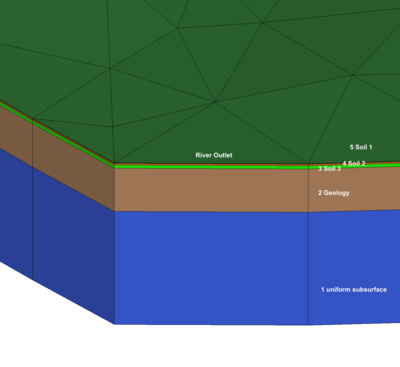
East River Full Watershed 3D
|
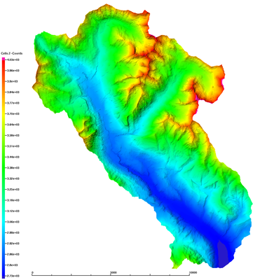
East River Full Watershed DEM
|
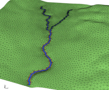
East River Watershed Subset at River Fork
|
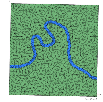
Subset LBL 10m small DEM at Pump House
|
Project Archives
Mesh information can be found in mesh directory in README.txt, RUNS, *.txt
README.txt is a general overview of the mesh version (cm).
mesh_stats.txt includes stats such as mesh info and material volumes
mesh_meter_stats.txt are the same stats after conversion to meters.

Mesh Files are written in formats:
  Linux Binary Exodus II (.exo)
  Linux Binary GMV (.gmv)
  ASCII AVS (.inp)
Mesh Files are available on local servers:
IDEAS Project Directory for Meshing:
/scratch/sft/tam/IDEAS/East_River
Full 3D Watershed 60m resolution:
  /scratch/tundra/tam/IDEAS/East_River/EXO_full_60m_3D_v1

Full DEM Watershed 60m resolution:
  /scratch/sft/tam/IDEAS/East_River/EXODUS_tri_full_60m/


Small DEM subset around Pump House from LBL:

  River 1 cell wide, DEM and dropped 1 meter
  /scratch/sft/tam/IDEAS/East_River/grids/subset_lbl_10m/EXODUS_v1.1

  River 2 cell wide, DEM and dropped 1 meter
  /scratch/sft/tam/IDEAS/East_River/grids/subset_lbl_10m/EXODUS_v1.2
Mesh Method
This is the workflow used to create triangulated surfaces from DEM and river polyline.
LaGriT Workflow
outline workflow here
Grid Team Contacts
| Carl Gable |
<gable -at- lanl -dot- gov> |
505-665-3533 |
| Terry Miller |
<tamiller -at- lanl -dot- gov> |
505-667-8009 |
| Lucia Short |
<lucia -at- lanl -dot- gov> |
505-665-7957 |