right, back, left
Tue Feb 13 14:47:58 2018
Project Directory: /scratch/sft/tam/IDEAS/East_River/Lower_Triangle
Steps for DEM to ATS Workflow:
INPUT DATA: Define and Process Input Data
SETUP: Define Spacing, Layers, and Boundaries
TOP SURFACE: Create Top surface triangulation and interpolate DEM
EXTRUDE INTO 3D: Generate Mesh Layers and stack into 3D Element mesh
MODEL SETUP: Write 3D Mesh and Boundary face sets to Exodus file.
/scratch/sft/tam/IDEAS/East_River/Lower_Triangle

All diretories include a compressed tar file with:
    prism_single_fs3.exo - single column with 3 facesets
    prism_fs6.exo - full mesh with 6 facesets (bottom,top,right,back,left,top layer outlet)
    prism_fs3.exo - full mesh with 3 facesets (bottom,top,sides)
    README.txt


Smooth 10m Triangulation

    Aug 13 lagrit_tri_10m_v1
    lagrit_tri_10m_v1/prism_fs6.exo nodes: 1309554 cells:  2171480   sm_10m_v1.tar.gz  (111M)
    README file for V1 10m

Smooth 25m Triangulation

    Aug 13 lagrit_tri_25m_v1
    lagrit_tri_25m_v1/prism_fs6.exo nodes: 284874  cells:  469935   sm_25m_v1.tar.gz  (23M)
    README file for V1 25m

Smooth 50m Triangulation

    Feb 12 lagrit_tri_50m_v1
    lagrit_tri_50m_v1/prism_fs6.exo nodes: 34596  cells:  55835  sm_50m_v1.tar.gz  (3.1M)
    README file for V1 50m


    Feb 12 lagrit_tri_50m_v2
    lagrit_tri_50m_v2/prism_fs6.exo nodes: 98022  cells:  178672  sm_50m_v2.tar.gz  (7.5M)
    README file for V2 50m
Gallery of All Mesh and DEM images
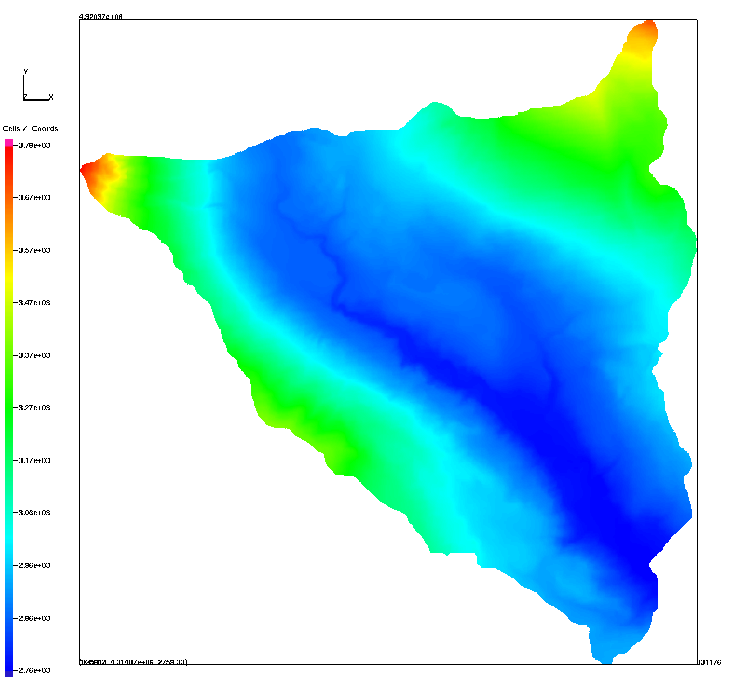
Source Data From LBNL Zexuan Xu zexuanxu@lbl.gov
USGS 10 meter DEM product, not the Lidar DEM which has small differences
/scratch/sft/tam/IDEAS/East_River/Lower_Triangle/data
  USGS_DEM_LT10_XYZ.xyz     296173 points (original data)
  USGS_DEM_LT10_points.csv  148190 points (flip llcorner so tip is bottom and remove null values)

10m DEM connected into triangle surface cropped at boundary for interpolation of elevation values.
dem_tri_crop.inp 147920 nodes    294150 triangles

NAME     MIN               MAX              DIFFERENCE
 xic     3.259128385E+05  3.311760044E+05   5.263165929E+03
 yic     4.314867400E+06  4.320370711E+06   5.503310380E+03
 zic     2.759333252E+03  3.775072021E+03   1.015738770E+03
|
Lower Triangle DEM with NULLS removed
|
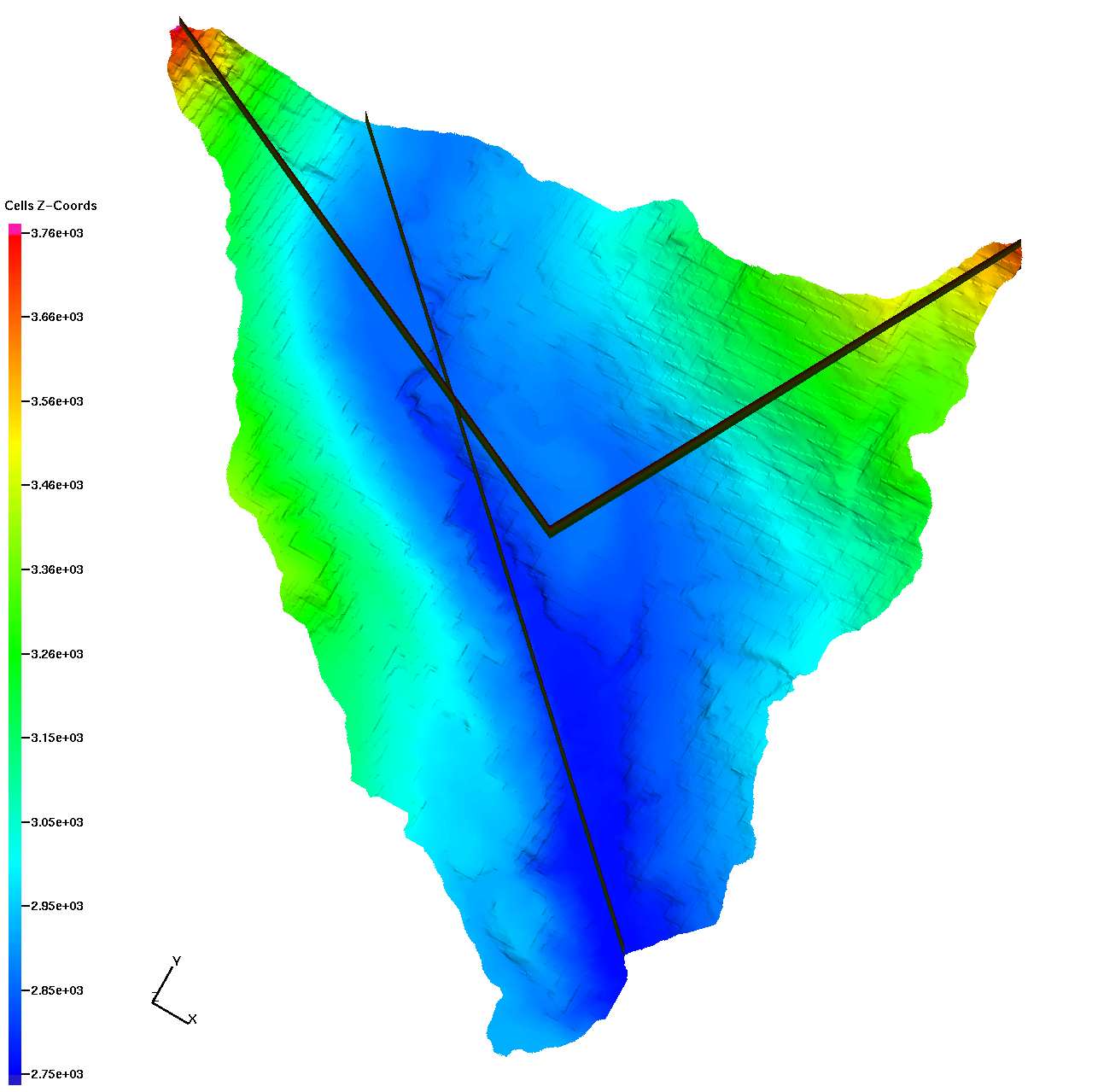
Lines to define boundary regions right, back, left
|
V1 5 Layers single cell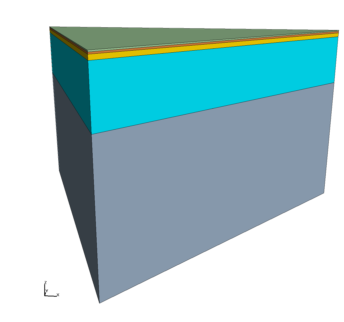
|
V2 5 Layers with multiple cells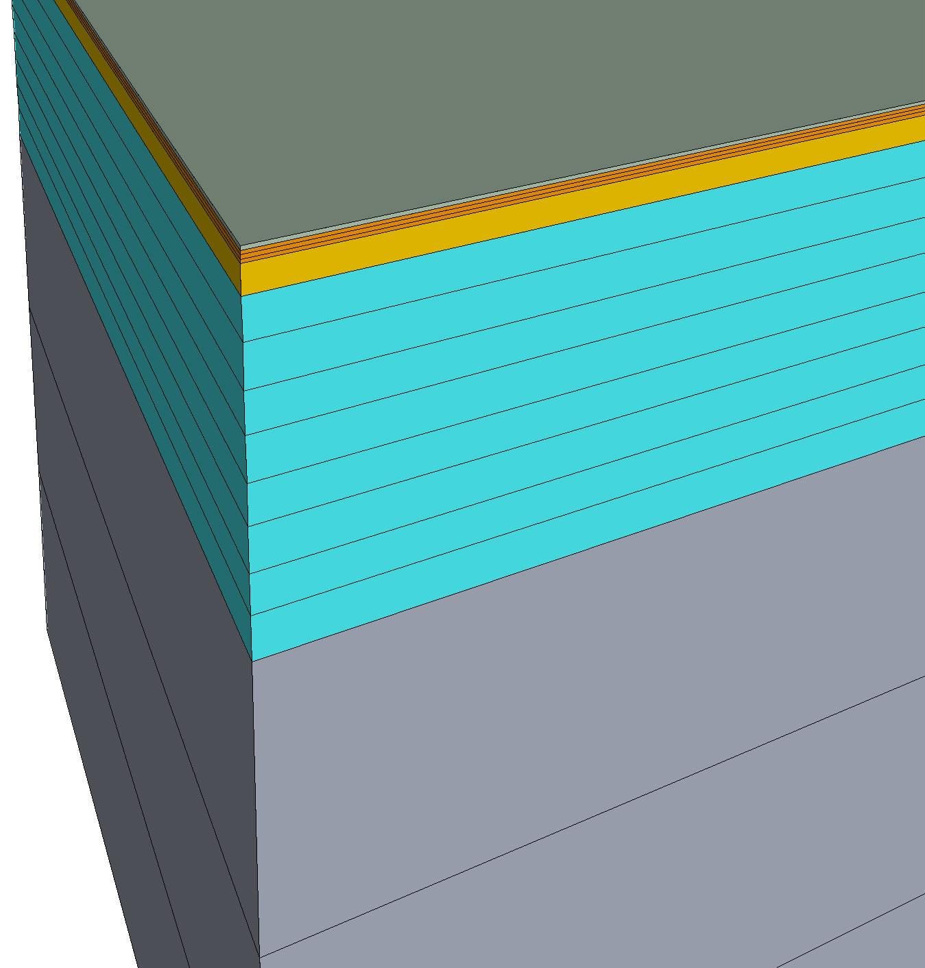
|
V1 Material layers are ordered from top = 1 to bottom = 5. Each layer is 1 cell thickness (thickness = dz). Layer 1: dz = 0.1, sublayers = 0 Layer 2: dz = 0.3, sublayers = 0 Layer 3: dz = 0.6, sublayers = 0 Layer 4: dz = 8.0, sublayers = 0 Layer 5: dz = 21.0, sublayers = 0 Total depth = 30 meters |
V2 Material layers are ordered from top = 1 to bottom = 5. Layer 1: dz = 0.1, sublayers = 0, cells 1 Layer 2: dz = 0.1, sublayers = 2, cells 3 Layer 3: dz = 0.6, sublayers = 0, cells 1 Layer 4: dz = 1.0, sublayers = 7, cells 8 Layer 5: dz = 7.0, sublayers = 2, cells 3 Total depth = 30 meters |
This part of the workflow is being developed in TINerator python software using GIS and LaGriT.
For these grids, LaGriT was used starting with a boundary polygon at uniform spacing.
LaGriT is used to triangulate and smooth to edge lengths near target lengths 50, 25, and 10m.
Quality measurements include aratio (1=all angles equal), min edges, max edges.
Boundary polygon points provided by Daniel Livingston scripts:
/scratch/sft/tam/IDEAS/East_River/Lower_Triangle/data
  USGS_DEM_LT10_boundary_10m.csv
  USGS_DEM_LT10_boundary_25m.csv
  USGS_DEM_LT10_boundary_50m.csv
50m boundary polygon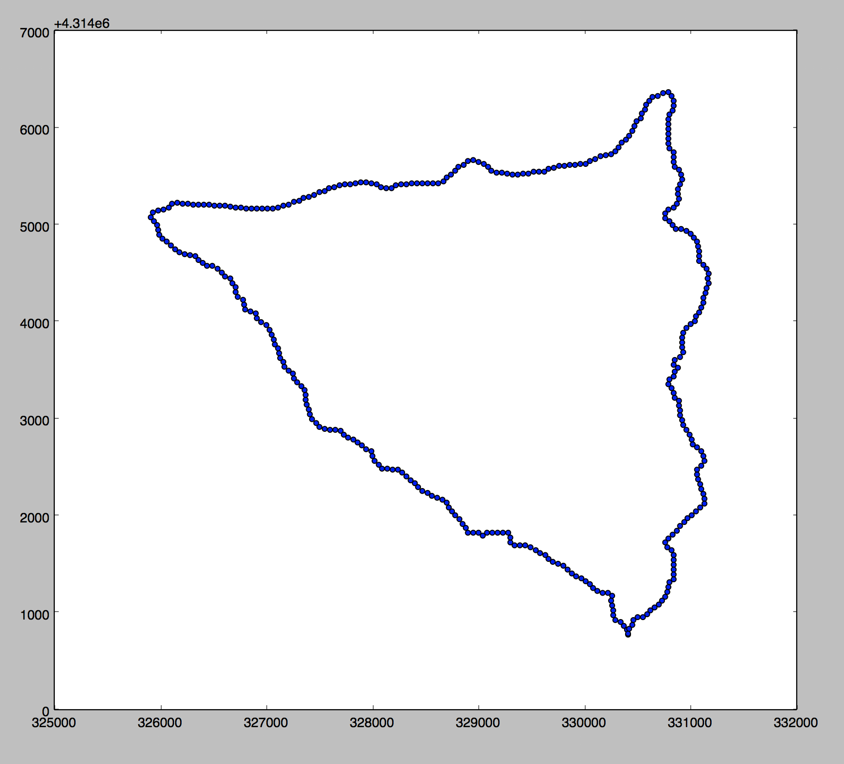
|
Triangulate Polygon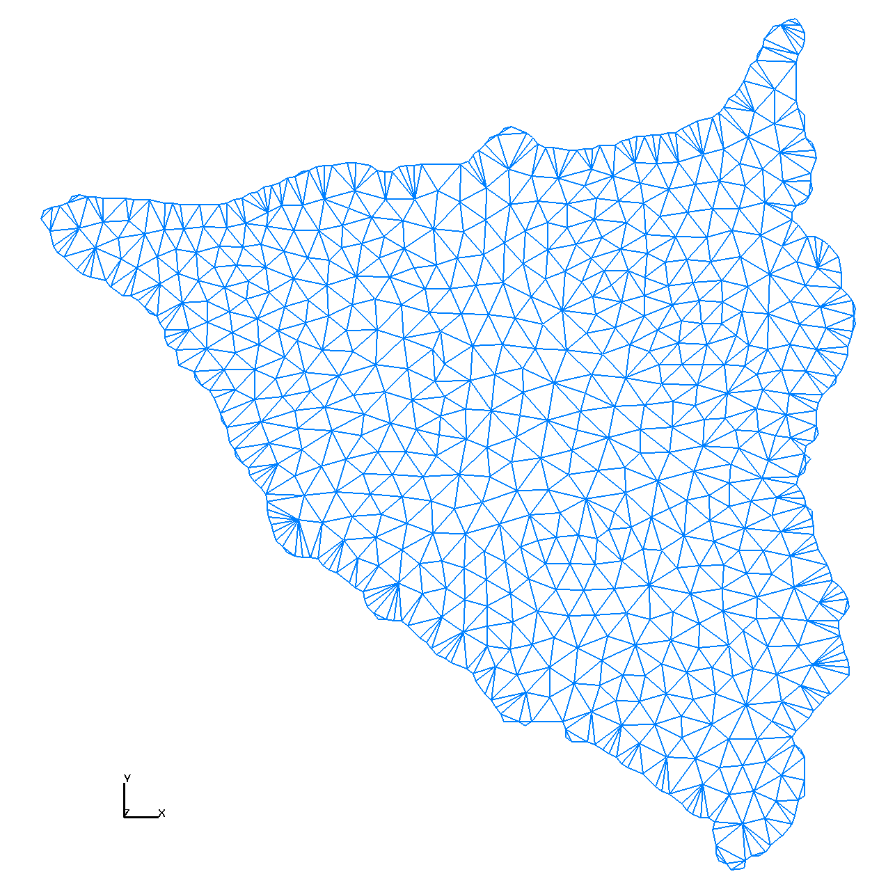
|
Smooth and Interpolate DEM elevations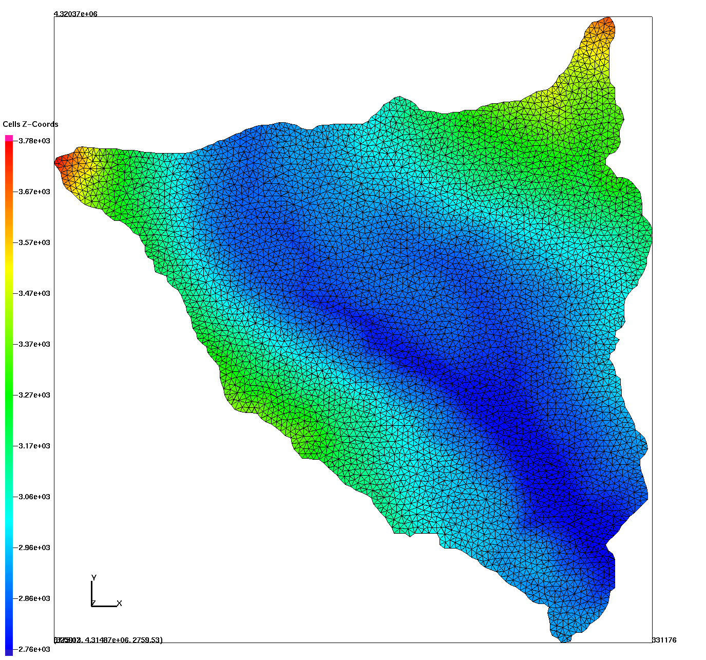
|
tri_aratio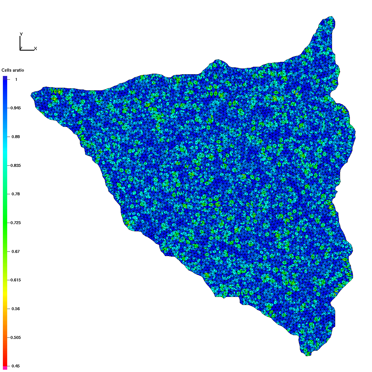
|
tri_emax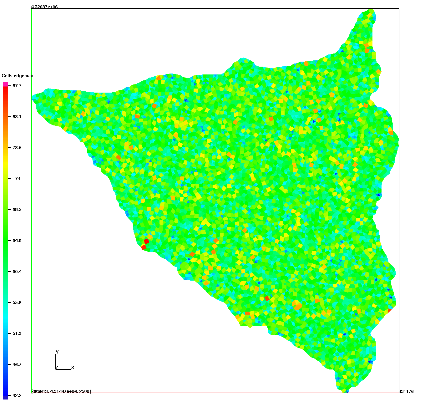
|
tri_emin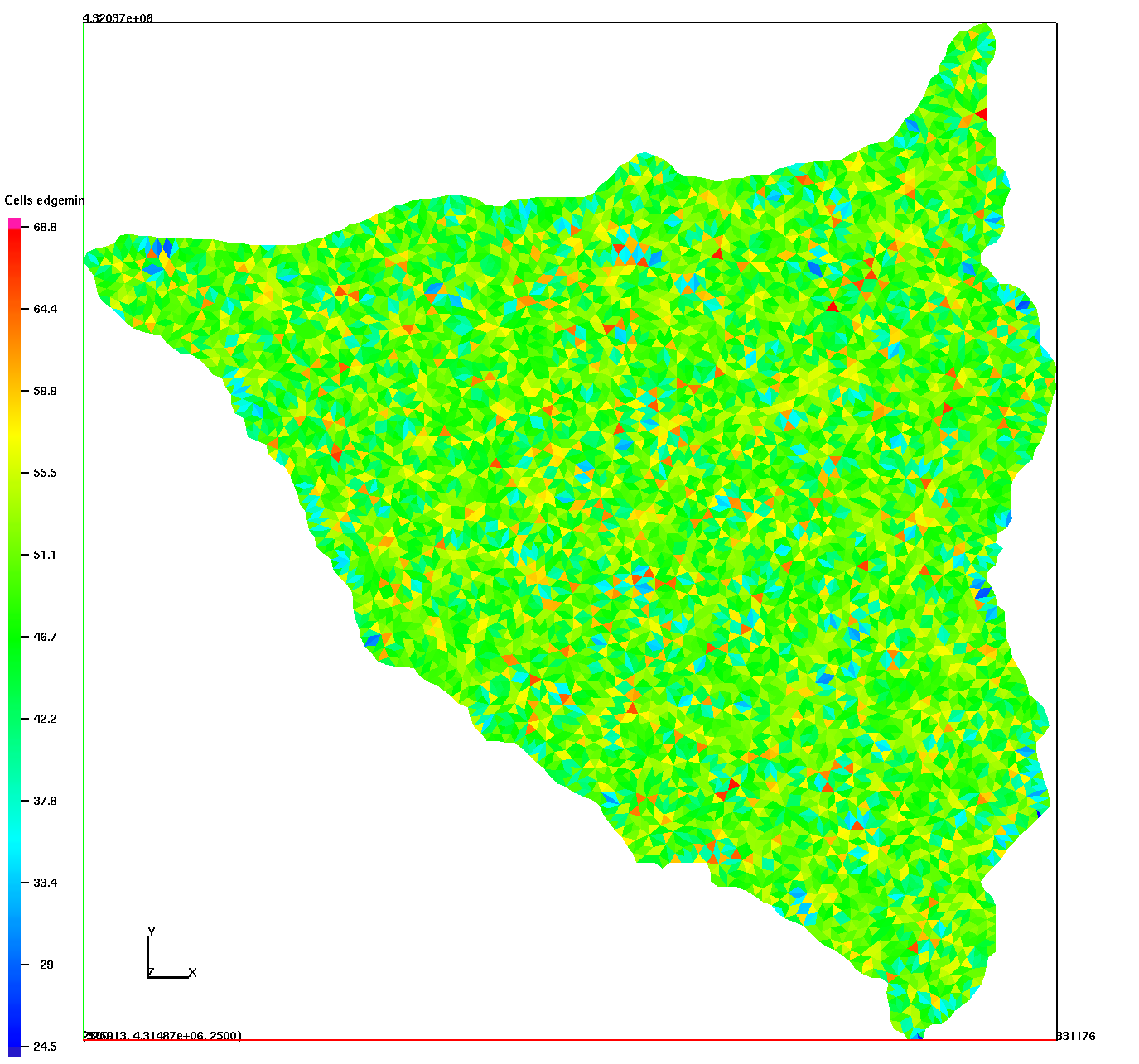
|
Use LaGriT to create layers from the top triangulation by translating to depth.
Stack layers and add sublayers as indicated and connect into a prism mesh.
Write Exodus Mesh file with boundary faces (side sets).
Sets include faces on bottom=1, and top=2
Sides are defined as 3 (default)
For 6 sets: right=3, back=4, left=5, River faces at outlet and top layer =6
stack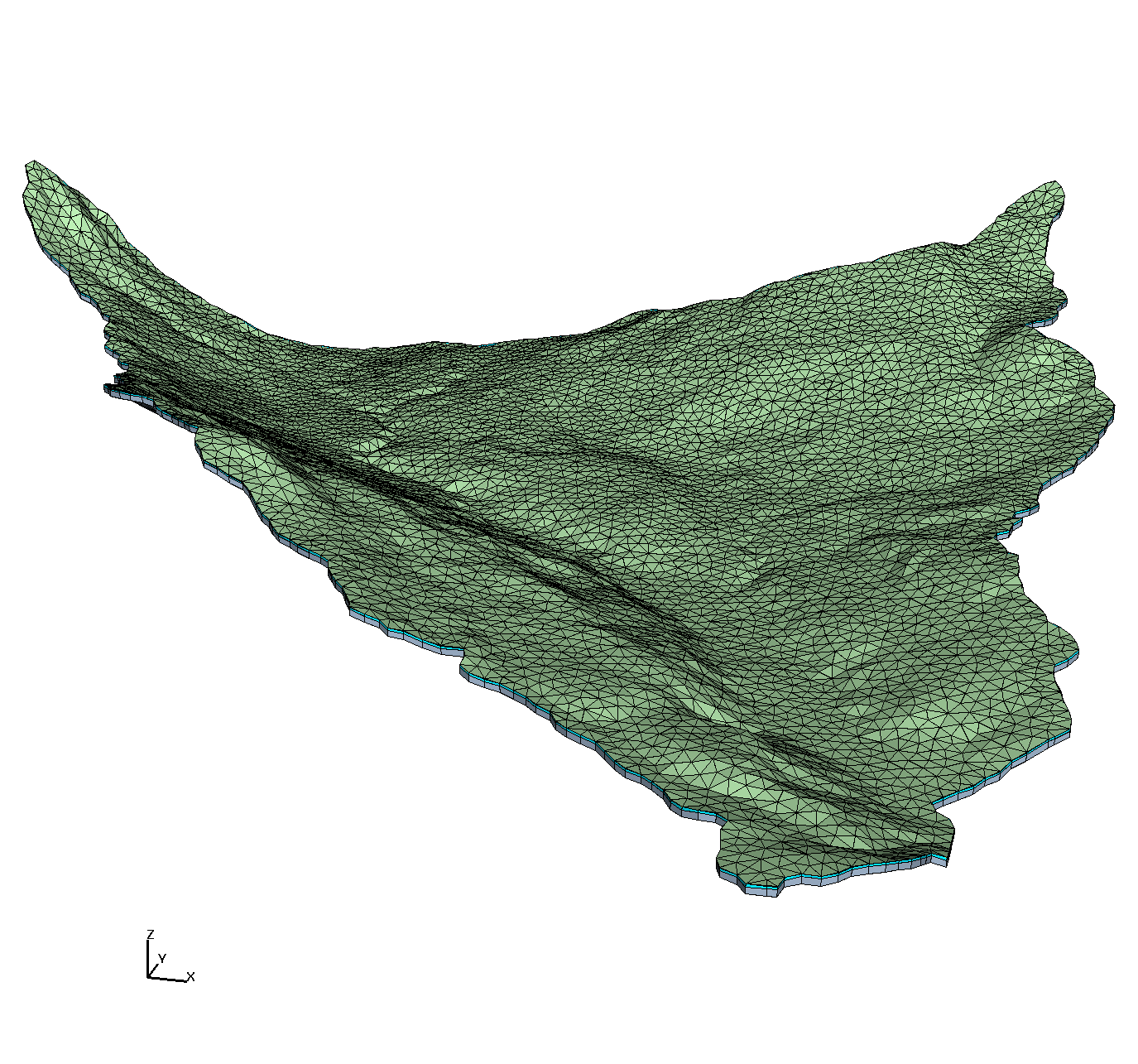
|
Find Elevations below 2771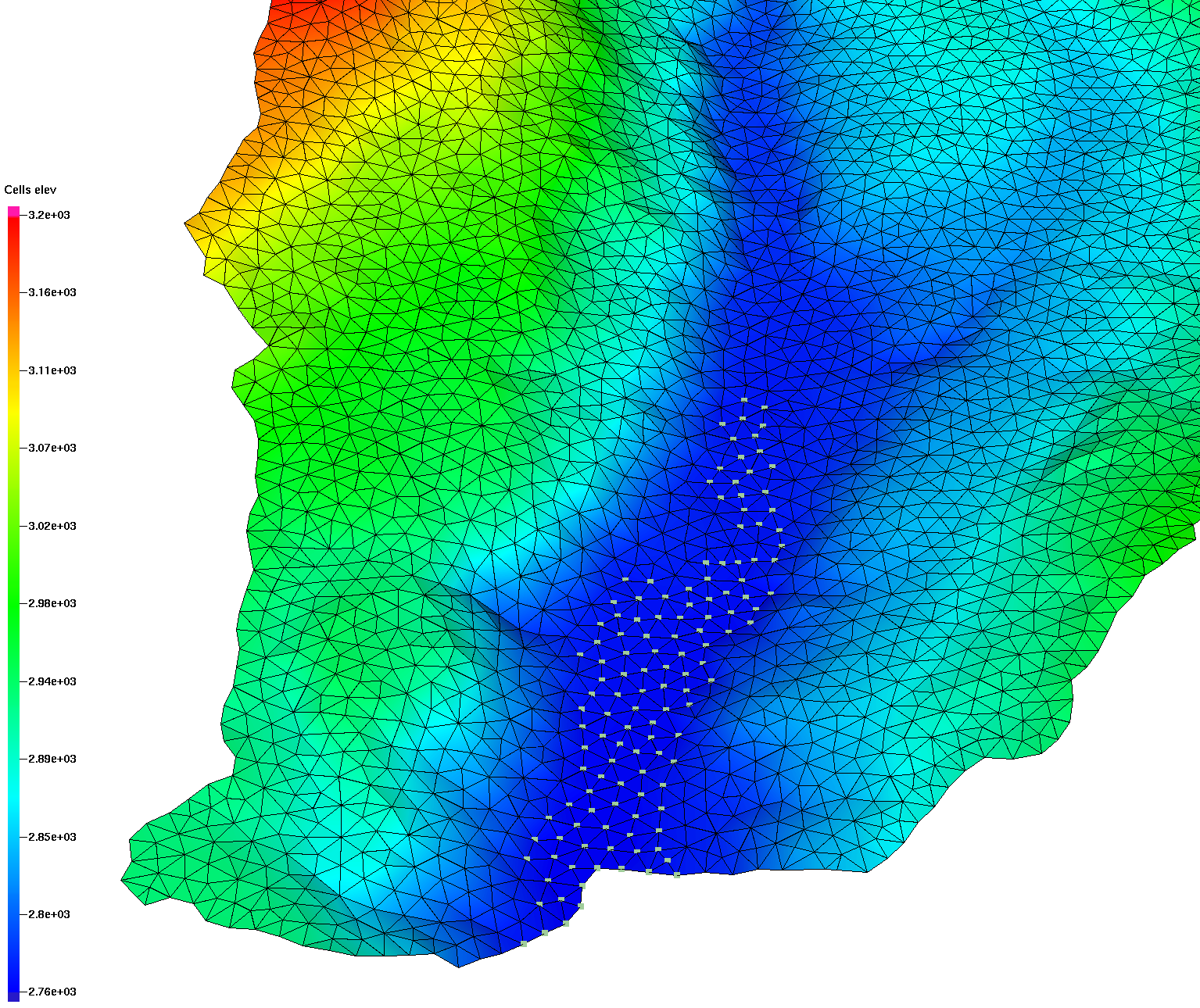
|
fs 6 at outlet and top layer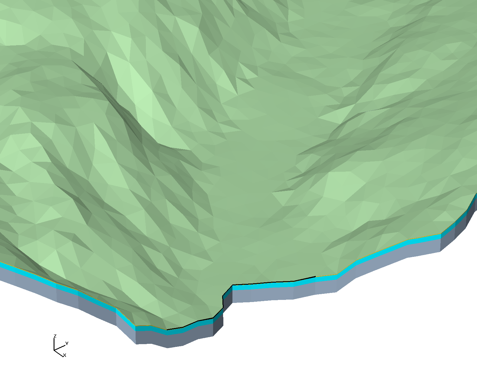
|
sm_fs1_bot_2top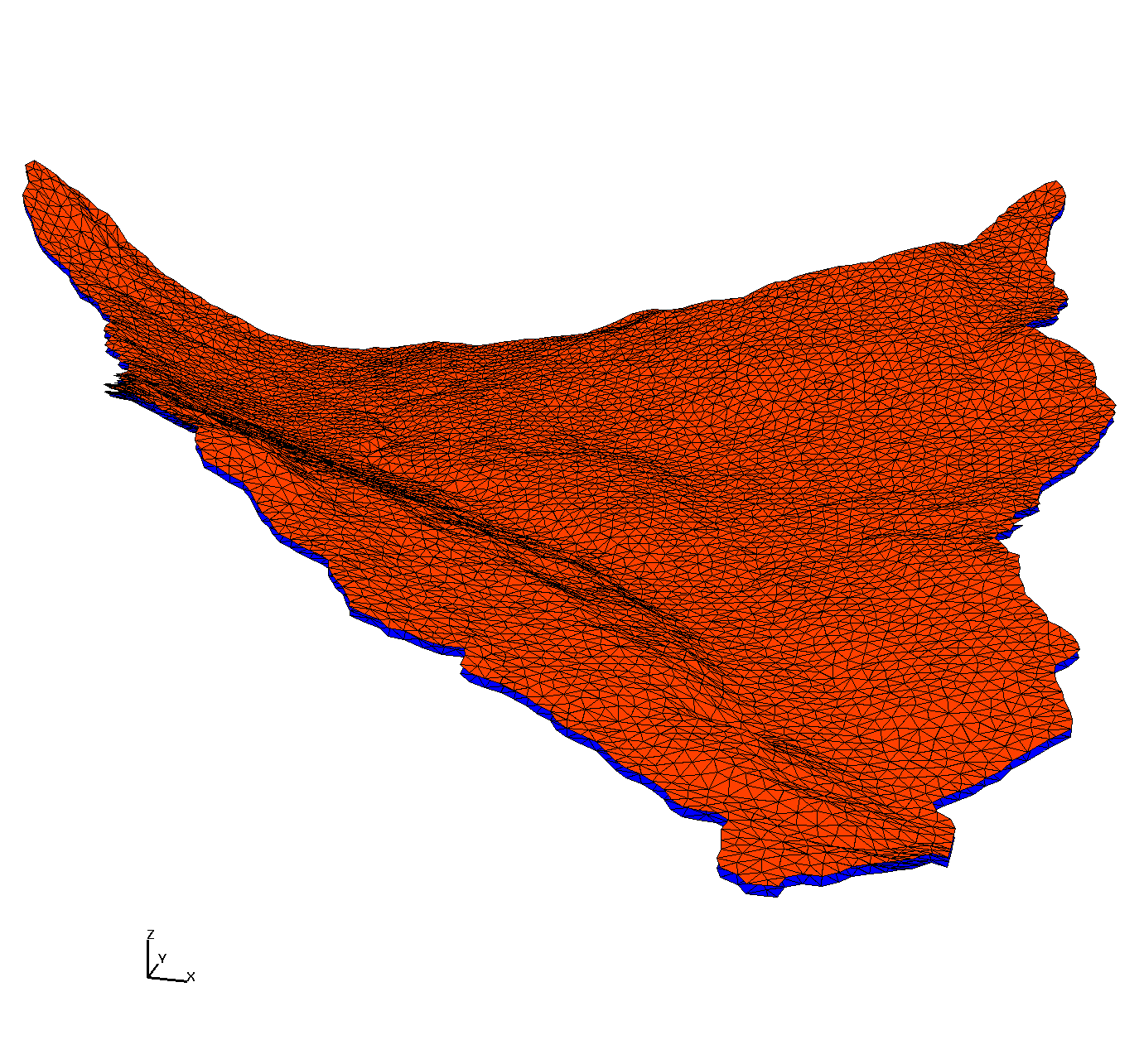
|
sm_fs3_all_sides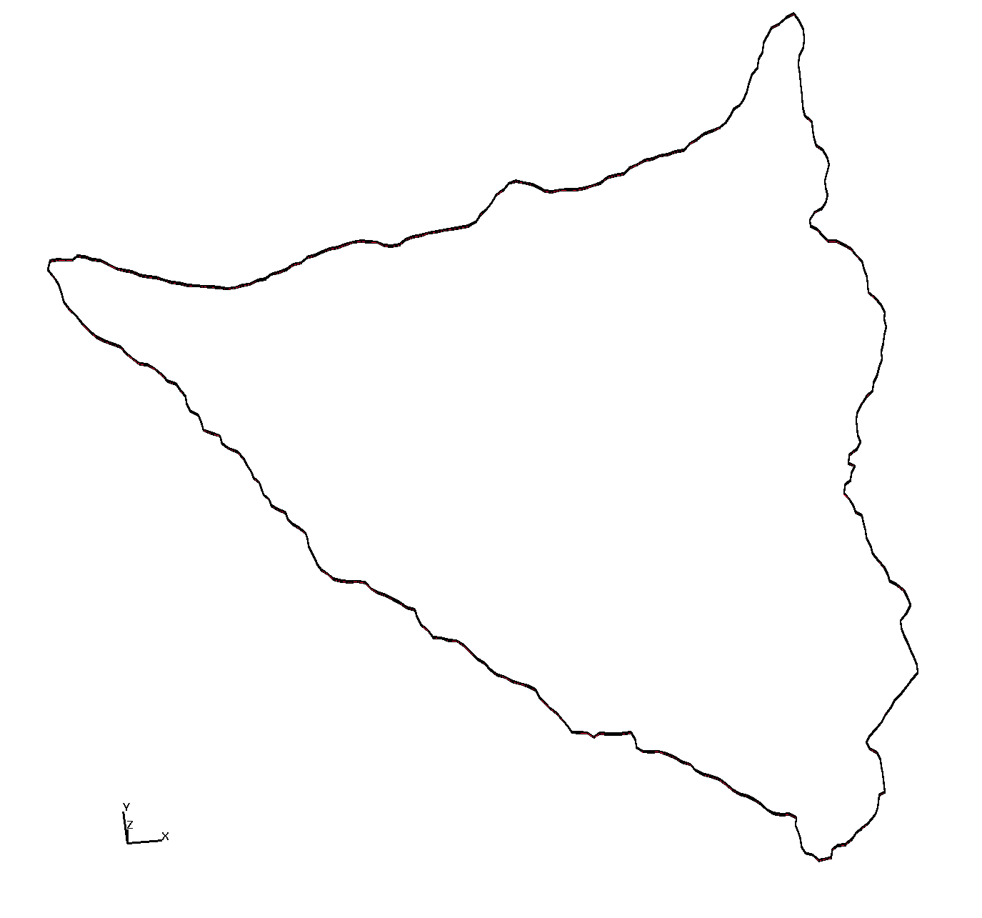
|
sm_fs3_right_4back_5left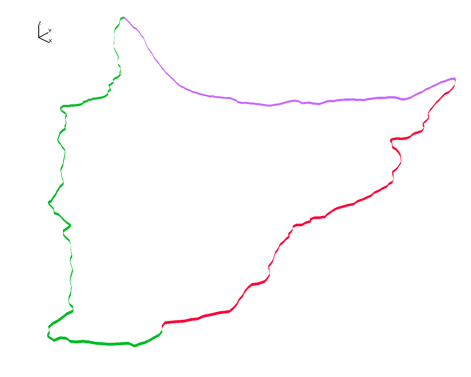
|