tesselate.lanl.gov:big_domain% more ill_01_lower.table
         0          0          0         10          0
00010  1  1  1  1  1  1  1  1  1  1
evol, real
x_coord_elem, real
y_coord_elem, real
z_coord_elem, real
ie_index, integer
je_index, integer
dx, real
dy, real
av_thick, real
id_mat, integer
       1  0.728560486400E+10  0.925000000000E+05  0.446250000000E+07 -0.347510772705E+03    1  108  0.500000000000E+03  0.500000000000E+03  0.291424194560E+05   1
       2  0.484336435200E+10  0.925000000000E+05  0.446250000000E+07 -0.104931396484E+03    1  108  0.500000000000E+03  0.500000000000E+03  0.193734574080E+05   2

Where the columns are:

element number
evol = hex element volume m**3
x_coord_elem = x coord, centroid
y_coord_elem = y coord, centroid
z_coord_elem = z coord, centroid
ie_index = i,j indexing of column of elements
je_index = i,j indexing of column of elements
dx = hex cell dx in meters
dy = hex cell dy in meters
av_thick = cell average thickness computed from evol/(dx*dy)
id_mat = material ID number
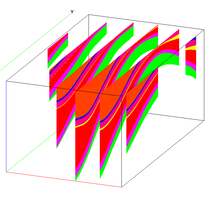
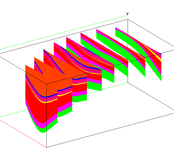
Click on image to enlarge.
Gallery written: Thu Jun 3 15:48:59 2010
Image Directory: /scratch/ymp/gable/grid_gen/www_mesh_catalog/nl_person/mt_simon01
Gallery written: Fri Nov 19 12:24:30 2010
Image Directory: /scratch/ymp/gable/grid_gen/mt_simon/data_091211/big_domain/fehm_demo
| fehm_mesh_01 |
fehm_mesh_02 |
fehm_mesh_03 |
fehm_mesh_04 |
| fehm_mesh_composit |
|
Top of Stratigraphic units (in meters) |
.inp file name |
Unit Name |
aquifer or confining unit |
|
Permian = Land Surface |
Top_ill01.inp |
||
| Pennsylvanian-Mississippian Sandstones??? | aquifer |
||
|
Pennsylvanian |
Top _ill02.inp |
||
| ??? | ??? | ||
|
Upper Mississippian |
Top _ill03.inp |
||
| ??? | ??? | ||
|
Lower Mississippian |
Top _ill04.inp |
||
| ??? | ??? | ||
|
Upper Devonian |
Top _ill05.inp |
||
| ??? |
??? | ||
| ??? |
Top_ill06b.inp |
||
| ??? |
??? | ||
| ??? |
Top_ill06a.inp |
||
| Devonian Carbonates??? | ??? | ||
|
Middle Devonian |
Top _ill06.inp |
||
| Devonian Carbonates??? | ??? |
||
|
Upper SIlurian |
Top _ill07.inp |
||
| ??? | ??? |
||
|
Lower Silurian |
Top _ill08.inp |
||
| ??? | ??? |
||
|
Upper Ordovician |
Top _ill09.inp |
||
| Ordivician Carbonate??? | ??? |
||
|
Lower Ordovician |
Top _ill10.inp |
||
| Ordivician Carbonate??? | ??? |
||
|
Upper Cambrian (Mt. Simon top) |
Top _ill11.inp |
||
| Mt Simon Sandstone | aquifer |
||
|
Mt. Simon bottom topography |
Mt_Simon_bottom.inp |
/scratch/ymp/gable/grid_gen/mt_simon/data_091211/big_domain
xyclip_Top_ill01.inpStep 1 : Use top layer (xyclip_Top_ill01.inp) to truncate all the other layers. That is, if the elevation of a layer is greater than the elevation of the top layer, set the elevation to the elevation of the truncating layer.
aquifer Pennsylvanian-Mississippian Sandstones
xyclip_Top_ill06b.inp
confining New Albany Shale
xyclip_Top_ill06a.inp
aquifer Devonian Carbonates
xyclip_Top_ill06.inp
confining Maqoketa Shale
xyclip_Top_ill07.inp
aquifer Ordivician Carbonate
xyclip_Top_ill10.inp
confining Eau Claire Shale
xyclip_Top_ill11.inp
aquifer Mt Simon Sandstone
xyclip_Mt_Simon_bottom.inp
Click on image to enlarge.
Gallery written: Tue Nov 30 13:54:48 2010
Image Directory: /scratch/ymp/gable/grid_gen/mt_simon/data_091211/big_domain/images_isopachs

