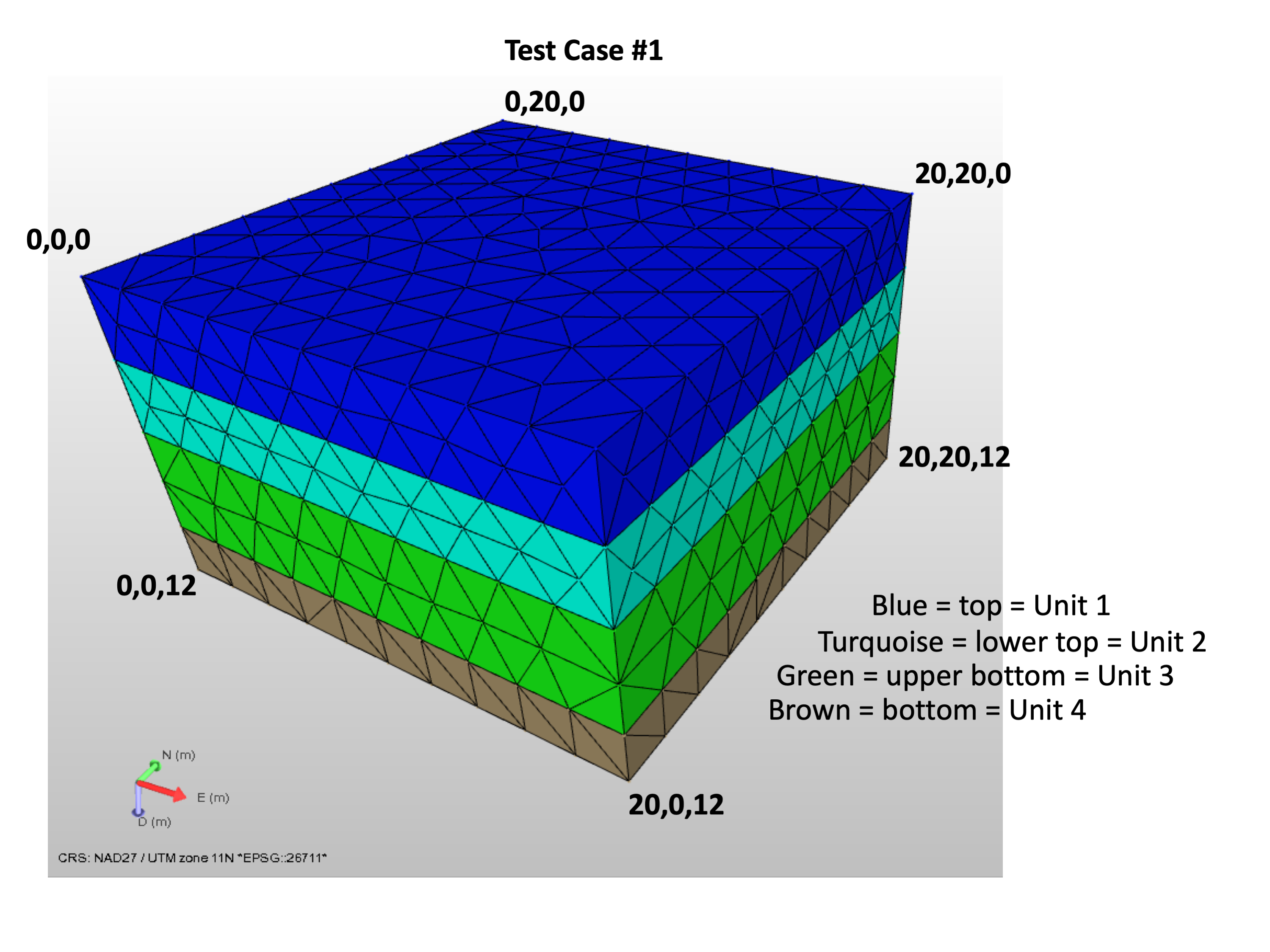
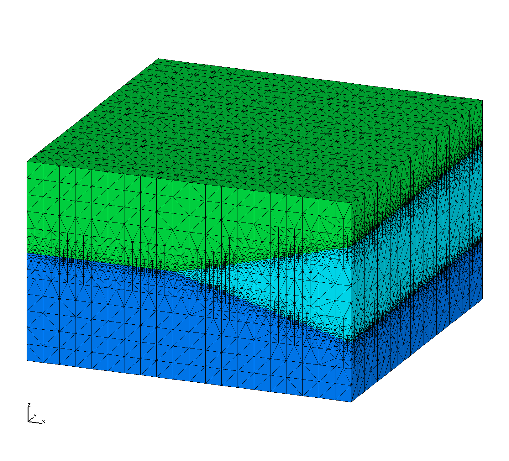
Horizontal Layers
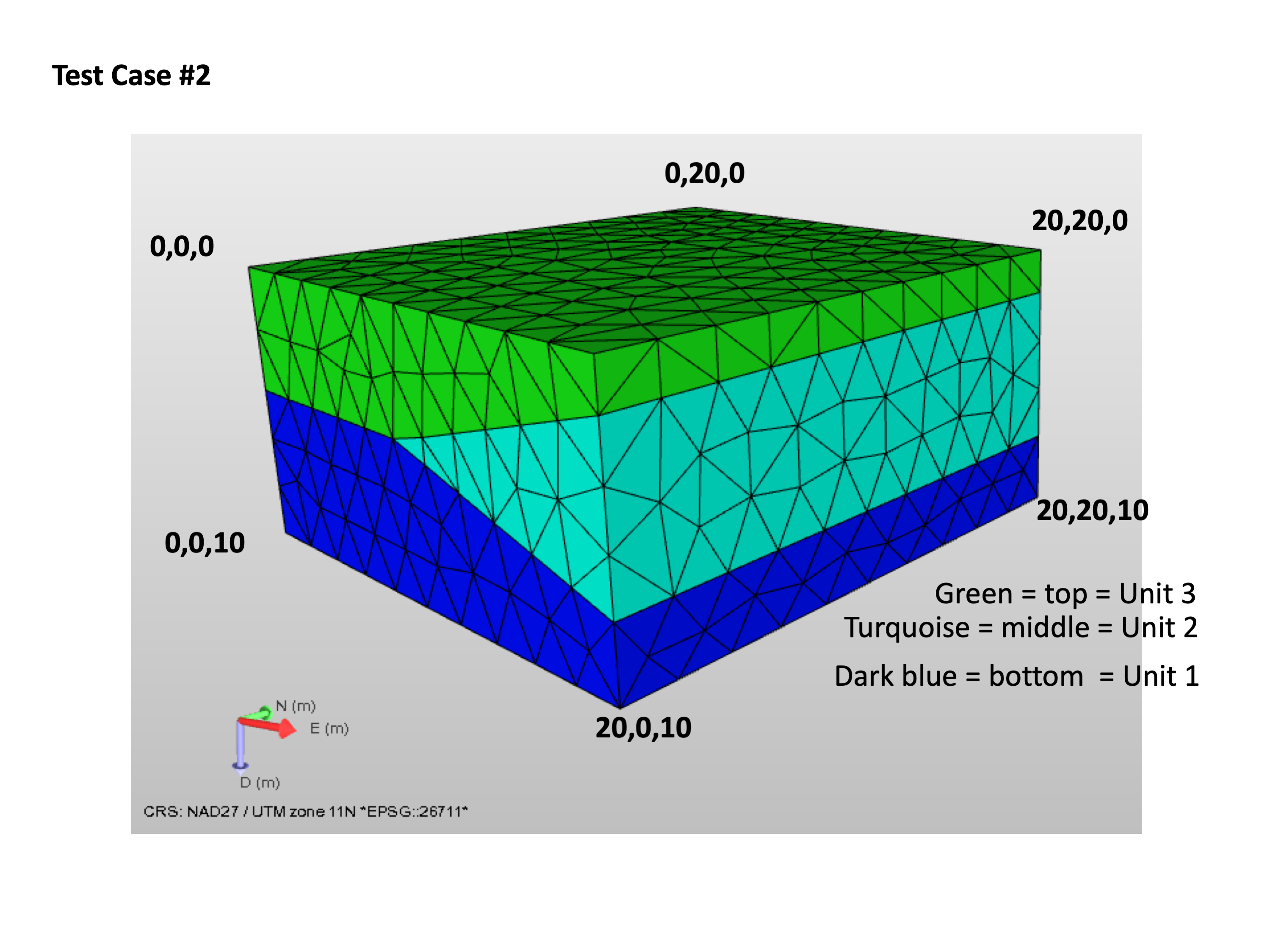
Layers with Pinchout
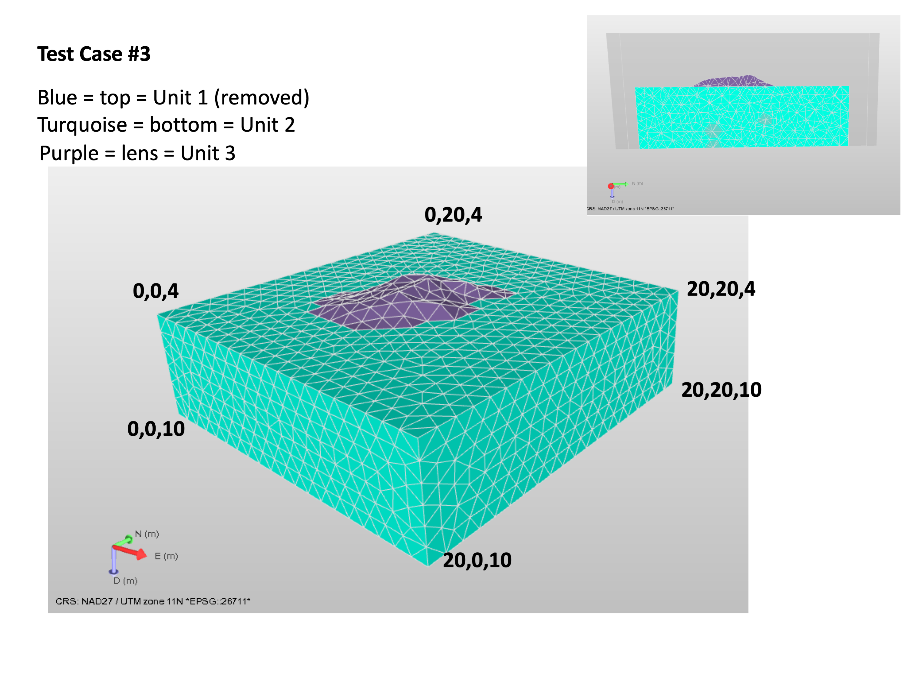
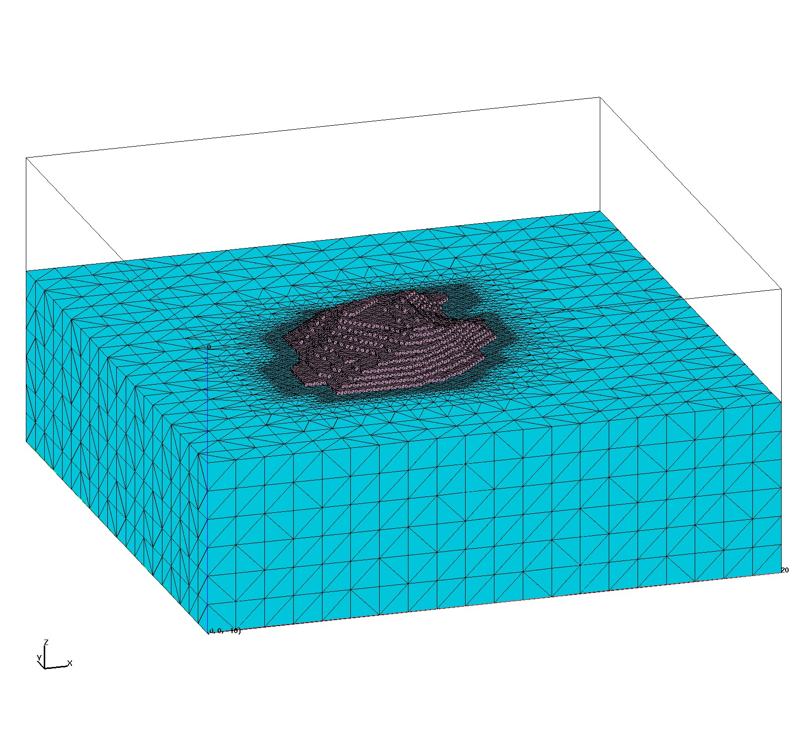
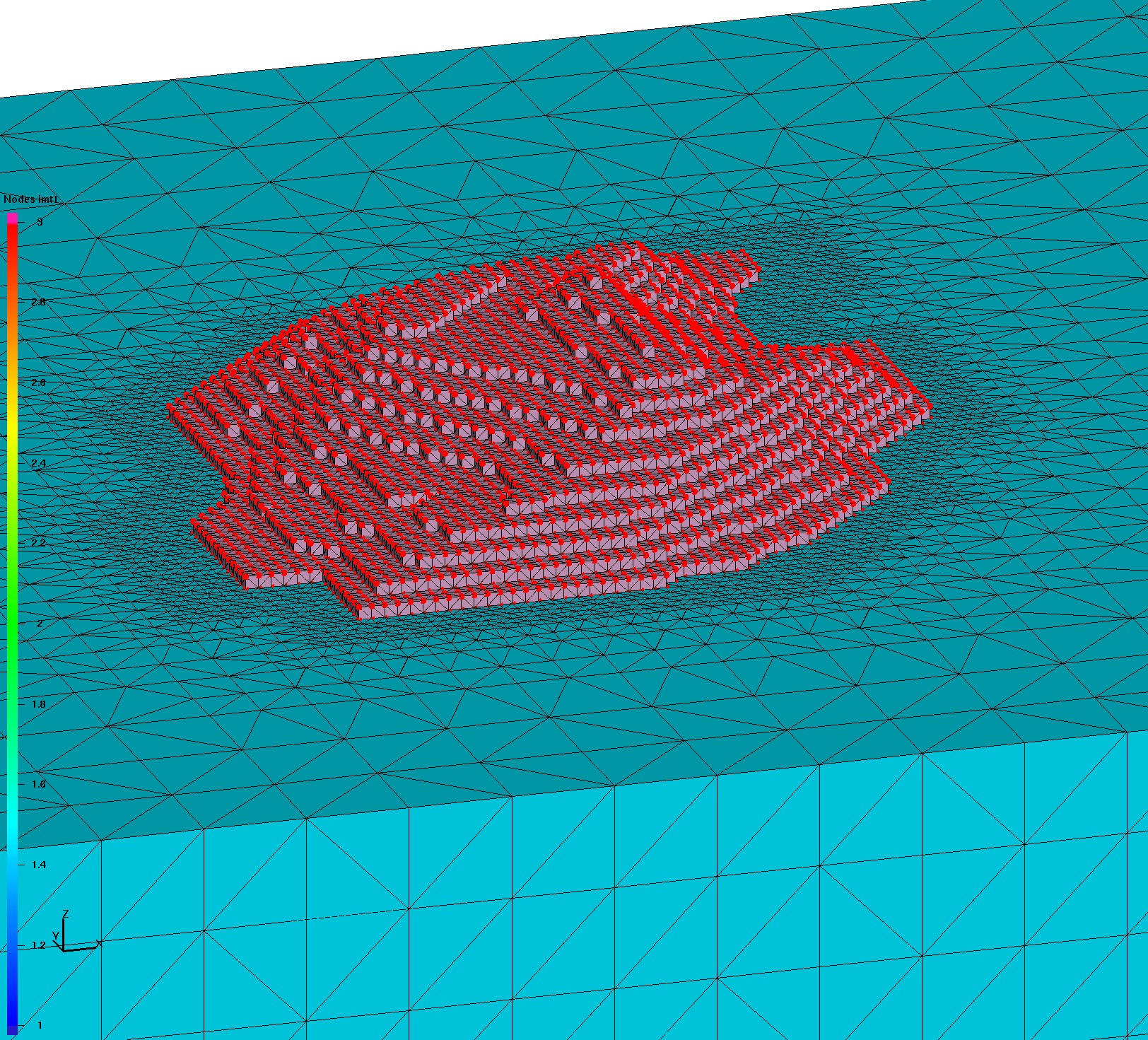
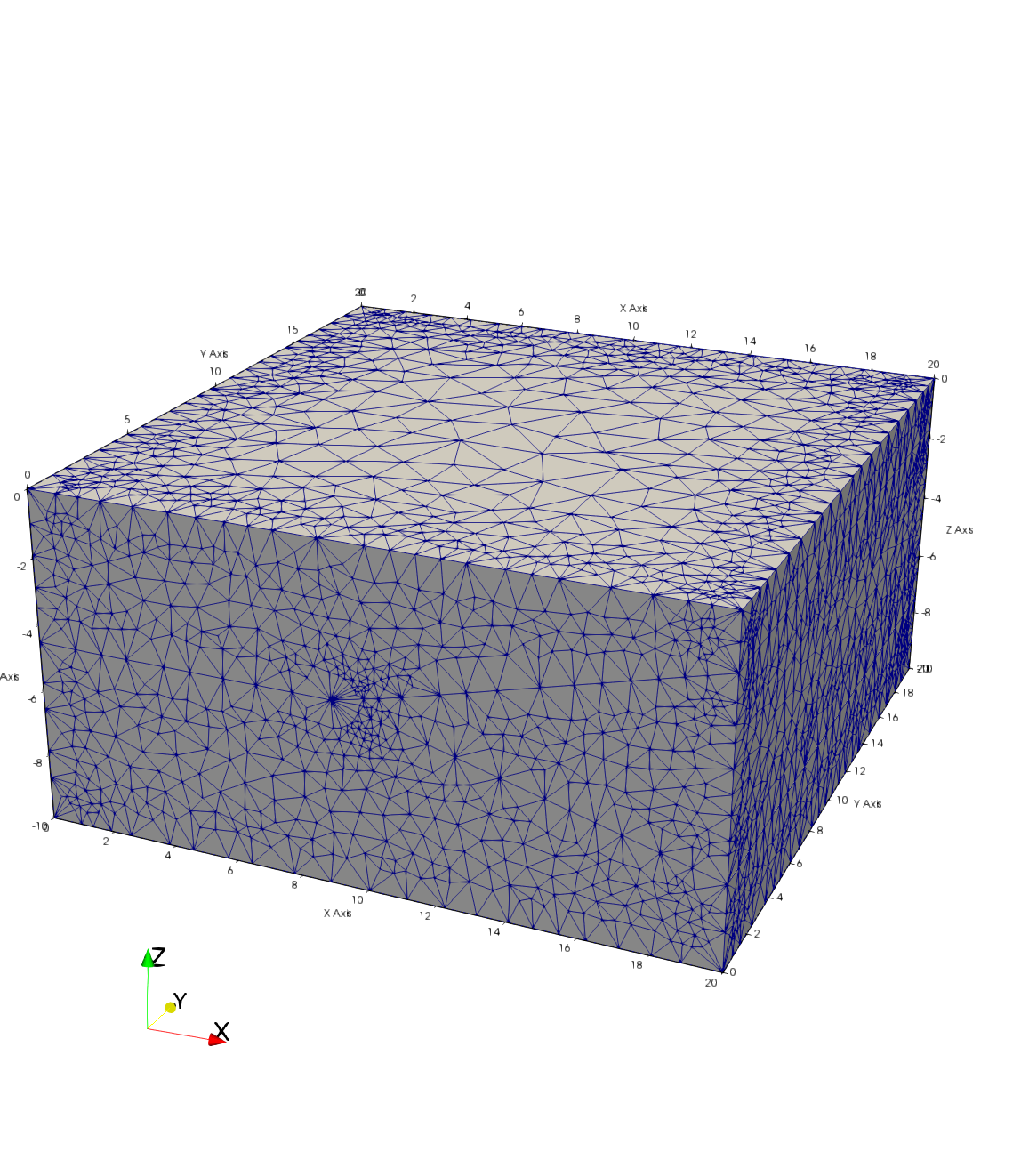
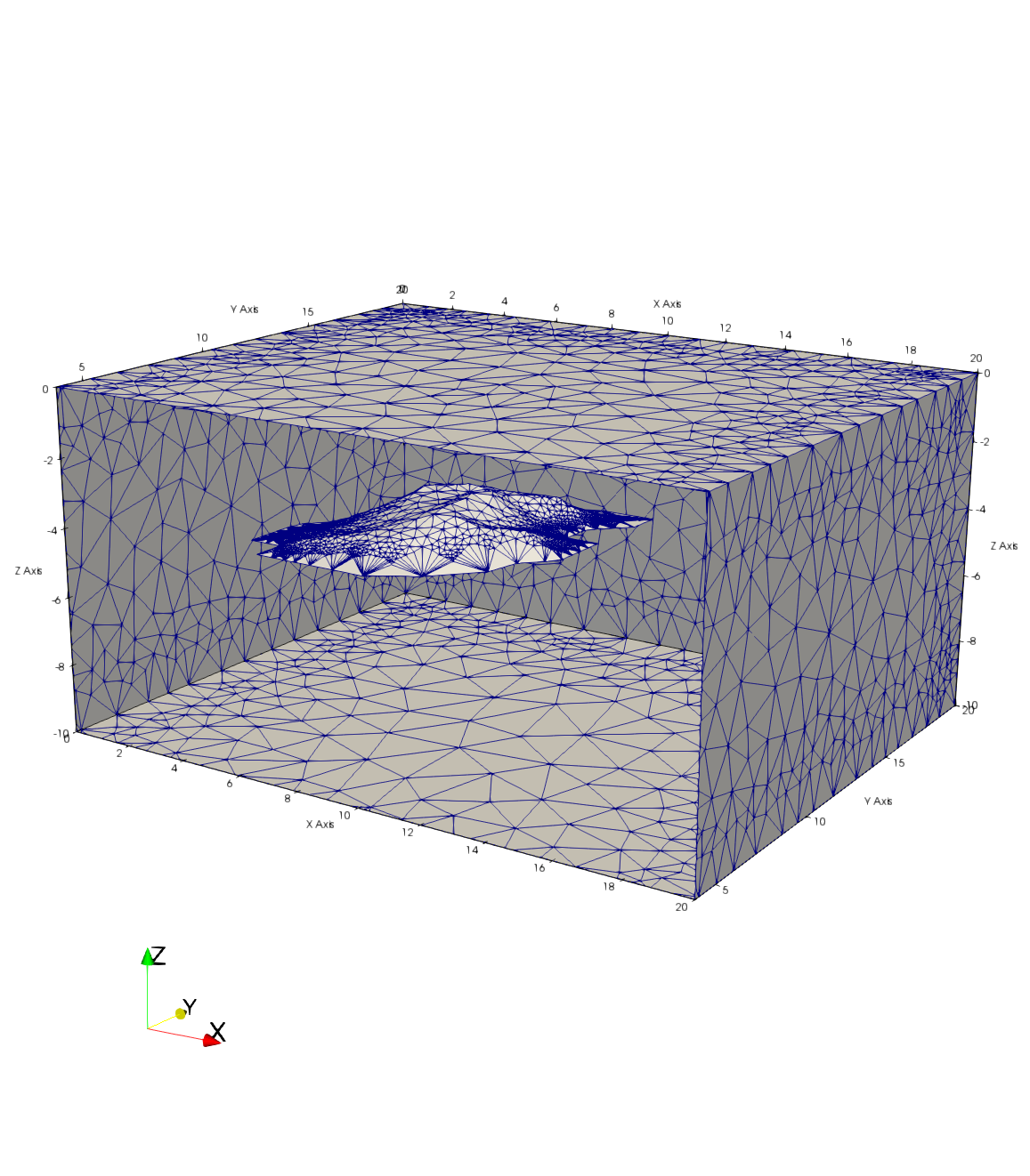
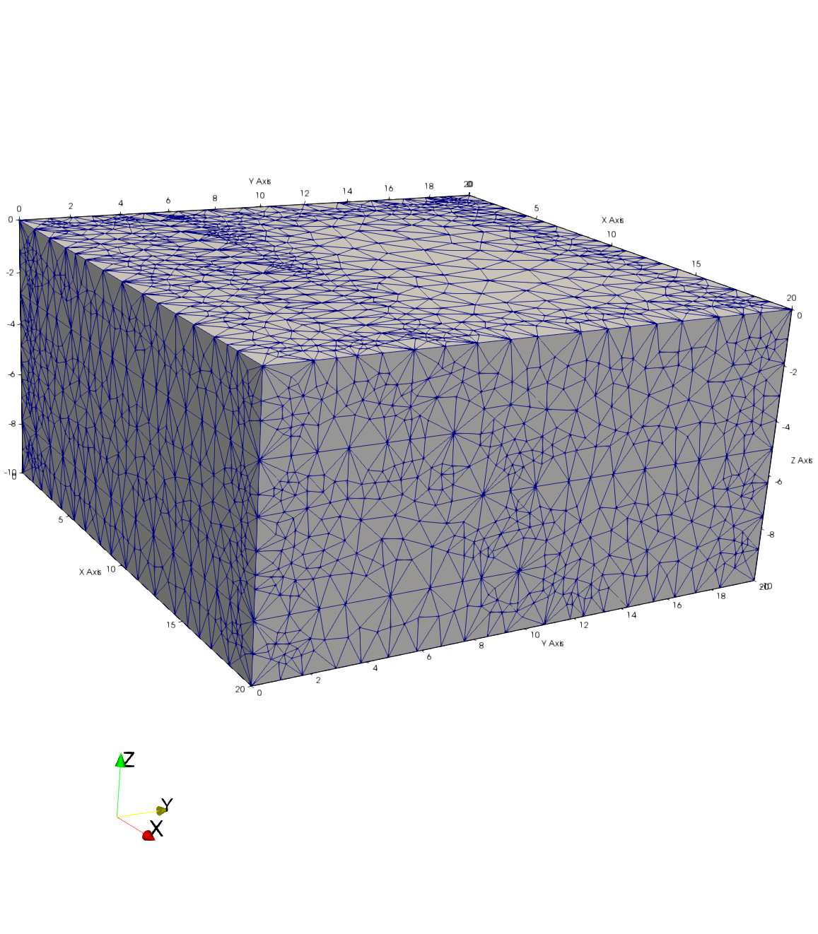
Embedded Lens
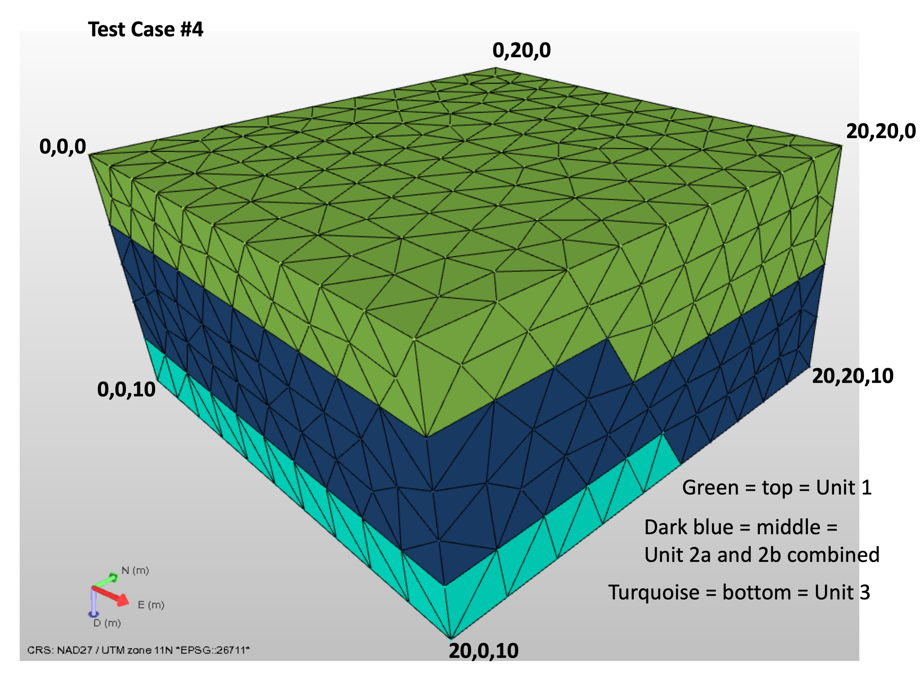
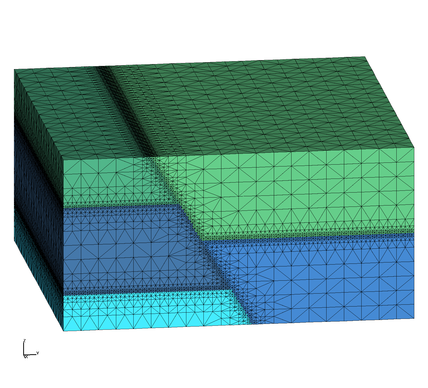
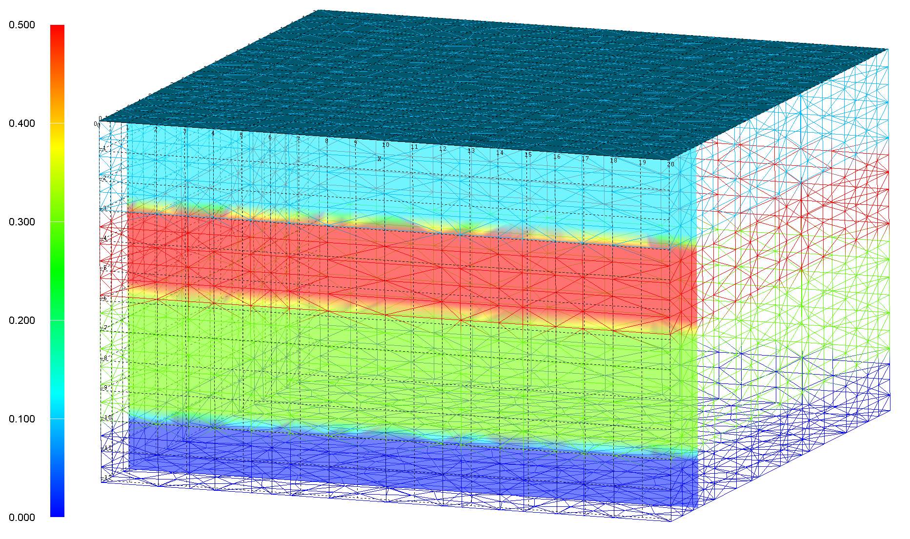
Fault with offset layers
| Mesh Team Members: | Terry Miller, Carl Gable, Daniel Livingston |
| Modeling Team Members: | Phil Stauffer, Jeffrey Hyman |
| Data Source: | JewelSuite Geologic Framework Model from EES-14 |
| Prototype Tests 1-4: | June 7 2019 |
| Delivered To: | SNL Tara LaForce and Emily Stein |
| Data Archive: | GitHub LANL/GeologicMeshing/GDSA |
| All images: | Image Gallery |
| Main Page: | Geo Integration |
The Hydrogeologic or Geologic Framework Model (HFM/GFM) used for Meshing can be represented in various ways.
Typically layer interfaces, bottom, and top are defined by horizontal surfaces and a DEM.
More complicated geometries can be added with intersecting fault surfaces and feature geometries such as flow bodies and lenses. Software applications such as RockWorks, EarthVision, and JewelSuite import data and help geologists visualize and build a 3D volume representing their interpretation of model volume.
Once the HFM/GFM is built, it is used to design and build a computational mesh and setup files for simulations. Modeling software such as FEHM and PFLOTRAN have mesh requirements that ensure the accuracy of simulations used on the mesh. Meshing software such as LaGriT have the tools to build the computational mesh and to write setup files that meet the Modeling software requirements.
The HFM/GFM needs to inform the meshing workflow about the represented geometry and topology. Meshing can use surfaces exported from the HFM/GFM,
meshed volumes, or by a query method that interpolates material ids to a mesh. JewelSuite does not export surfaces, but can export air tight surface tessellations that represent the exterior bounding surface of each material volume.
Steps for Meshing Workflow with JewelSuite
1) Create interface between JewelSuite GFM and LaGriT for meshing.
These tests are designed to represent common GFM features and are used to Test the interface between JewelSuite and Meshing Software.
Note that these tests did not use the import of geologic data such as a DEM. This will need to be tested.
|
Test 1 Horizontal Layers
|
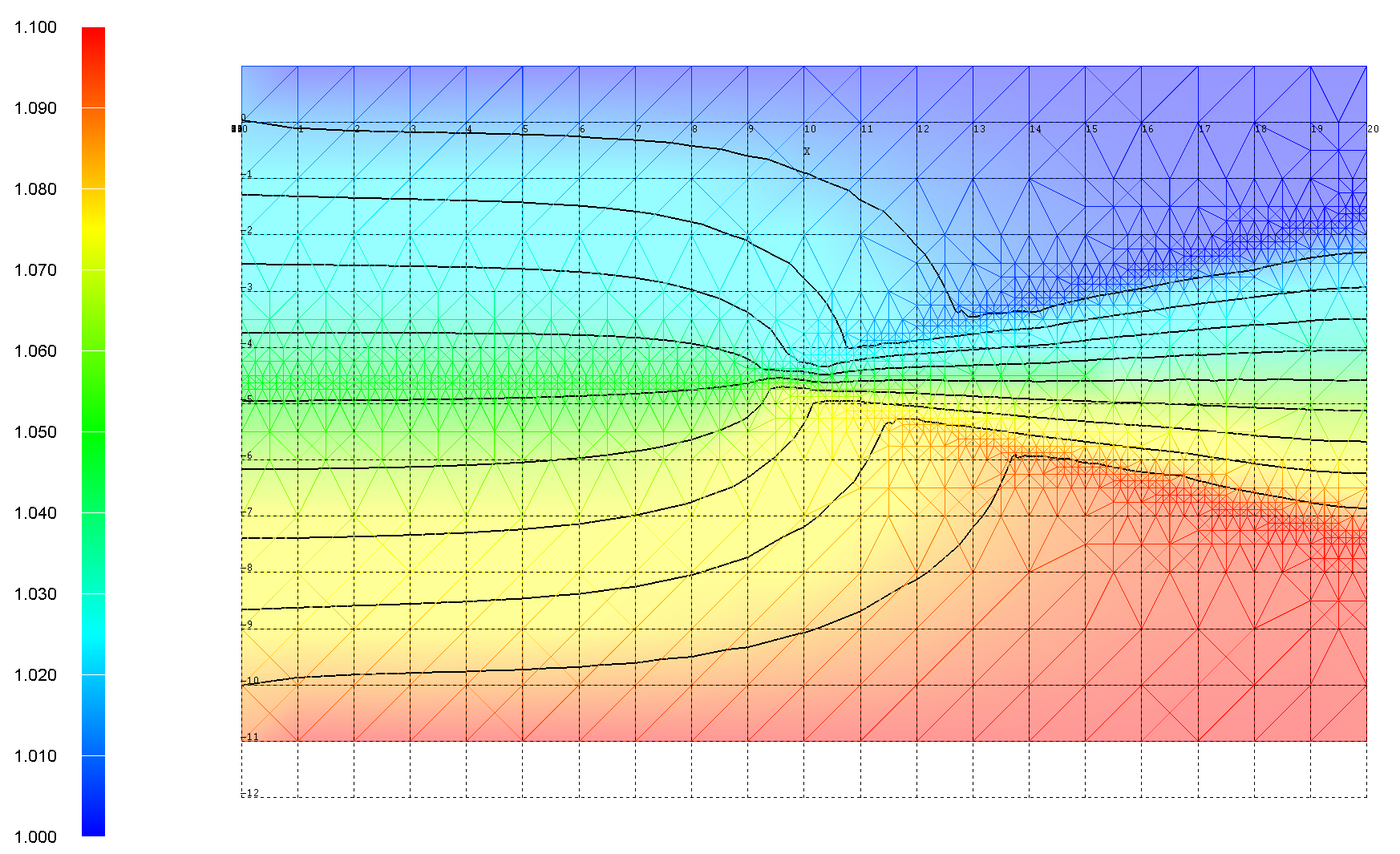
Test 2 Layers with Pinchout
|
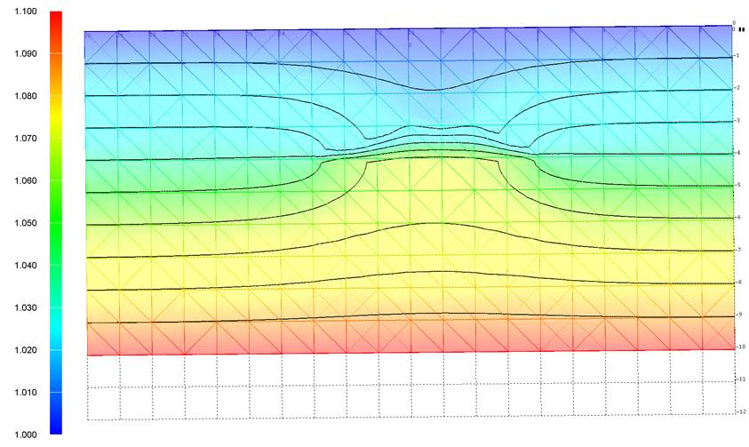
Test 3 Embedded Lens
|
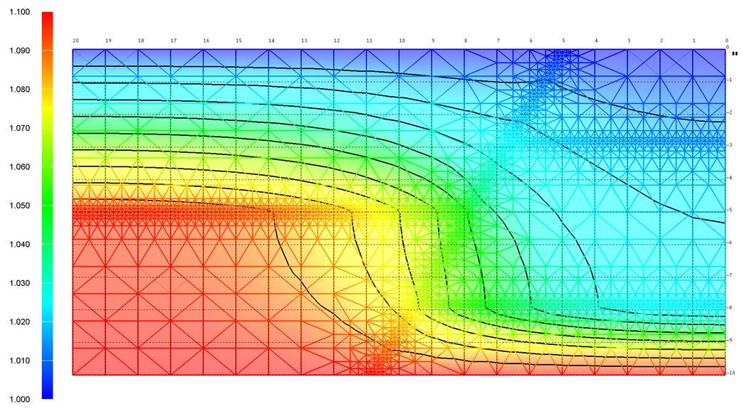
Test 4 Fault with offset layers
|
The Meshing workflow uses Materials and structures from the GFM to design and create a mesh for modeling.
We use GFM material volumes to interpolate materials to the computational mesh or to identify areas for refinement.
We use GFM surfaces to identify boundaries, design conforming interfaces, truncate by ground surface, and identify areas for refinement.
Using JewelSuite GFM is new to our workflow and we need to figure out how to export the GFM in a manner we can use.
JewelSuite can export the material volumes as a tetrahedral mesh in GOCAD file format.
This GOCAD mesh needs a translation to the right-hand coordinate system before we can use it. JewelSuite has Z defined as Depth instead of the usual convention with Z defined as Elevation.
The four Test GOCAD files are translated by multiplying the GOCAD Z values by -1 and then fixing the tetrahedral node order so elements are not inside out.
Further testing is needed to make sure this translation works when ARCInfo data such a DEM is imported into JewelSuite and then written to the GOCAD file.
JewelSuite can not export surfaces so we use LaGriT to extract the triangulated boundary surface and interfaces from the exported GOCAD mesh.
Test 1 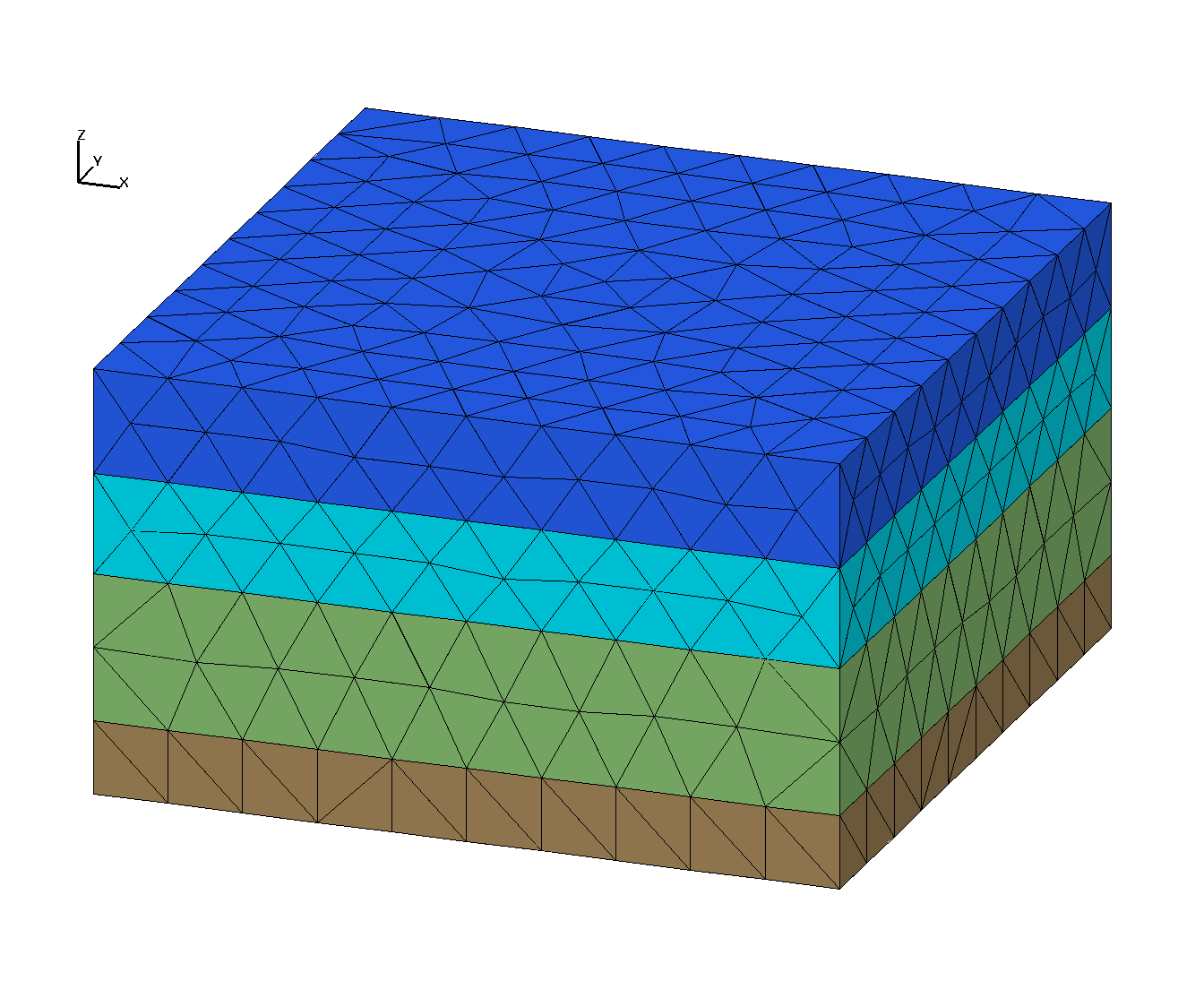
|
Test 2 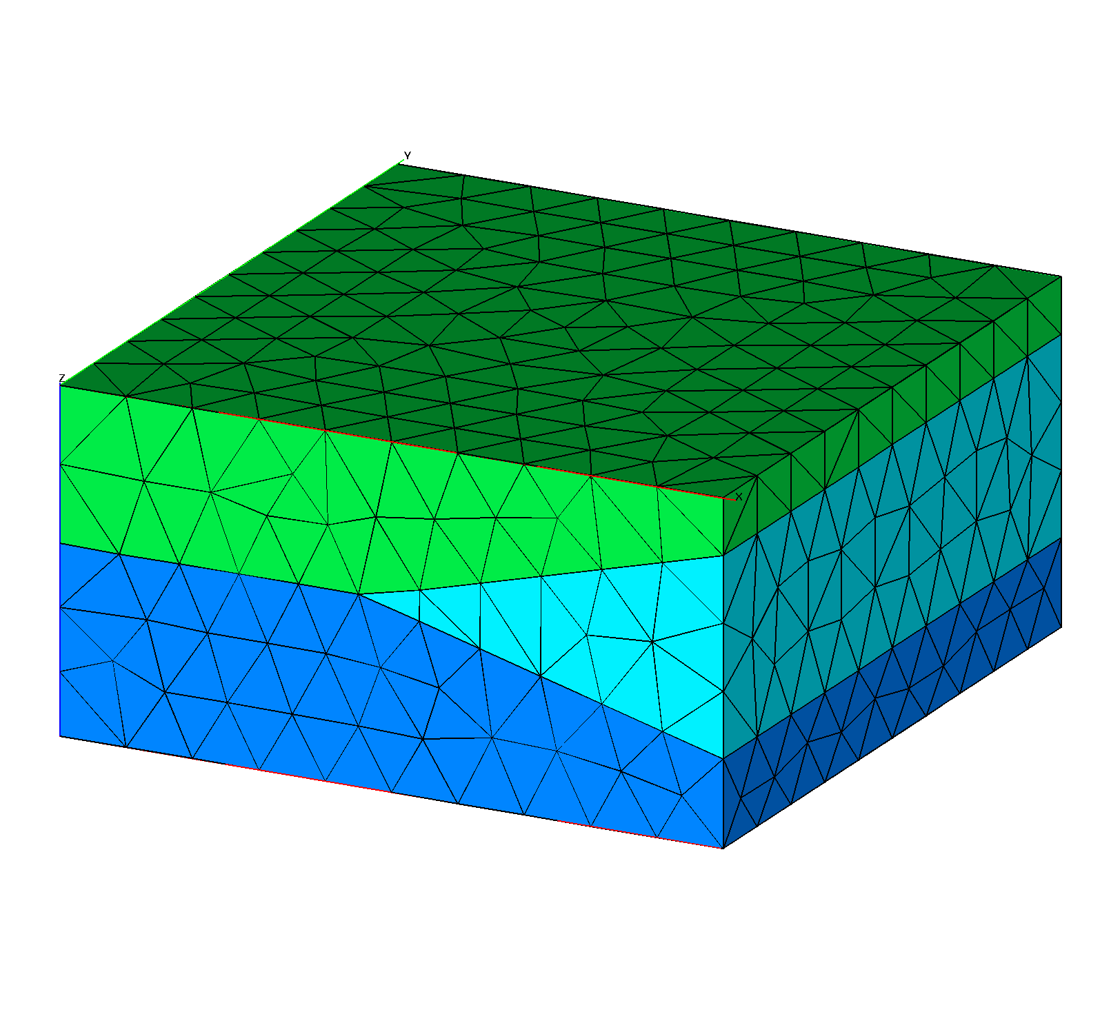
|
Test 3 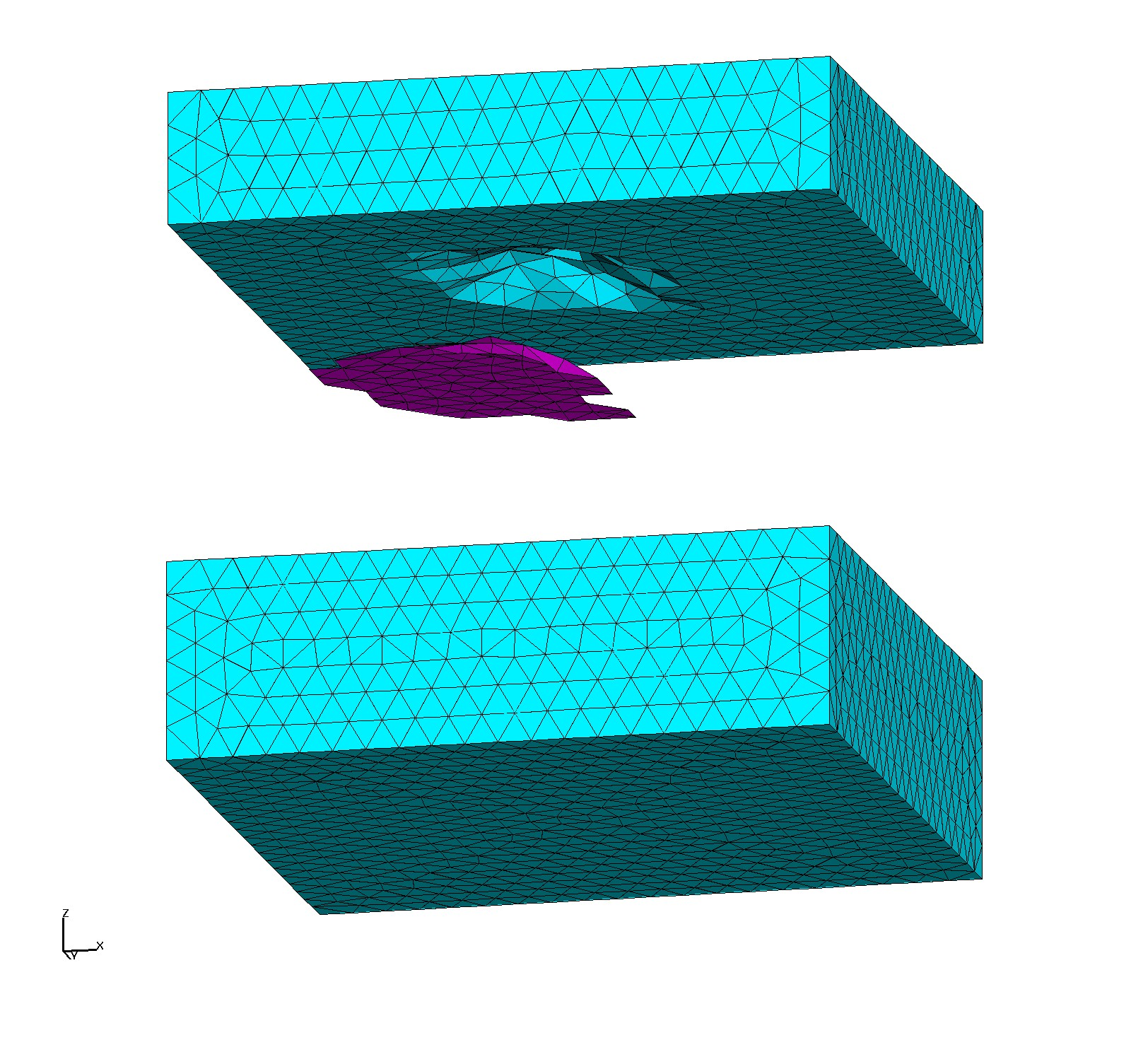
|
Test 4 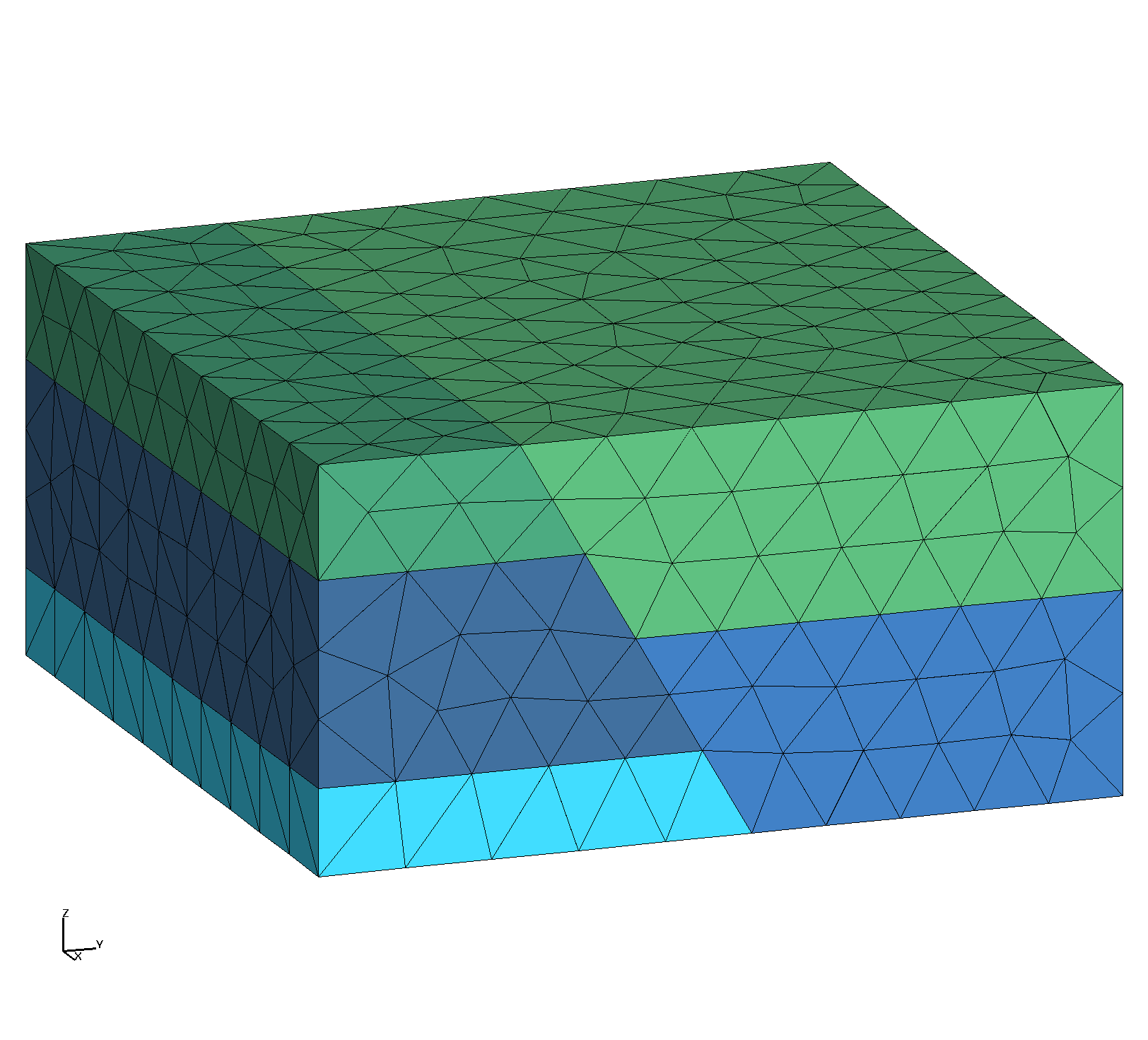
|
Test 1 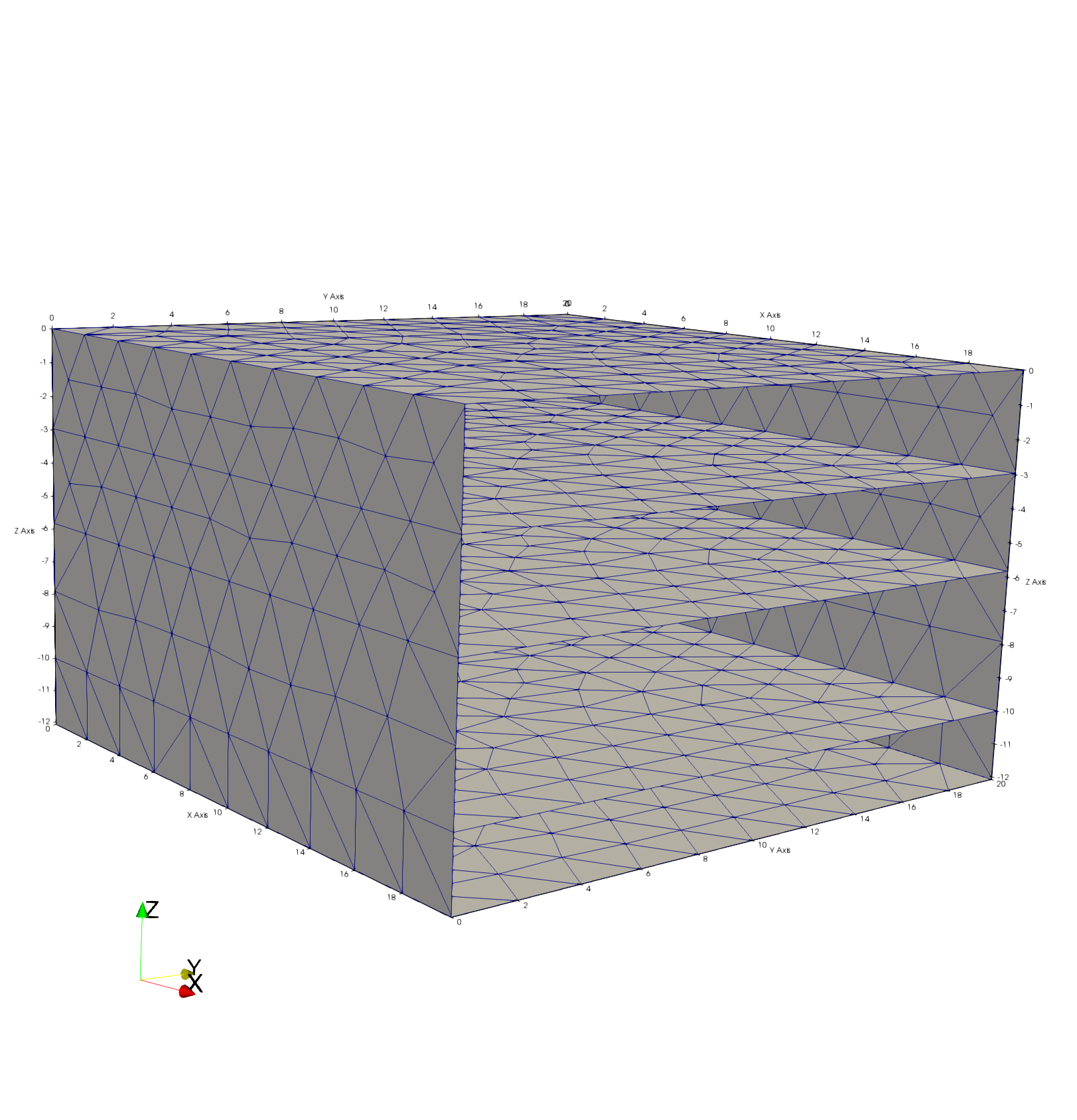
|
Test 2 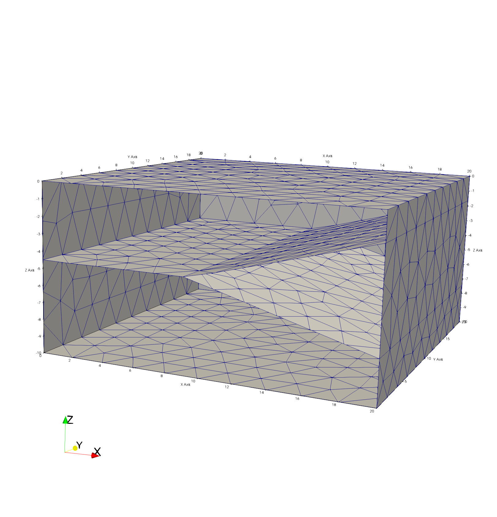
|
Test 3 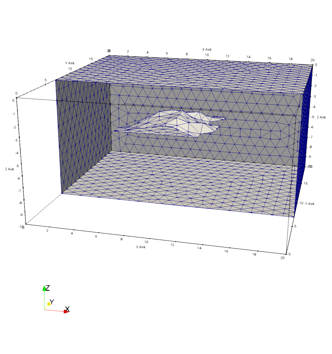
|
Test 4 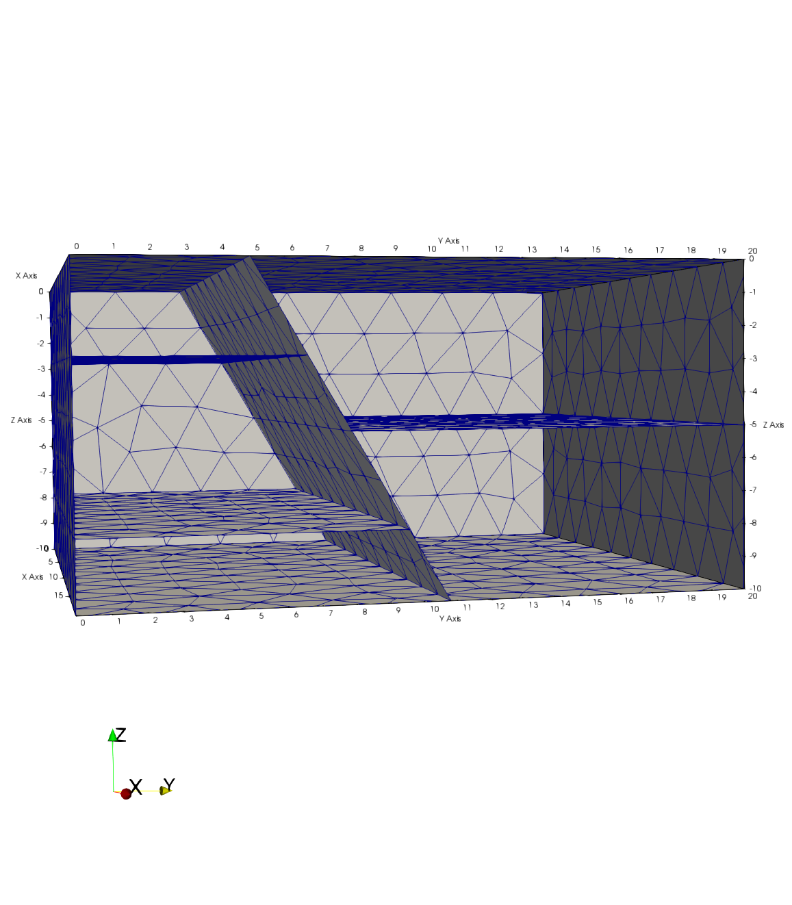
|
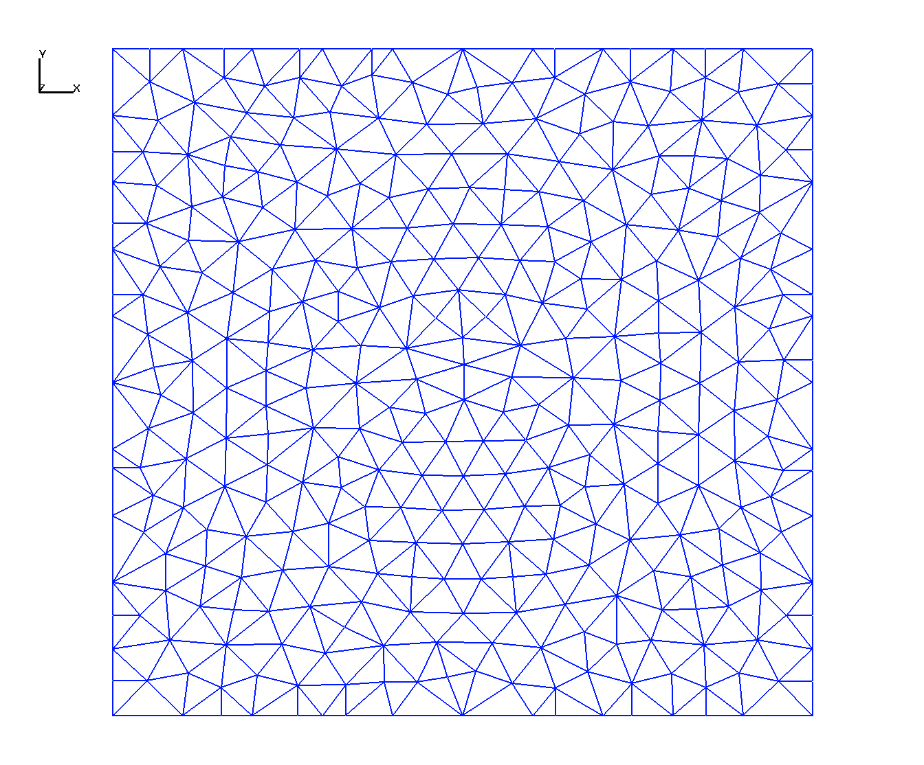
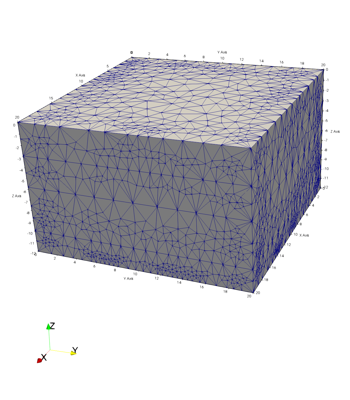
Using the GFM data we create a computational mesh for Modeling requiring the Delaunay criteria for accurate simulations.
The mesh must also represent the GFM materials well enough to represent the physics simulated.
Various meshing strategies can be used, here we use methods well established for our modeling needs.
The first is a Stacked Mesh method, a 2D Delaunay triangulation is created for the domain. Elevations from
each of the GFM layers are interpolated to create surfaces for each boundary. These are stacked with
thicknesses designed to maintain the Delaunay criteria. These points are then connected into a Delaunay tet mesh.
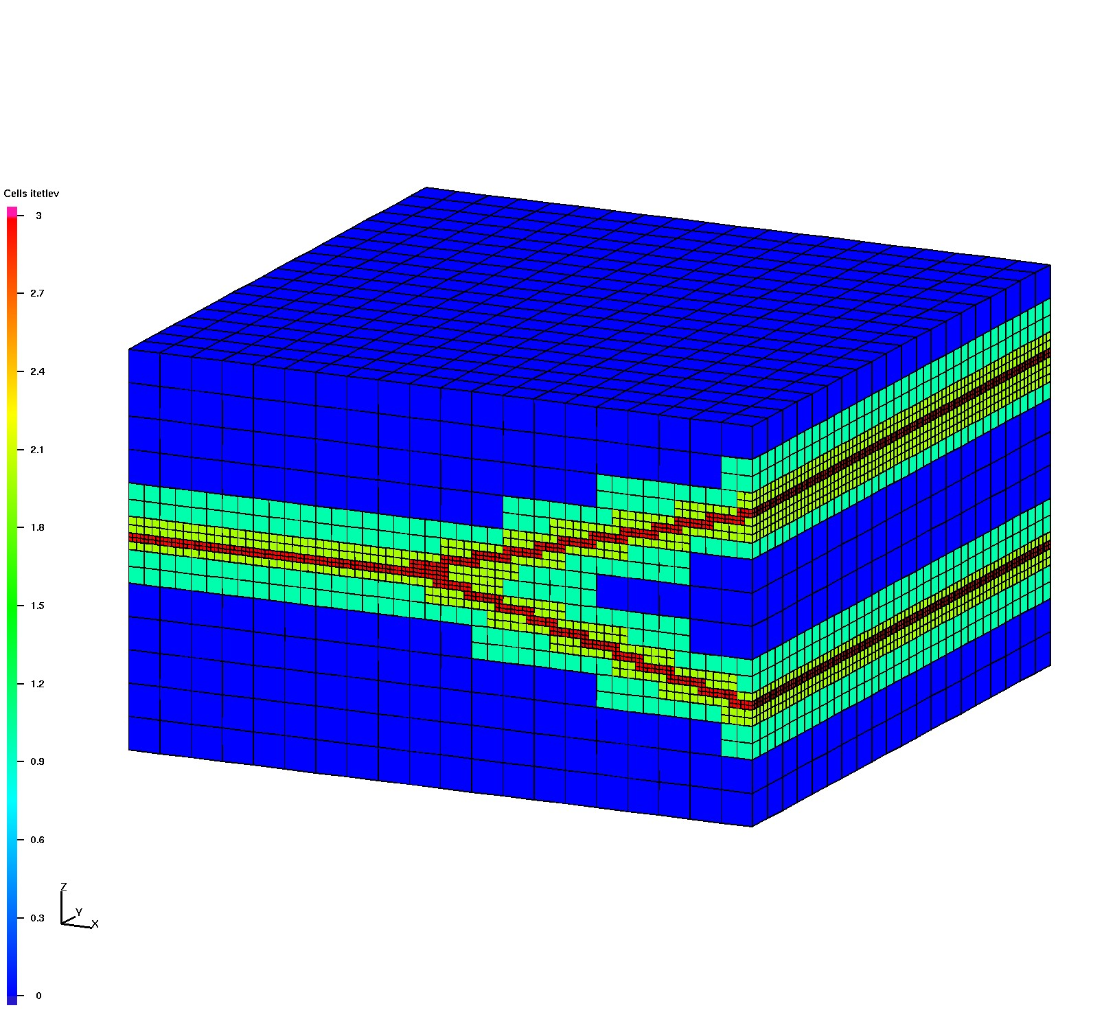
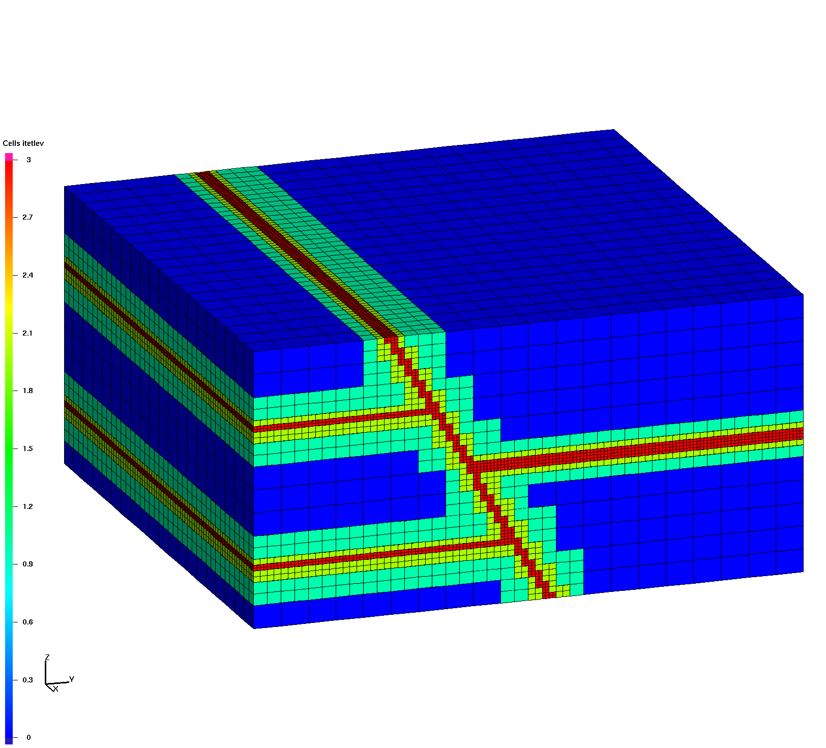
The second method uses the GFM interface boundaries to refine a hex mesh where these boundaries intersect.
The octree refined mesh is then connected into the Delaunay tet mesh.
|
Test 1 Horizontal Layers Stack 2D Delaunay surfaces and connect into 3D tet mesh |
Test 2 Layers with Pinchout Octree refine hex mesh with intersection of interfaces then connect into 3D tet mesh |
Test 3 Embedded Lens Octree refine hex mesh with intersection of lens body then connect into 3D tet mesh |
Test 4 Fault with Offset Layers Octree refine hex mesh with intersection of interfaces then connect into 3D tet mesh |
Surface Triangluation
|
Octree Refined Hex Mesh
|
Octree Refined Hex Mesh

|
Octree Refined Hex Mesh
|
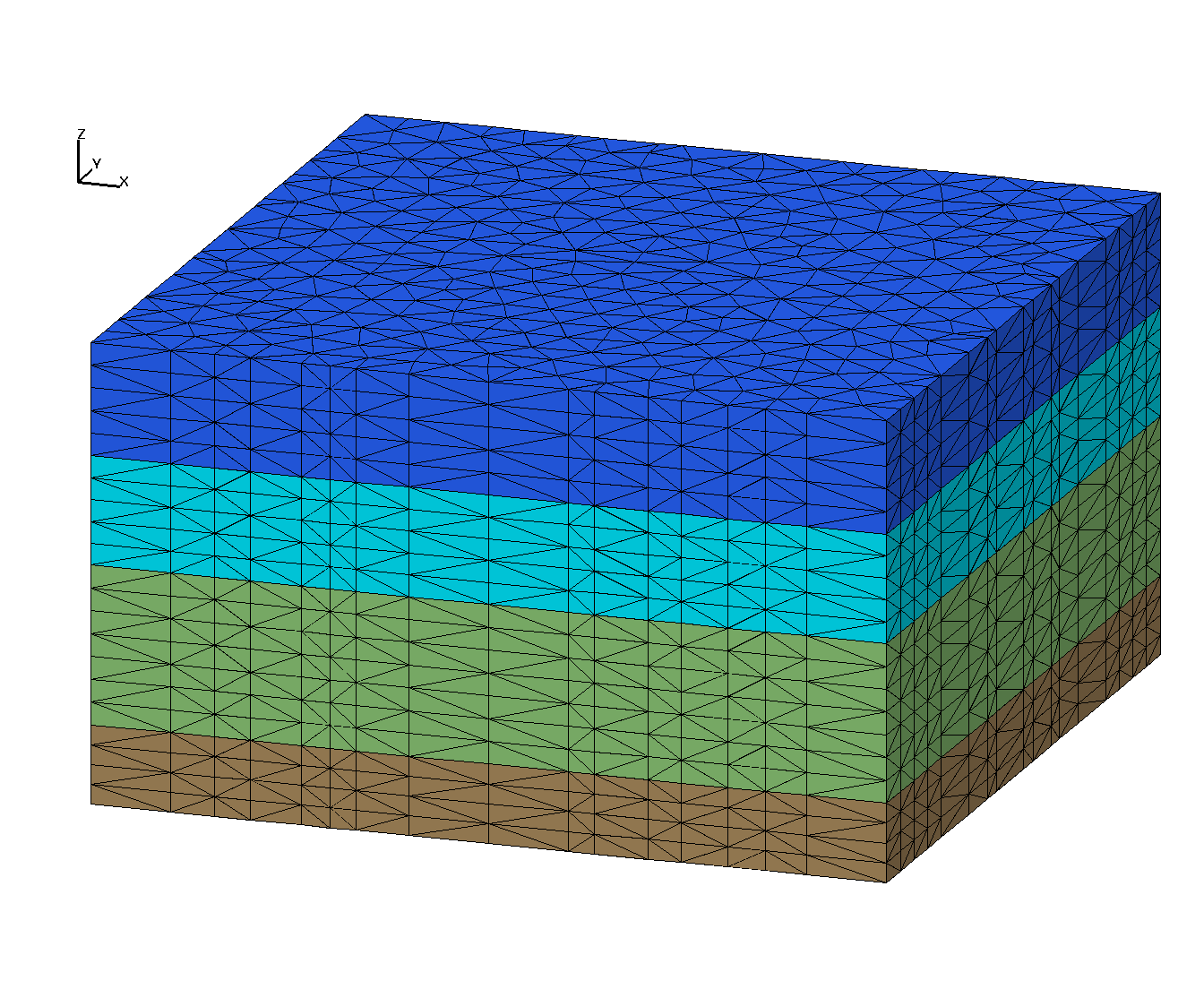
Delaunay Tet Mesh
|
Delaunay Tet Mesh
|
Delaunay Tet Mesh
|
Delaunay Tet Mesh
|
Detail of Tet Mesh Vertices
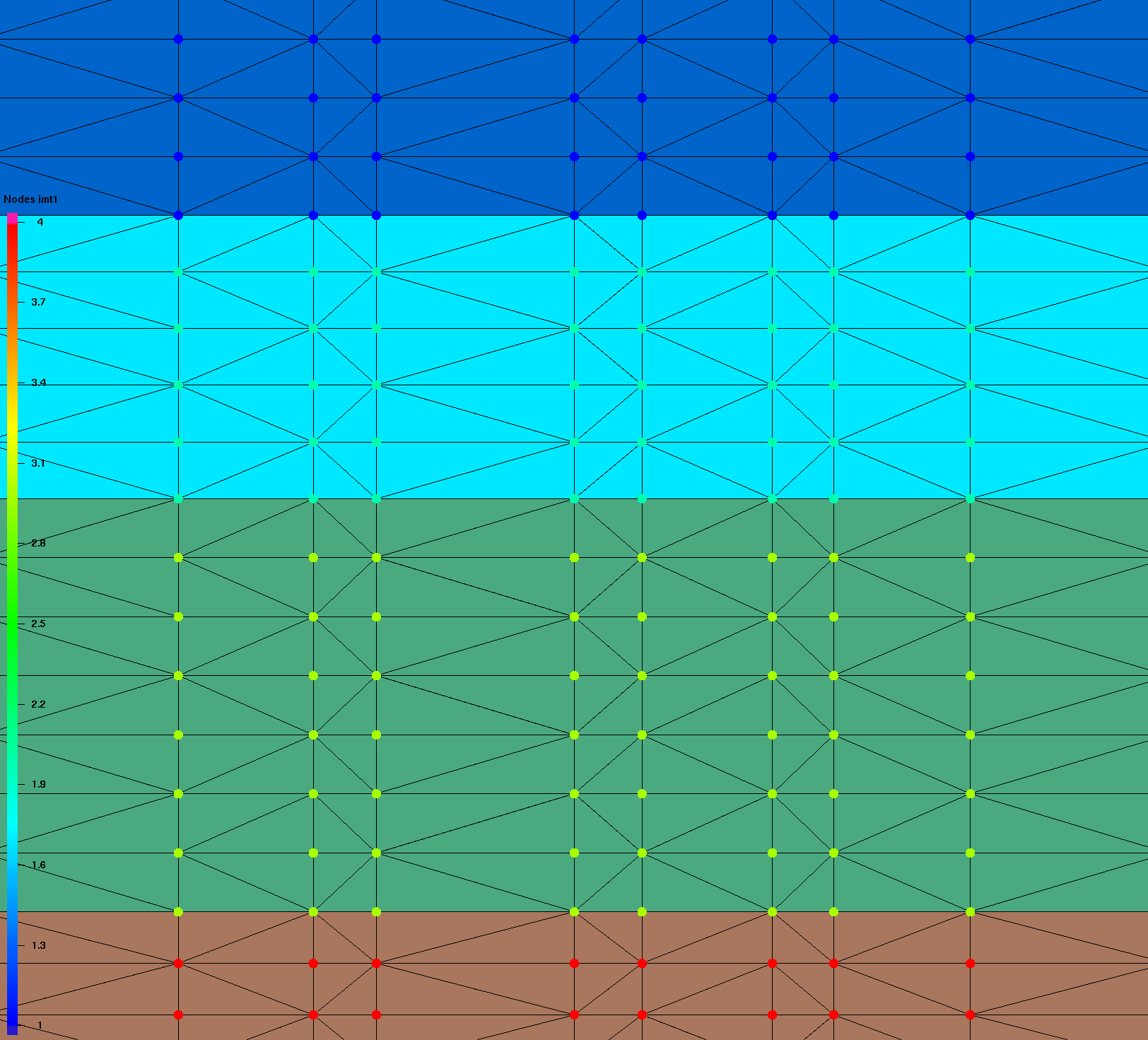
|
Detail of Tet Mesh Vertices
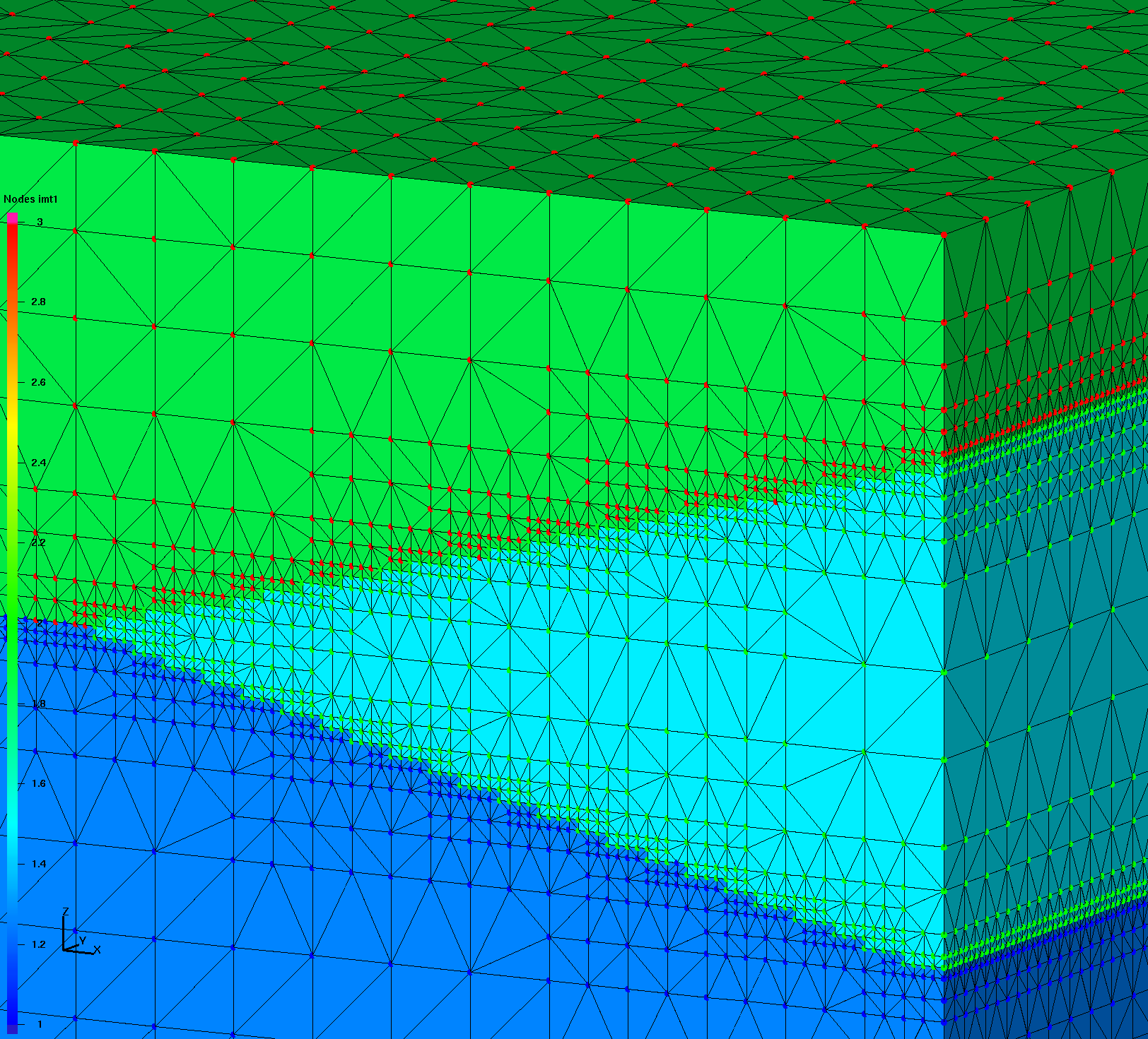
|
Detail of Tet Mesh Vertices
|
Detail of Tet Mesh Vertices
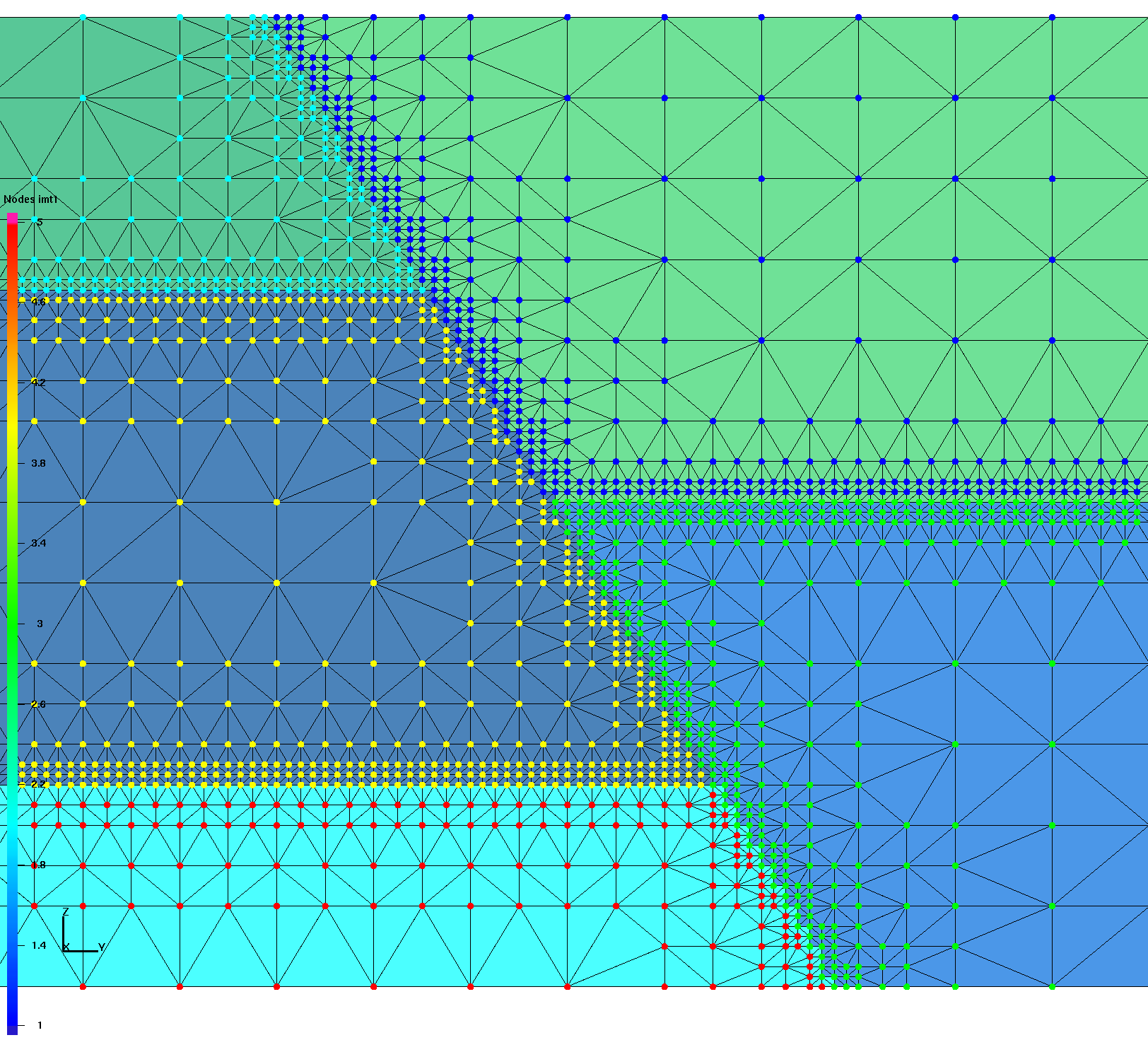
|
FEHM is run with mesh and model setup files written by LaGriT.
Once the model is verified, PFLOTRAN files are written using the tet mesh and FEHM perm and por values.
The module for this conversion is a script developed by dfnWorks.
Test 1 Horizontal Layers
|
Test 2 Wedge
|
Test 3 Lens
|
Test 4 Offset Layers
|
VoroCrust software is used to create Voronoi meshes based on the GFM boundary surfaces.
We are developing methods to pass this on to Modeling applications.
Currently we can only view the results but not yet use them.
Test 1 Voronoi Mesh
|
Test 2 Voronoi Mesh
|
Test 3 Voronoi Mesh
|
Test 4 Voronoi Mesh
|