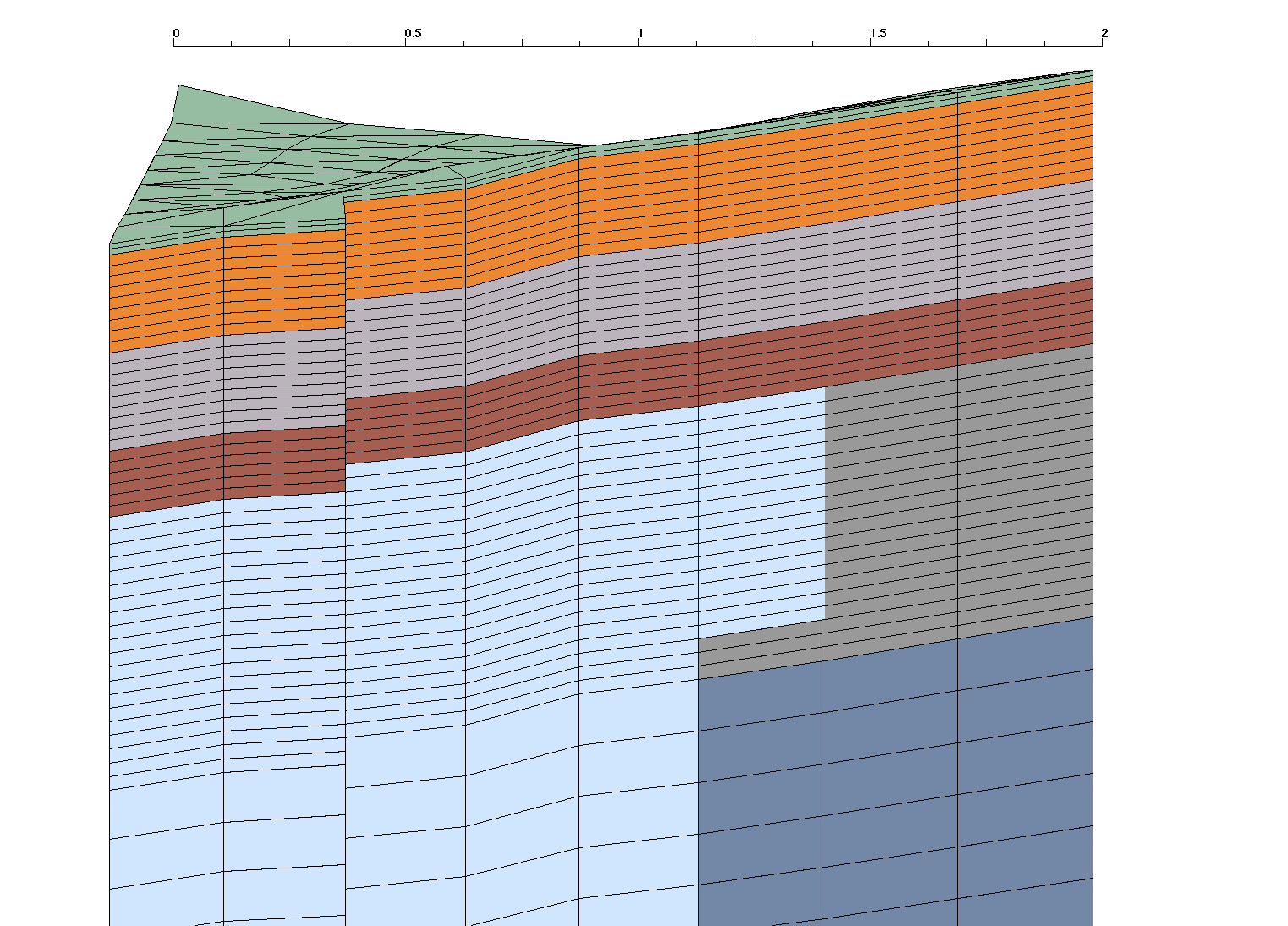
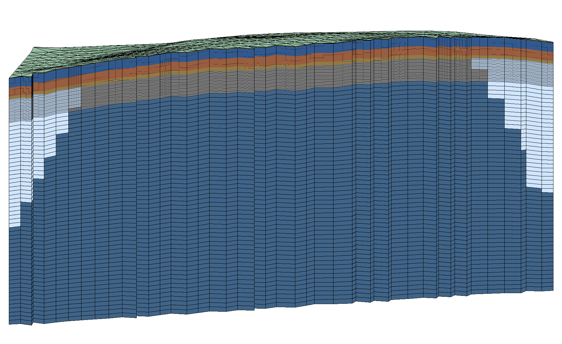
Full Stacked Mesh with Ice Wedge
6 material layers plus ice material
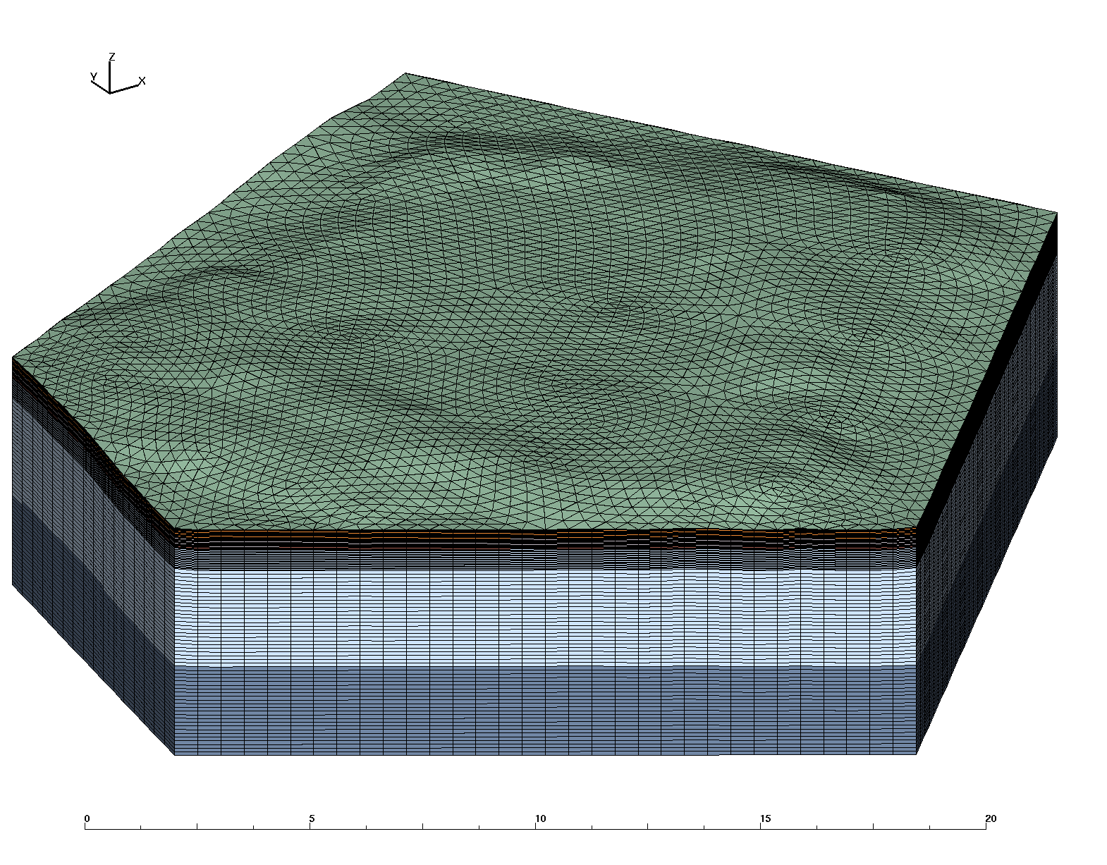
Full Stacked Mesh with Ice Wedge
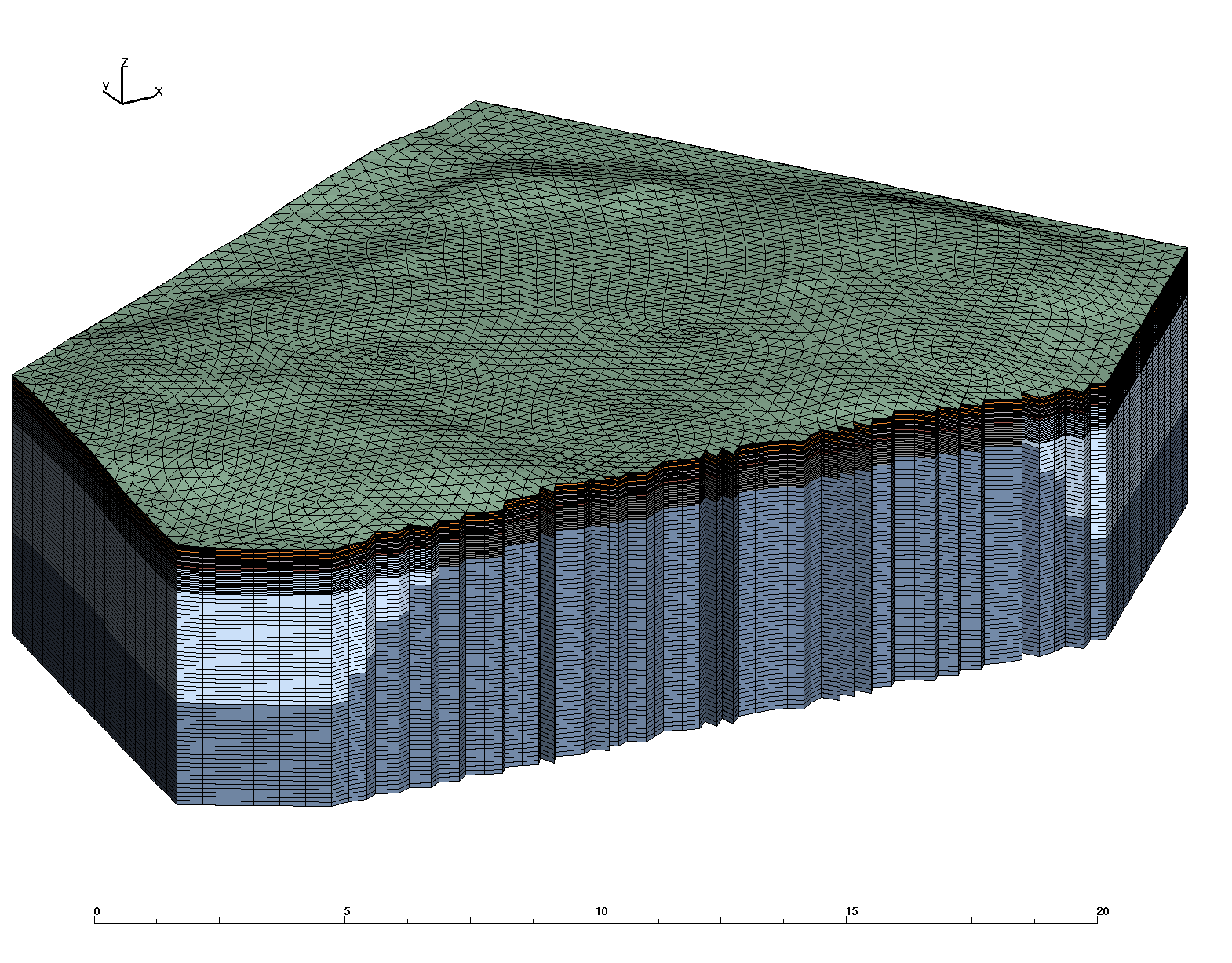
Cut to show internal materials
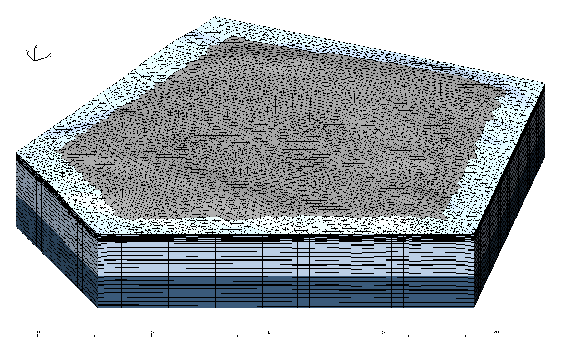
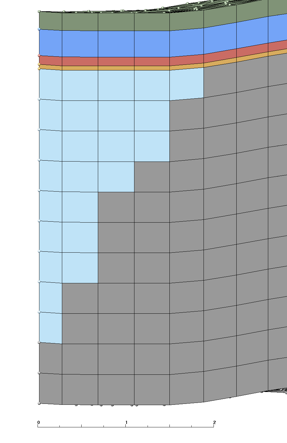
Mesh and Ice Wedge
with moss and organic layers removed
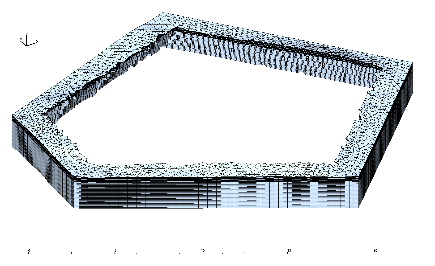
Ice Wedge
| Grid Team Member: | Lucia Short |
| Grid Version: | Version 03: single polygon #40 |
| Data Source: | LiDAR from Area C |
| Delivered To: | Scott Painter |
| Date Completed: | June 6 2013 |
| V1 Mesh (prototype): | 51,344 Nodes and 94,080 Cells |
| V2 Mesh (5 layers) : | 311,273 Nodes and 602,112 Cells |
| V3 Mesh (6 layers) : | 311,273 Nodes and 602,112 Cells |
These meshes were developed in support of the Arctic Next Generation Ecosystem Experiment (NGEE-Arctic) Project and LANL Laboratory Directed project LDRD20120068DR. These two projects share a need for high quality computational meshes for use in fine-scale modeling of thermal hydrology in ice-wedge polygon landscapes.
Version 3 is a modification of the Version 2 mesh which adds a third mineral layer between upper and lower organic layers. This mesh design will be used for the version 01 with multiple polygons. This mesh is 3D based on single polygon #40 generated using LiDAR data set (area C). This mesh follows the criteria listed in the Mesh Input Parameters below. The mesh has 1 moss layer, 2 organic layers, and 3 mineral layers with a flat bottom. The Ice Wedge starts at the top of the mineral layers and is aprox 2.8 meters long. The convention of layer order numbering is from top to bottom. Two Exodus II mesh files are written, one multi-material with ice, and one single material.
This version has a correction to file interpolate_icewedge.lgi and now ensures that ice material does not replace any elements in layers 1-4. The layers above ice have a constant thickness throughout the mesh. The bottom layers (mineral 5 and 6) have variable thickness where ice material replaces mineral material.
Summary of email from Joel Rowland referring to the core data the ORNL sent:
  -----------------
  1 moss           .02 (2 x .01)
  2 upper organic  .18 (9 x .02)  changed from .20 (10 x .02)
  3 upper mineral  .18 (9 x .02)  changed from .20 (10 x .02)
  4 lower organic  .12 (6 x .02)  changed from .08 ( 4 x .02)
  5 lower mineral  .5 (20 x .025)
  6 deep mineral   ~4.8 (50 x .09)
  7 ice            ~2.8
  -----------------
|
Full Stacked Mesh with Ice Wedge
|
Full Stacked Mesh with Ice Wedge
|
|
|
|
Same as V02 using Polygon #40 and following layer definitions with added organic layer :
We want the top of the ice wedge to be at 50 cm depth (corresponds to the top of the inorganic layer).
Top of wedge starts at top of mineral layer (replaces cells only in materials 5 and 6)
Top wedge width (distance from polygon) is aprox 1.2
Depth from top of ice to tip is aprox 2.8
The side sets defined are top, bottom, and sides (corresponding to the 4 sectors within 45 degrees of each direction).
Output is a stacked prism mesh written as two Exodus files; a single material mesh and a multi-material Mesh with 7 materials (6 layers plus the Ice Wedge).
Files are written in formats; Exodus II (.exo), AVS (.inp), and GMV (.gmv)
Final Mesh files: mesh_fsets.exo, mesh_fsets.gmv, mesh_fsets.inp
Final Mesh with single material: mesh_fsets_1mat.exo, mesh_fsets_1mat.gmv, mesh_fsets_1mat.inp
Mesh Element Type:             prism
Mesh Software Used: LaGriT, ExodusII

Total nodes:       311273
Total elements:    602112
Total Volume:      0.2273467E+04

from file write_exo.out.txt:
Mesh Extents (Meters):
        MIN              MAX             DIFFERENCE
 x    4.634709930E+01  7.183999634E+01 2.549289703E+01
 y    1.062200012E+02  1.326065216E+02 2.638652039E+01
 z   -1.000000000E+00  4.992260933E+00 5.992260933E+00

from file write_exo.out.txt:
SUMMARY VOLUME/AREA METERS of ELEMENT COLORS (BLOCKS)
Color    Num. Elements   Volume          Fractional Volume
    1       12544      0.7936425E+01     0.003490890
    2       56448      0.7142782E+02     0.031418013
    3       56448      0.7142801E+02     0.031418096
    4       37632      0.4761855E+02     0.020945342
    5       95524      0.1464469E+03     0.064415680
    6      293616      0.1745817E+04     0.767909504
    7/30   49900       0.1827924E+03     0.080402475

from file stack_full_poly.out.txt:
SUMMARY ELEVATIONS at LAYER TOPS (METERS)
        MIN          MAX       DIFF MAX below (thickness)
    1 4.504300117  4.992260933   .02
    2 4.484300117  4.972260933   .18
    3 4.304300117  4.792260933   .18
    4 4.124300117  4.612260933   .12
    5 4.004300117  4.492260933   .50
    6 3.504300117  3.992260933  4.99
      (Bottom is flat at -1.0)
| Mesh Layer Definitions (meters)
|
|||||||||||||||||||||||||||||||||||||||||||||||||||||||||
|---|---|---|---|---|---|---|---|---|---|---|---|---|---|---|---|---|---|---|---|---|---|---|---|---|---|---|---|---|---|---|---|---|---|---|---|---|---|---|---|---|---|---|---|---|---|---|---|---|---|---|---|---|---|---|---|---|---|
|
|
||||||||||||||||||||||||||||||||||||||||||||||||||||||||
|
|
Boundary Side Sets |
|
|---|---|
Top and Bottom: neon-pink top (num_side_ss2) has 6272 faces neon-green bottom (num_side_ss1) has 6272 faces 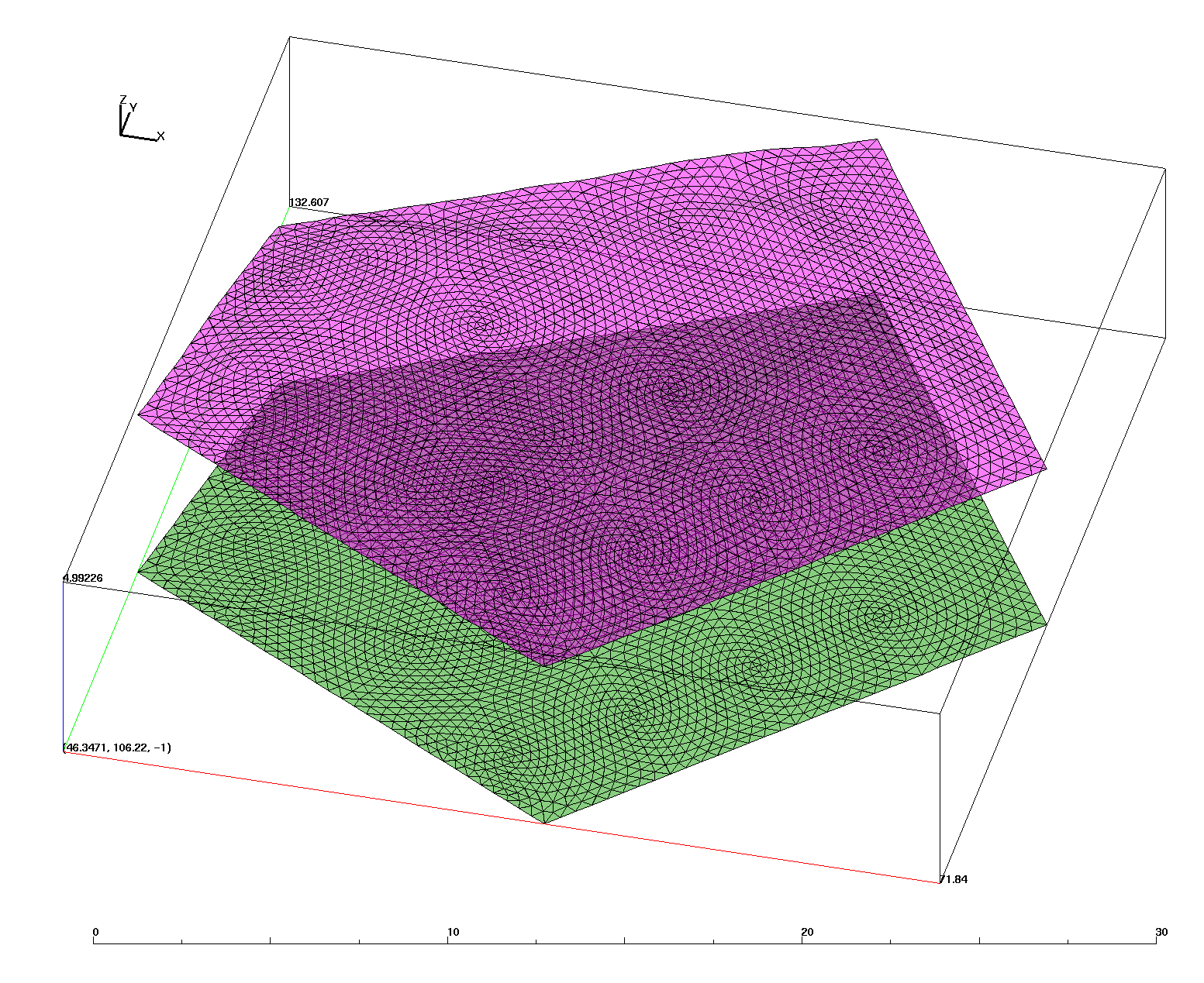
|
Sides: red east right (num_side_ss3) has 6144 faces yellow north back (num_side_ss4) has 3072 faces green west left (num_side_ss5) has 1536 faces blue south front (num_side_ss6) has 3072 faces 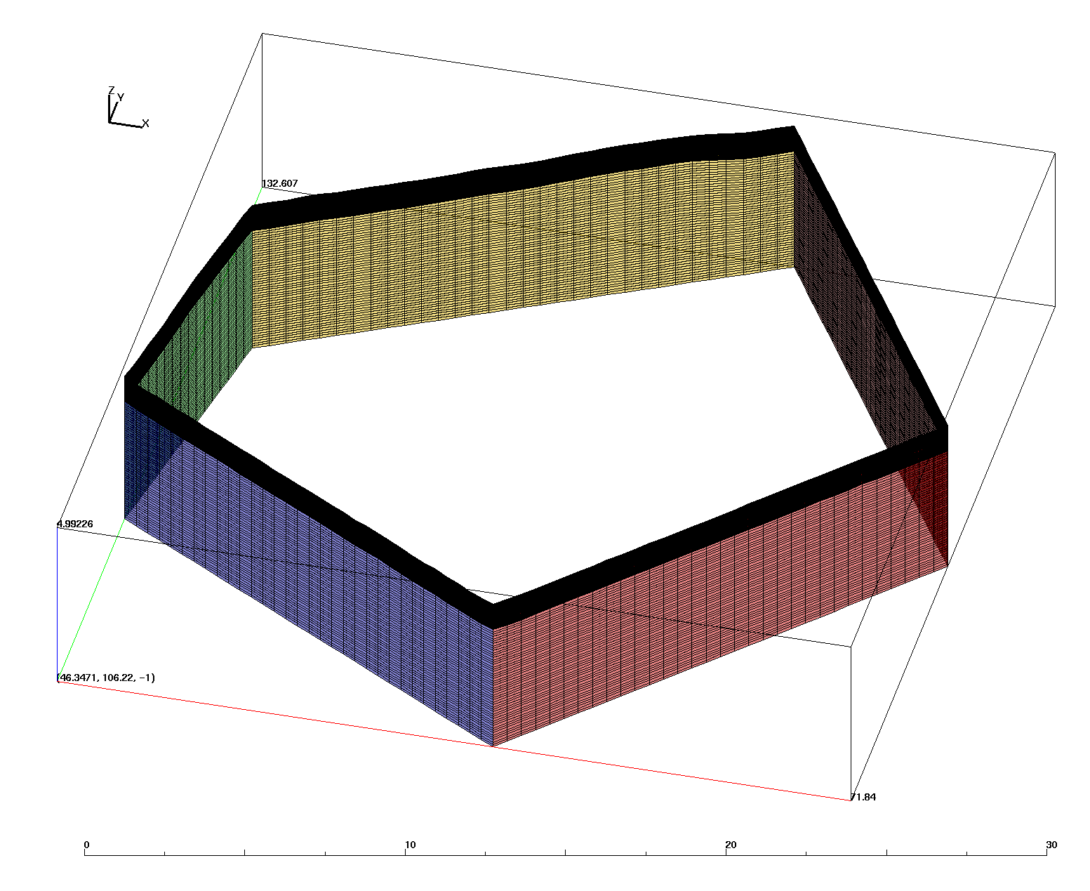
|
/scratch/sft2/lucia/grid_gen/arctic/arctic_fine_v3_0

tar file sent (*tgz):

Created from clean subdirectory with mesh files:
drwxr-xr-x  3 lucia sftus     12288 Jun  7 14:20 mesh_v3/

LaGriT faceset files with elem number and face (*.faceset):
-rw-r--r--  1 lucia sftus     81639 Jun  7 14:07 fs_1_bot.faceset
-rw-r--r--  1 lucia sftus     69095 Jun  7 14:07 fs_2_top.faceset
-rw-r--r--  1 lucia sftus     86119 Jun  7 14:07 fs_3_rig.faceset
-rw-r--r--  1 lucia sftus     43111 Jun  7 14:07 fs_4_bac.faceset
-rw-r--r--  1 lucia sftus     21607 Jun  7 14:07 fs_5_lef.faceset
-rw-r--r--  1 lucia sftus     43111 Jun  7 14:07 fs_6_fro.faceset

Mesh and faceset files for 6 Materials (mesh_fsets.*):
-rw-r--r--  1 lucia sftus  26953576 Jun  7 14:07 mesh_fsets.exo
-rw-r--r--  1 lucia sftus  46374600 Jun  7 14:08 mesh_fsets.gmv
-rw-r--r--  1 lucia sftus  89405021 Jun  7 14:08 mesh_fsets.inp

Mesh and faceset files for 1 Material (mesh_fsets_1mat.*):
-rw-r--r--  1 lucia sftus  26951604 Jun  7 14:07 mesh_fsets_1mat.exo
-rw-r--r--  1 lucia sftus  42678672 Jun  7 14:07 mesh_fsets_1mat.gmv
-rw-r--r--  1 lucia sftus  89093748 Jun  7 14:07 mesh_fsets_1mat.inp

LaGriT output files contain information reported during the run (*.out):
-rw-r--r-- 1 lucia sftus  20338 Jun  7 14:07 interpolate_icewedge.out
-rw-r--r-- 1 lucia sftus 110772 Jun  7 14:07 make_poly.out
-rw-r--r-- 1 lucia sftus 266584 Jun  7 14:08 stack_full_poly.out
-rw-r--r-- 1 lucia sftus  78740 Jun  7 14:08 write_exo.out

Mesh images:
drwxr-xr-x  2 lucia sftus      4096 Jun  7 14:19 images
 /scratch/sft2/lucia/grid_gen/arctic/arctic_fine_v3_0/input/

 -rw-r--r--  2 lucia sftus 30928912 Apr 18 13:59 lidar_site3.inp
 -rw-r--r--  1 lucia sftus      123 Apr 18 13:59 poly10001.avs
 -rw-r--r--  1 lucia sftus      178 Apr 18 13:59 poly10002.avs
						...
 -rw-r--r--  1 lucia sftus      155 Apr 18 13:59 poly10071.avs
 -rw-r--r--  1 lucia sftus      190 Apr 18 13:59 poly10072.avs
/scratch/sft2/lucia/grid_gen/arctic/arctic_fine_v3_0/
These are LaGriT input (.lgi) and output (outx3dgen) files used in creating this mesh. The output files provide good information about the data and mesh, including min and max values of mesh attributes.
The complete set of scripts and input files are in /scratch/sft2/lucia/grid_gen/arctic/arctic_fine_v3_0. The output files for various mesh versions are in /scratch/sft2/lucia/grid_gen/arctic/.
Step 1: Create Ice Object from Polygon (make_poly.lgi) Input Output
Step 2: Create and stack layers into full mesh (stack_full_poly.lgi) Input Output
Step 3: Interpolate Ice Material on to Full Stacked Mesh (interpolate_icewedge.lgi) Input Output
Step 4: Create facesets and write final Exodus files (write_exo.lgi)
Input
Output
| Carl Gable | <gable -at- lanl -dot- gov> | 505-665-3533 |
| Terry Miller | <tamiller -at- lanl -dot- gov> | 505-667-8009 |
| Lucia Short | <lucia -at- lanl -dot- gov> | 505-665-7957 |