Grid Project:
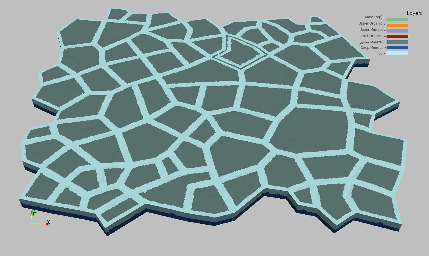
Barrow Ice Wedge Area C Polygons
V3.C.0 (fine scale)
| Grid Team Member: |
Lucia Short |
| Grid Version: |
Version 03.C.0: all area C polygons |
| Data Source: |
LiDAR data Area C from Chandana Gangodagamage |
| Delivered To: |
Scott Painter |
| Date Completed: |
July 2, 2013 |
| |
|
| V3.C.0 Mesh (6 layers): |
16,970,053 Nodes and |
33,441,792 Cells |
| V3.1 Mesh (6 layers) : |
1,404,657 Nodes and |
2,740,224 Cells |
| V3 Mesh (6 layers) : |
311,273 Nodes and |
602,112 Cells |
| V2 Mesh (5 layers) : |
311,273 Nodes and |
602,112 Cells |
| V1 Mesh (prototype): |
51,344 Nodes and |
94,080 Cells |
Purpose of Project
These meshes were developed in support of the Arctic Next Generation Ecosystem Experiment (NGEE-Arctic) Project and LANL Laboratory Directed project LDRD20120068DR. These two projects share a need for high quality computational meshes for use in fine-scale modeling of thermal hydrology in ice-wedge polygon landscapes.
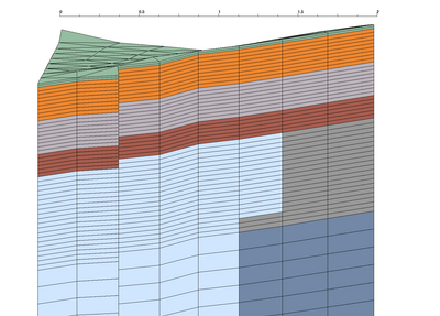
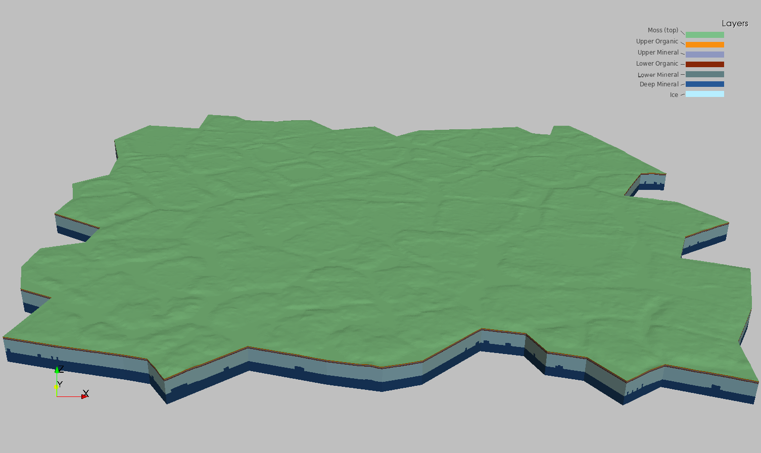
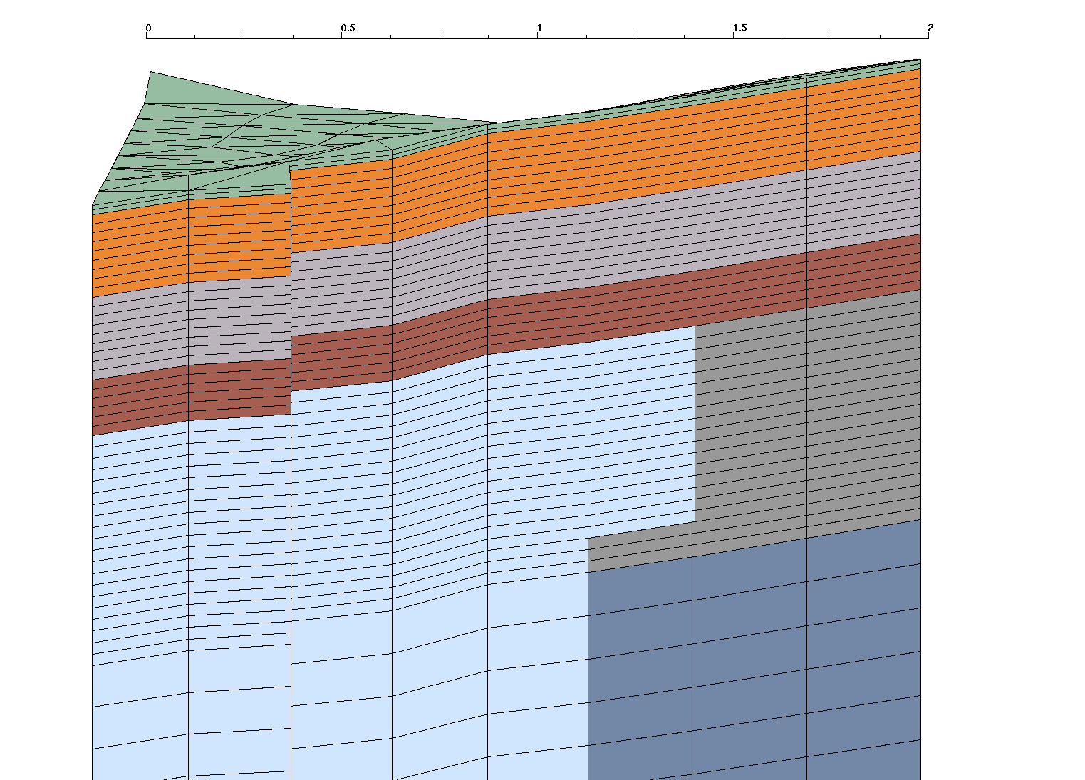
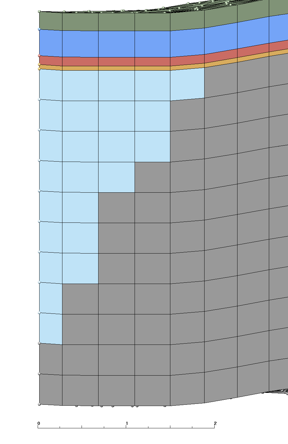
Version 3.C.0 runs the Version 3.1 with area C polygons to create the mesh. This mesh is 3D based on polygons generated using LiDAR data set (area C). This mesh follows the criteria listed in the Mesh Input Parameters below. The mesh has 1 moss layer, 2 organic layers, and 3 mineral layers with a flat bottom. The Ice Wedge starts at the top of the mineral layers and is aprox 2.8 meters long. The convention of layer order numbering is from top to bottom. Two Exodus II mesh files are written, one multi-material with ice, and one single material.
The layers above ice have a constant thickness throughout the mesh. The bottom layers (mineral 5 and 6) have variable thickness where ice material replaces mineral material.
Changes in Files
This version doesn't have any changes besides the different set of polygons.
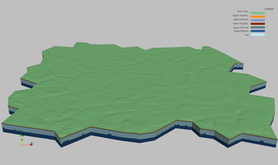
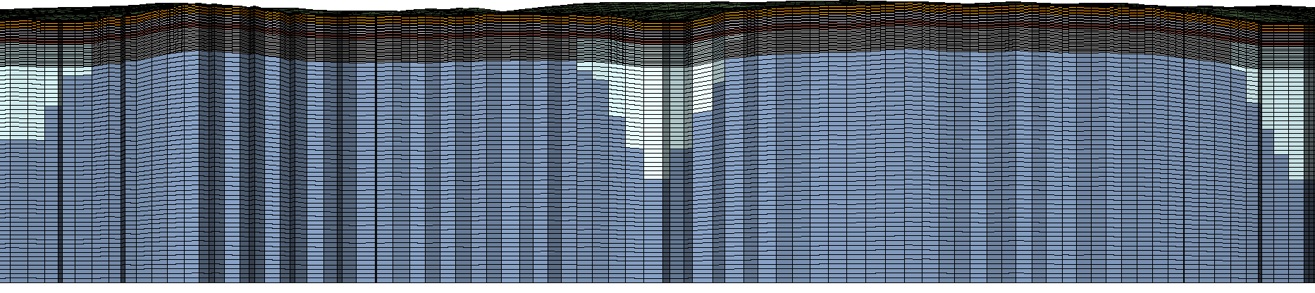
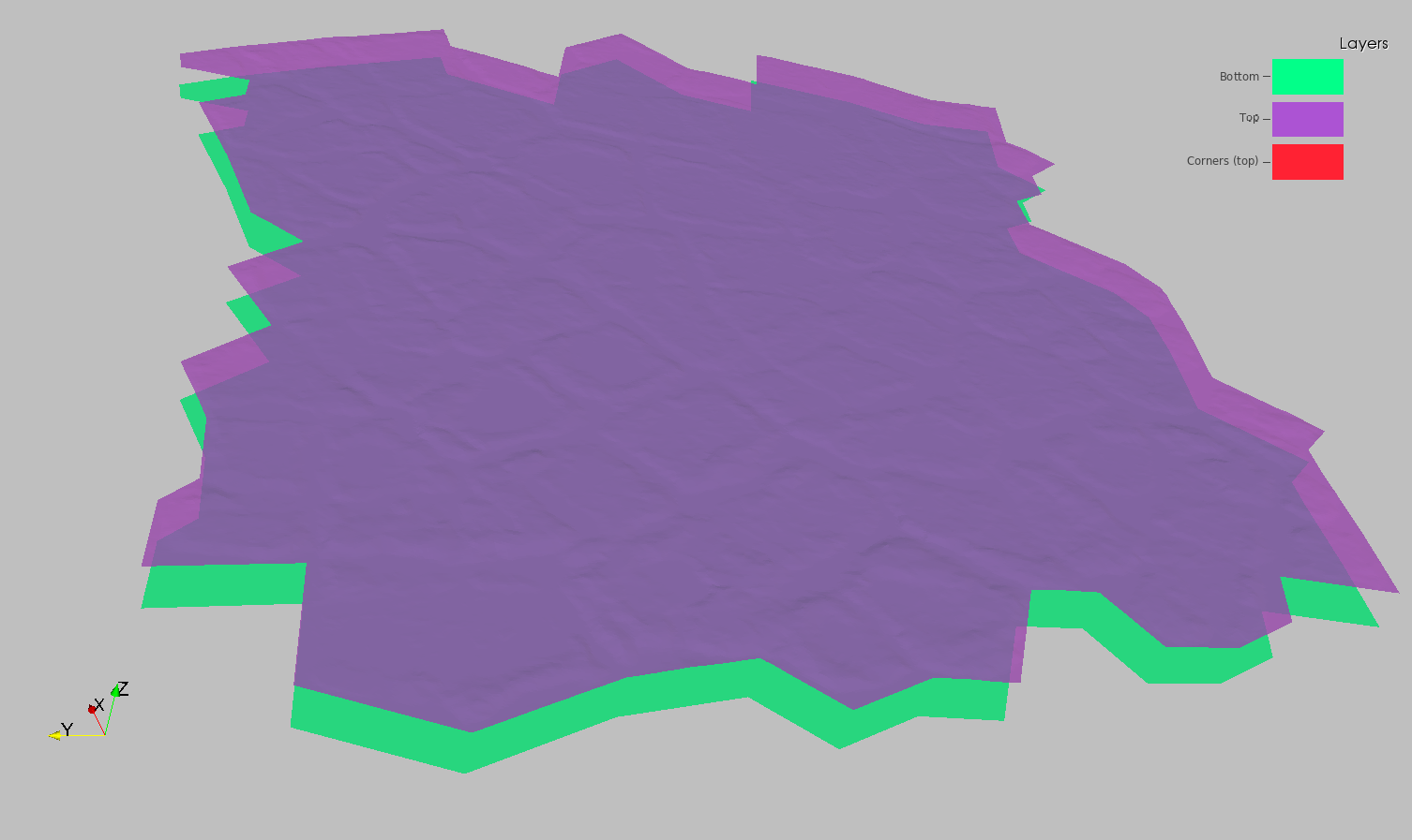
Full Stacked Mesh with Ice Wedge
6 material layers plus ice material
 |
Full Stacked Mesh with Ice Wedge
Cut to show internal materials
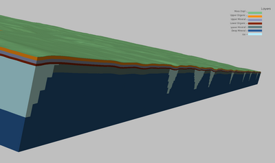 |
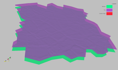
Mesh and Ice Wedge
with moss and organic layers removed
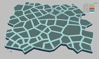 |
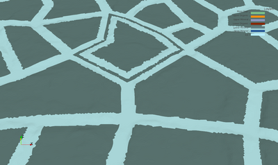
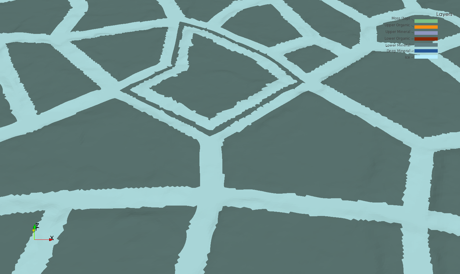
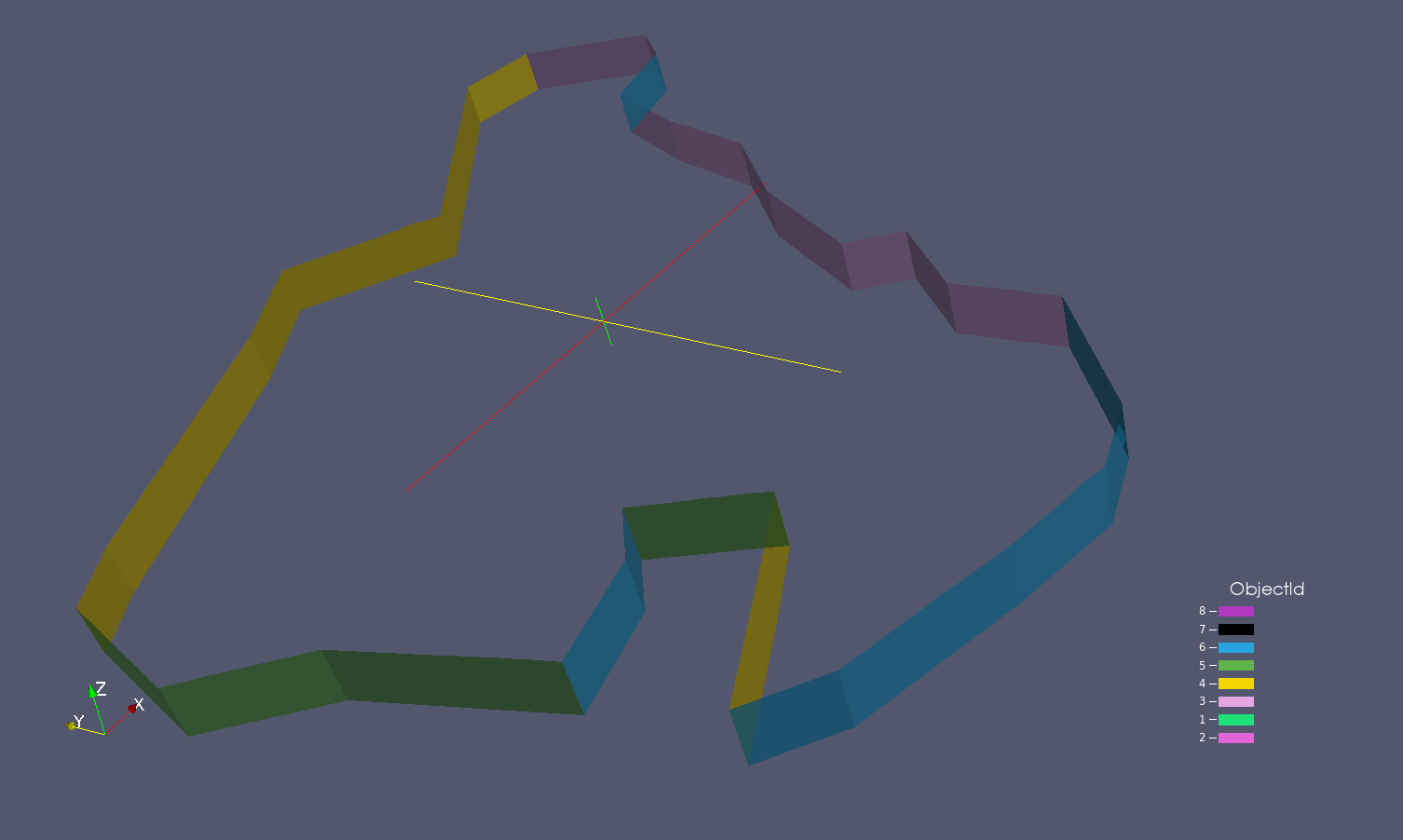
Mesh and Ice WedgePolygon #56
the concave polygon error
 |
Mesh Input Parameters V3.C.0
General Description
Same as V03 using all area C polygons. The only change was in the mesh_adjoin.py file in set_poly_surf_file. I added loop to break up the number of polygons to separate them with "&" in order to fix the "long line" error in lagrit. This version uses the following layer definitions :
- Layer 1 (top) is the live organic layer and should be 2 cm thick with 2 cells.
- Organic layer such that all combined are 48 cm thick with 24 cells (2cm each).
- Top organic and mineral layer are the same. Thickness is 18 cm with 9 cells.
- Lowest organic layer is about 3/4 the thickness of upper 2 layers. Set thickness to 12 cm with 6 cells.
- The bottom Materials 5 and 6 are both mineral soils with higher resolution at the top of the mineral soil.
- The domain bottom should be flat at Z = -1.
Material Ice Wedge
We want the top of the ice wedge to be at 50 cm depth (corresponds to the top of the inorganic layer).
Top of wedge starts at top of mineral layer (replaces cells only in materials 5 and 6)
Top wedge width (distance from polygon) is aprox 1.2
Depth from top of ice to tip is aprox 2.8
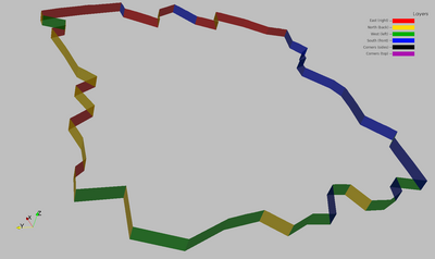
Outside Boundaries (Exodus side sets)
The side sets defined are top, bottom, and sides (corresponding to the 4 sectors within 45 degrees of each direction).
Output Mesh Description
Output is a stacked prism mesh written as two Exodus files; a single material mesh and a multi-material Mesh with 7 materials (6 layers plus the Ice Wedge).
Files are written in formats; Exodus II (.exo), AVS (.inp), and GMV (.gmv)
Final Mesh files: mesh_fsets.exo, mesh_fsets.gmv, mesh_fsets.inp
Final Mesh with single material: mesh_fsets_1mat.exo, mesh_fsets_1mat.gmv, mesh_fsets_1mat.inp
Mesh Element Type:             prism
Mesh Software Used: LaGriT, ExodusII

Total nodes:        16970053
Total elements:     33441792
Total Volume:  0.1179366E+06

from file write_exo.out.txt:
Mesh Extents (Meters):
              MIN               MAX       DIFFERENCE
 x   4.459000015E+01  2.180899963E+02 1.734999962E+02
 y   4.240127182E+01  2.005397644E+02 1.581384926E+02
 z  -1.000000000E+00  4.997776985E+00 5.997776985E+00

from file write_exo.out.txt:
SUMMARY VOLUME/AREA METERS of ELEMENT COLORS (BLOCKS)
Color    Num. Elements   Volume          Fractional Volume
    1      696704          0.4259782E+03     0.003611925
    2     3135168          0.3833804E+04     0.032507322
    3     3135168          0.3833814E+04     0.032507408
    4     2090112          0.2555869E+04     0.021671548
    5     4936758          0.7405076E+04     0.062788600
    6    15994629          0.8838223E+05     0.749404391
   30     3453253          0.1149986E+05     0.097508806

from file stack_full_poly.out.txt:
SUMMARY ELEVATIONS at LAYER TOPS (METERS)
        MIN          MAX       DIFF MAX below (thickness)
    1 4.020999908  4.997776985   .02
    2 4.000999908  4.977776985   .18
    3 3.820999908  4.797776985   .18
    4 3.640999908  4.617776985   .12
    5 3.520999908  4.497776985   .50
    6 3.020999908  3.997776985  4.99
      (Bottom is flat at -1.0)
Mesh Layer Definitions (meters)
|
| ID |
Layer Name |
Layer
Thick |
Layer
Vertical Cells |
Layer
Volume |
Min Top
Elevation |
Max Top
Elevation |
| 1 |
moss(top) |
0.02 |
2 x .01 |
7.936425 |
4.50 |
4.99 |
| 2 |
upper organic |
0.18 |
9 x .02 |
79.36425 |
4.48 |
4.97 |
| 3 |
upper mineral |
0.18 |
9 x .02 |
71.42801 |
4.30 |
4.79 |
| 4 |
lower organic |
0.12 |
6 x .02 |
47.61855 |
4.12 |
4.61 |
| 5 |
lower mineral |
0.50 |
20 x .025 |
146.4469 |
4.00 |
4.49 |
| 6 |
deep mineral |
2.2 -
4.8 |
50 x .09 |
1745.817 |
3.50 |
3.99 |
| 7/30 |
ice |
0.00 -
2.3 |
variable |
182.7924 |
4.49 |
4.00 |
|  |
Boundary Side Sets
|
Top and Bottom:
neon-pink  top     (num_side_ss2) has  348352 faces
neon-green bottom  (num_side_ss1) has  348352 faces
|
Sides:
red     east right   (num_side_ss3) has  38400 faces
yellow  north back   (num_side_ss4) has  36096 faces
green   west left    (num_side_ss5) has  33792 faces
blue    south front  (num_side_ss6) has  39936 faces
|
 |
 |
Project Archive Location
Full Set of files:
/scratch/sft2/lucia/grid_gen/arctic/arctic_fine_v3_C/

tar files created (*tgz):
-rw-r--r--  1 lucia  sft  8154167407 Feb 26 14:17 mesh_v3_C_all.tgz

Created from clean subdirectories with mesh files:
drwxr-xr-x   3 lucia  sft         61440 Feb 26 13:35 v3_C_all

LaGriT faceset files with elem number and face (*.faceset):
-rw-r--r--  1 lucia  sft  4877031 Feb 26 12:36 fs_1_bot.faceset
-rw-r--r--  1 lucia  sft  4528679 Feb 26 12:36 fs_2_top.faceset
-rw-r--r--  1 lucia  sft   614503 Feb 26 12:36 fs_3_rig.faceset
-rw-r--r--  1 lucia  sft   577639 Feb 26 12:36 fs_4_bac.faceset
-rw-r--r--  1 lucia  sft   540775 Feb 26 12:36 fs_5_lef.faceset
-rw-r--r--  1 lucia  sft   639079 Feb 26 12:36 fs_6_fro.faceset

Mesh and faceset files for 6 Materials (mesh_fsets.*):
-rw-r--r--  1 lucia  sft  1484182536 Feb 26 12:38 mesh_fsets.exo
-rw-r--r--  1 lucia  sft  2539326312 Feb 26 12:38 mesh_fsets.gmv
-rw-r--r--  1 lucia  sft  5598206589 Feb 26 12:41 mesh_fsets.inp

Mesh and faceset files for 1 Material (mesh_fsets_1mat.*):
-rw-r--r--  1 lucia  sft  1484180564 Feb 26 12:41 mesh_fsets_1mat.exo
-rw-r--r--  1 lucia  sft  2322963952 Feb 26 12:42 mesh_fsets_1mat.gmv
-rw-r--r--  1 lucia  sft  5581236536 Feb 26 12:44 mesh_fsets_1mat.inp

LaGriT output files contain information reported during the run (*.out.txt):
-rw-r--r--  1 lucia  sftus   22849 Jul  2  2013 interpolate_icewedge.out.txt
-rw-r--r--  1 lucia  sftus   99513 Jul  2  2013 make_poly10001.out.txt
-rw-r--r--  1 lucia  sftus  104373 Jul  2  2013 make_poly10002.out.txt
								. . .
-rw-r--r--  1 lucia  sftus  105831 Jul  2  2013 make_poly10071.out.txt
-rw-r--r--  1 lucia  sftus  107451 Jul  2  2013 make_poly10072.out.txt
-rw-r--r--  1 lucia  sftus  202126 Jul  2  2013 merge_ice.out.txt
-rw-r--r--  1 lucia  sftus  266746 Jul  2  2013 stack_full_poly.out.txt
-rw-r--r--  1 lucia  sftus   78740 Jul  2  2013 write_exo.out.txt


Mesh images:
/scratch/sft2/lucia/grid_gen/arctic/arctic_fine_v3_C/images
Input Data files:
/scratch/sft2/lucia/grid_gen/arctic/arctic_fine_v3_C_1/input

-rw-r--r--  2 lucia  sftus  30928912 Jul  9 11:47 lidar_site3.inp
-rw-r--r--  1 lucia  sftus       123 Jul  9 11:47 poly10001.avs
-rw-r--r--  1 lucia  sftus       178 Jul  9 11:47 poly10002.avs
						...
-rw-r--r--  1 lucia  sftus       155 Jul  9 11:47 poly10071.avs
-rw-r--r--  1 lucia  sftus       190 Jul  9 11:47 poly10072.avs
Main Work Directory for Polygon Meshing Method:
/scratch/sft2/lucia/grid_gen/arctic/arctic_fine_v3_C
Links to Images and Project Details
Gallery of All Project Images
Method Description Overview (from V01)
Input and Output Files Running LaGriT to create the Mesh
These are LaGriT input (.lgi) and output (outx3dgen) files used in creating this mesh. The output files provide good information about the data and mesh, including min and max values of mesh attributes.
The complete set of scripts and input files are in /scratch/sft2/lucia/grid_gen/arctic/arctic_fine_v3_C. The output files for various mesh versions are in /home/lucia/sandbox/arctic and /scratch/sft2/lucia/grid_gen/arctic/.
Steps to create the surface mesh for all polygons
To create a surface mesh, we run 2 python scripts. Normally, the Path 1 doesn't need to be re-run, so we just copy output files from this run to the output folder from the folder output_surf_mesh. If any of the Part 1 scripts are changed, then the Part 1 should be re-run, so Path 1 or 2 should be taken.
Path 1: Run script surf_mesh.py.
Path 2: (If you didn't run Part 1, remove all the files from the ouput folder. Then copy files from directory output_surf_mesh into the output folder.) Run script mesh_adjoin.py
Steps to create the 3D mesh for several polygons
The easiest path is to run surf_mesh.py and then mesh_adjoin.py scripts. That creates necessary LaGriT files and runs other scripts.
Step 1: Create Ice Objects from Polygon make_poly.lgi. This script is used to create all polygons separately. The Input is the same for all polygons. The output is different for all the polygons, but it is similar. To get the output for the polygon you are interested in, change the # of the polygon in the link: make_poly<enter_your_number>.out.txt
- Polygon #6: Output
Step 2: Merge all the ice objects created in Step 1. Input Output
Step 3: Create and stack layers into full mesh (stack_full_poly.lgi) Input Output
Step 4: Interpolate Ice Material on to Full Stacked Mesh (interpolate_icewedge.lgi) Input Output
Step 5: Create facesets and write final Exodus files (write_exo.lgi) Input Output
Grid Team Contacts
| Carl Gable |
<gable -at- lanl -dot- gov> |
505-665-3533 |
| Terry Miller |
<tamiller -at- lanl -dot- gov> |
505-667-8009 |
| Lucia Short |
<lucia -at- lanl -dot- gov> |
505-665-7957 |
