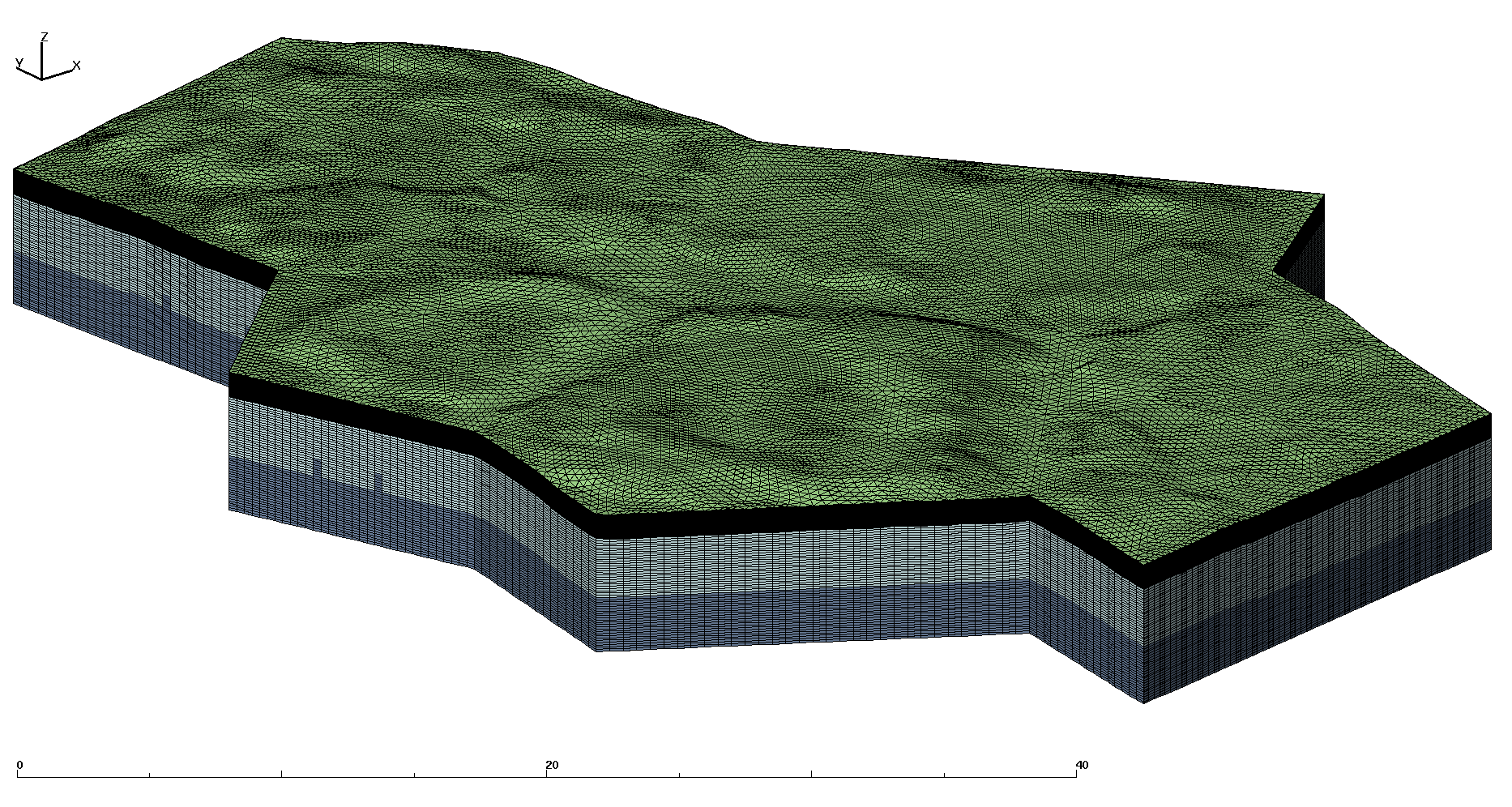
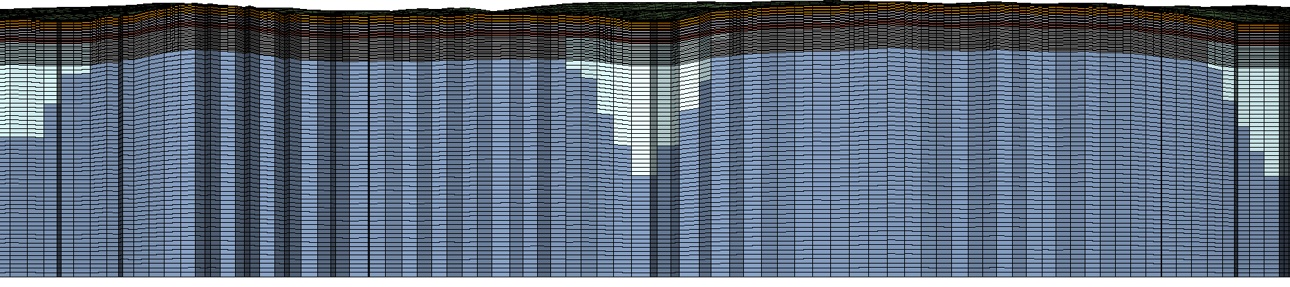
Full Stacked Mesh with Ice Wedge
6 material layers plus ice material
Full Stacked Mesh with Ice Wedge
Cut to show internal materials
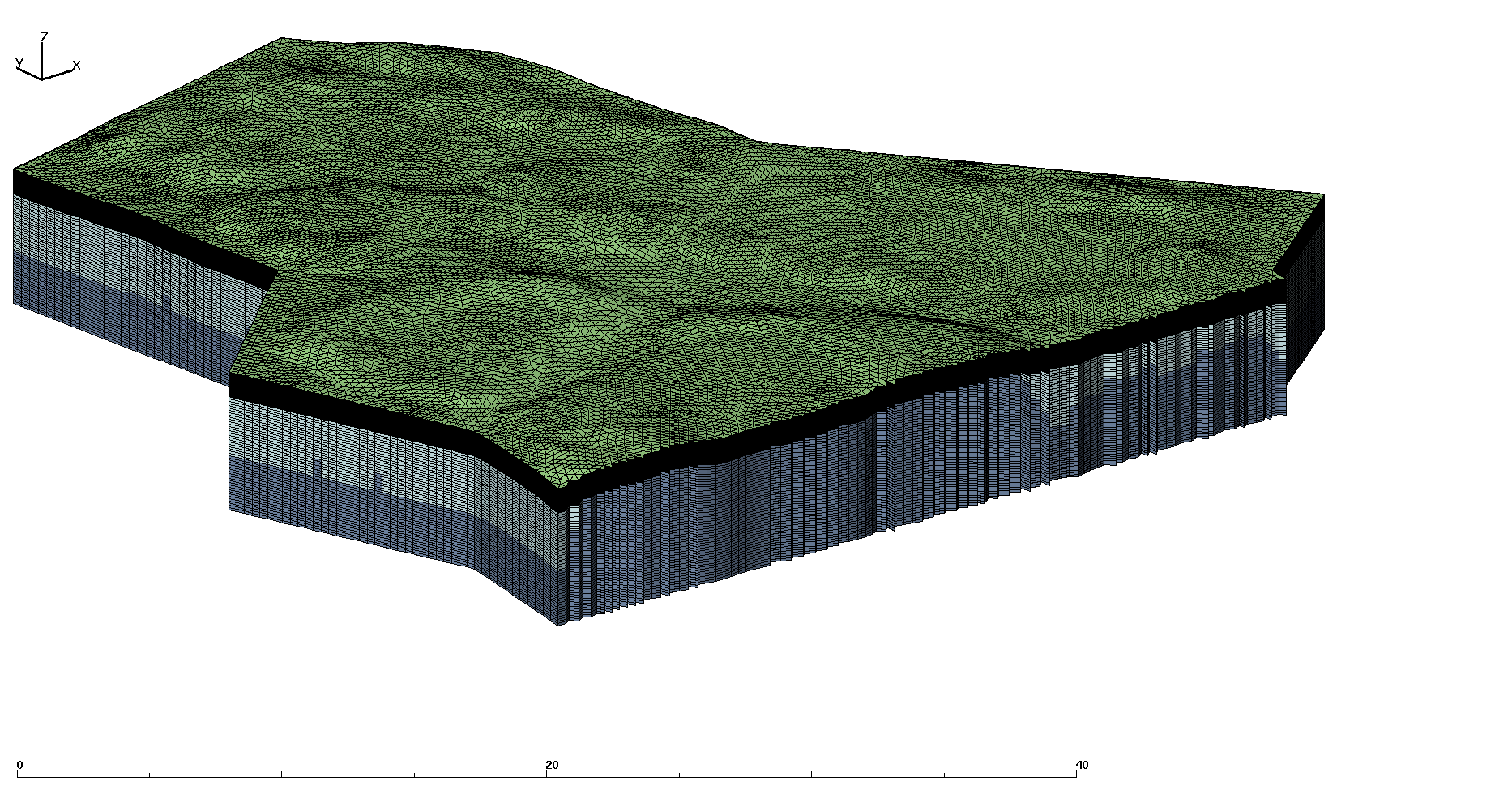
Mesh and Ice Wedge
with moss and organic layers removed
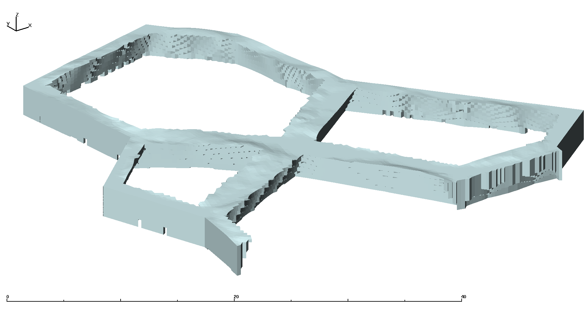
Ice Wedge
| Grid Team Member: | Lucia Short |
| Grid Version: | Version 03: multiple polygons #32, 40, 42, 43, 49 |
| Data Source: | LiDAR data Area C from Chandana Gangodagamage |
| Delivered To: | Scott Painter |
| Date Completed: | June 12, 2013 |
| V1 Mesh (prototype): | 51,344 Nodes and 94,080 Cells |
| V2 Mesh (5 layers) : | 311,273 Nodes and 602,112 Cells |
| V3 Mesh (6 layers) : | 311,273 Nodes and 602,112 Cells |
| V3.1 Mesh (6 layers) : | 1,404,657 Nodes and 2,740,224 Cells |
These meshes were developed in support of the Arctic Next Generation Ecosystem Experiment (NGEE-Arctic) Project and LANL Laboratory Directed project LDRD20120068DR. These two projects share a need for high quality computational meshes for use in fine-scale modeling of thermal hydrology in ice-wedge polygon landscapes.
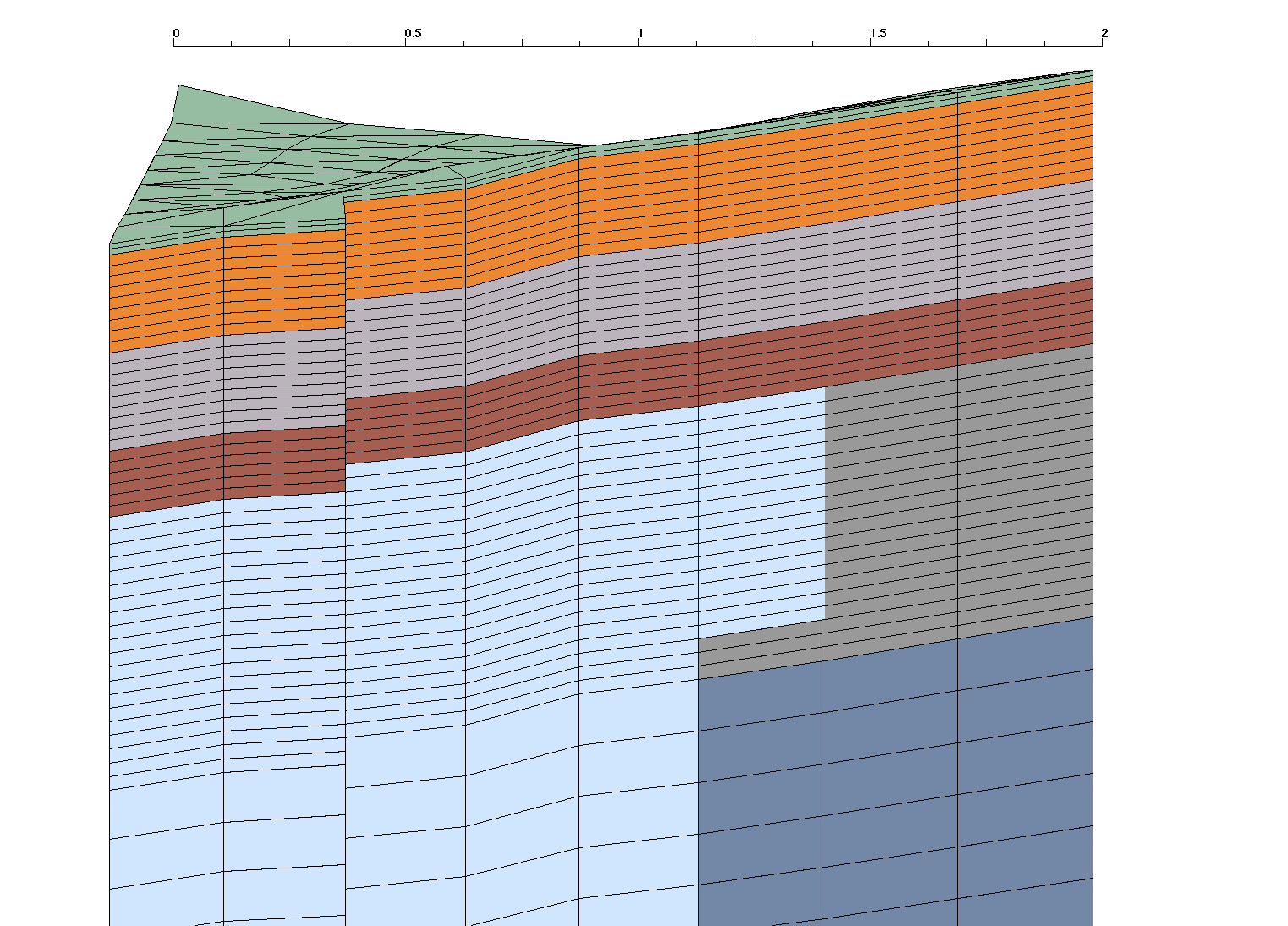
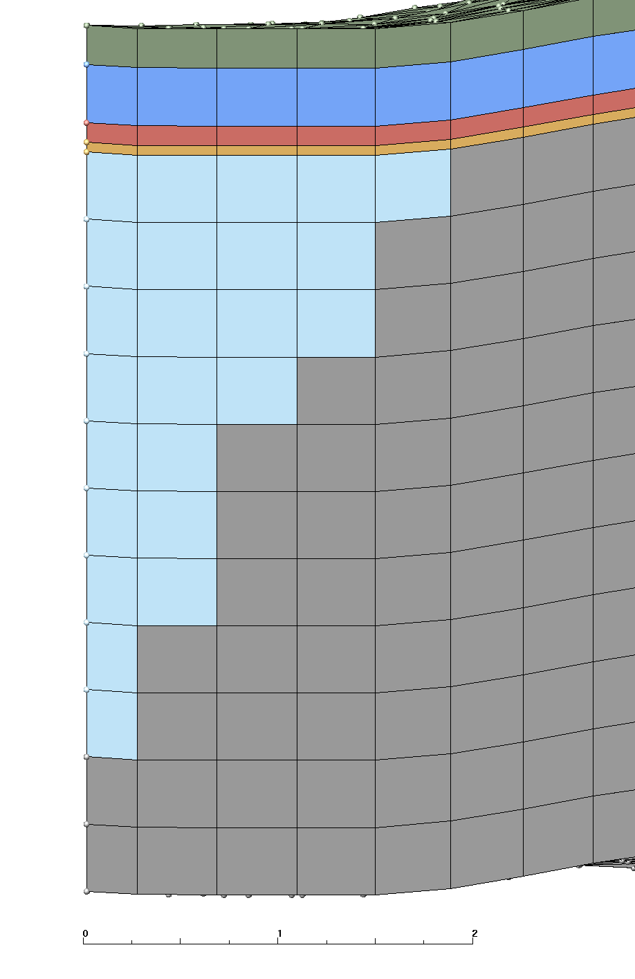
Version 3.1 is a modification of the Version 3 mesh which adds neighboring polygons to the polygon #40. This mesh is 3D based on multiple polygons #32, 40, 42, 43, 49 generated using LiDAR data set (area C). This mesh follows the criteria listed in the Mesh Input Parameters below. The mesh has 1 moss layer, 2 organic layers, and 3 mineral layers with a flat bottom. The Ice Wedge starts at the top of the mineral layers and is aprox 2.8 meters long. The convention of layer order numbering is from top to bottom. Two Exodus II mesh files are written, one multi-material with ice, and one single material.
The layers above ice have a constant thickness throughout the mesh. The bottom layers (mineral 5 and 6) have variable thickness where ice material replaces mineral material.
This version has additional file merge_ice.lgi that would merge ice prototypes for several polygons. This file can be generated automatically by the Python script merge_ice.py.
The file get_poly_surf.lgi corrected to extract several polygons from the mesh. This file can be generated automatically by a Python script mesh_adjoin.py
|
Full Stacked Mesh with Ice Wedge
|
Full Stacked Mesh with Ice Wedge
|
|
|
|
Same as V03 using Polygons #32, 40, 42, 43, 49 and following layer definitions :
We want the top of the ice wedge to be at 50 cm depth (corresponds to the top of the inorganic layer).
Top of wedge starts at top of mineral layer (replaces cells only in materials 5 and 6)
Top wedge width (distance from polygon) is aprox 1.2
Depth from top of ice to tip is aprox 2.8
The side sets defined are top, bottom, and sides (corresponding to the 4 sectors within 45 degrees of each direction).
Output is a stacked prism mesh written as two Exodus files; a single material mesh and a multi-material Mesh with 7 materials (6 layers plus the Ice Wedge).
Files are written in formats; Exodus II (.exo), AVS (.inp), and GMV (.gmv)
Final Mesh files: mesh_fsets.exo, mesh_fsets.gmv, mesh_fsets.inp
Final Mesh with single material: mesh_fsets_1mat.exo, mesh_fsets_1mat.gmv, mesh_fsets_1mat.inp
Mesh Element Type:             prism
Mesh Software Used: LaGriT, ExodusII

Total nodes:         1404657
Total elements:      2740224
Total Volume:  0.9434834E+04

from file write_exo.out.txt:
Mesh Extents (Meters):
              MIN               MAX       DIFFERENCE
 x   4.459000015E+01  8.848859406E+01 4.389859390E+01
 y   9.783683014E+01  1.609271698E+02 6.309033966E+01
 z  -1.000000000E+00  4.992260933E+00 5.992260933E+00

from file write_exo.out.txt:
SUMMARY VOLUME/AREA METERS of ELEMENT COLORS (BLOCKS)
Color    Num. Elements   Volume          Fractional Volume
    1       57088          0.3334762E+02     0.003534521
    2      256896          0.3001286E+03     0.031810687
    3      256896          0.3001293E+03     0.031810771
    4      171264          0.2000857E+03     0.021207125
    5      415009          0.5942210E+03     0.062981609
    6     1322224          0.7165848E+04     0.759509720
   30      260847          0.8410736E+03     0.089145567

from file stack_full_poly.out.txt:
SUMMARY ELEVATIONS at LAYER TOPS (METERS)
        MIN          MAX       DIFF MAX below (thickness)
    1 4.439099789  4.992260933   .02
    2 4.419099789  4.972260933   .18

    3 4.239099789  4.792260933   .18
    4 4.059099789  4.612260933   .12
    5 4.004300117  4.492260933   .50
    6 3.939099789  3.992260933  4.99
      (Bottom is flat at -1.0)
| Mesh Layer Definitions (meters) |
|||||||||||||||||||||||||||||||||||||||||||||||||||||||||
|---|---|---|---|---|---|---|---|---|---|---|---|---|---|---|---|---|---|---|---|---|---|---|---|---|---|---|---|---|---|---|---|---|---|---|---|---|---|---|---|---|---|---|---|---|---|---|---|---|---|---|---|---|---|---|---|---|---|
|  |
||||||||||||||||||||||||||||||||||||||||||||||||||||||||
 |
| Boundary Side Sets |
|
|---|---|
Top and Bottom: neon-pink top (num_side_ss2) has 28544 faces neon-green bottom (num_side_ss1) has 28544 faces 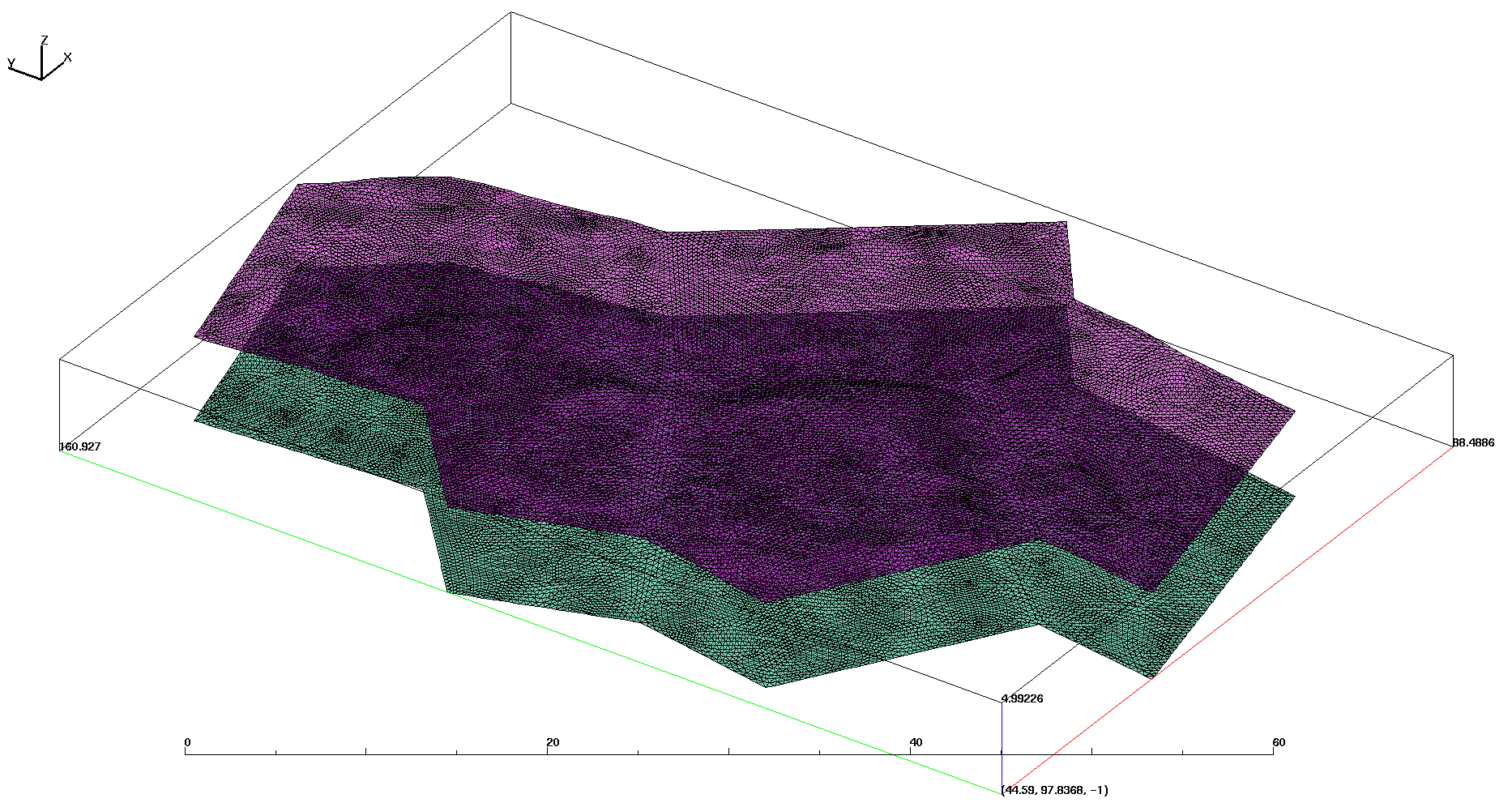 |
Sides: red east right (num_side_ss3) has 13824 faces yellow north back (num_side_ss4) has 6144 faces green west left (num_side_ss5) has 9216 faces blue south front (num_side_ss6) has 10752 faces 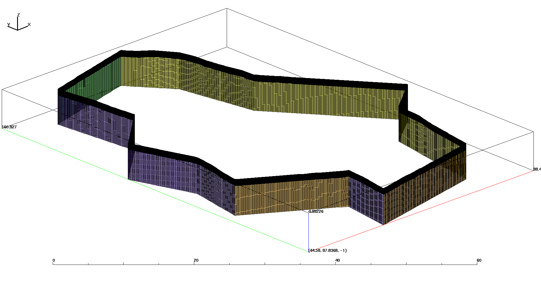 |
/scratch/sft2/lucia/grid_gen/arctic/arctic_fine_v3_1

tar file sent (*tgz):
mesh_3D_poly40_v03_1.tgz

Created from clean subdirectory with mesh files:
drwxr-xr-x  3 lucia sftus      20480 Jun 18 11:22 mesh_v03_1

LaGriT faceset files with elem number and face (*.faceset):
-rw-r--r-- 1 lucia sftus 371175 Jun 12 13:52 fs_1_bot.faceset
-rw-r--r-- 1 lucia sftus 342631 Jun 12 13:52 fs_2_top.faceset
-rw-r--r-- 1 lucia sftus 193639 Jun 12 13:52 fs_3_rig.faceset
-rw-r--r-- 1 lucia sftus  86119 Jun 12 13:52 fs_4_bac.faceset
-rw-r--r-- 1 lucia sftus 129127 Jun 12 13:52 fs_5_lef.faceset
-rw-r--r-- 1 lucia sftus 150631 Jun 12 13:52 fs_6_fro.faceset

Mesh and faceset files for 6 Materials (mesh_fsets.*):
-rw-r--r-- 1 lucia sftus 122179624 Jun 12 13:53 mesh_fsets.exo
-rw-r--r-- 1 lucia sftus 209678648 Jun 12 13:54 mesh_fsets.gmv
-rw-r--r-- 1 lucia sftus 427475687 Jun 12 13:54 mesh_fsets.inp

Mesh and faceset files for 1 Material (mesh_fsets_1mat.*):
-rw-r--r-- 1 lucia sftus 122177652 Jun 12 13:55 mesh_fsets_1mat.exo
-rw-r--r-- 1 lucia sftus 192465616 Jun 12 13:56 mesh_fsets_1mat.gmv
-rw-r--r-- 1 lucia sftus 426071030 Jun 12 13:56 mesh_fsets_1mat.inp
LaGriT output files contain information reported during the run (*.out.txt):

Mesh images:
/scratch/sft2/lucia/grid_gen/arctic/arctic_fine_v3_1/www/images_v3_adjoin
 /scratch/sft2/lucia/grid_gen/arctic/arctic_fine_v3_1/input/

 -rw-r--r--  2 lucia sftus 30928912 Apr 18 13:59 lidar_site3.inp
 -rw-r--r--  1 lucia sftus      123 Apr 18 13:59 poly10001.avs
 -rw-r--r--  1 lucia sftus      178 Apr 18 13:59 poly10002.avs
						...
 -rw-r--r--  1 lucia sftus      155 Apr 18 13:59 poly10071.avs
 -rw-r--r--  1 lucia sftus      190 Apr 18 13:59 poly10072.avs
/scratch/sft2/lucia/grid_gen/arctic/arctic_fine_v3_1
These are LaGriT input (.lgi) and output (outx3dgen) files used in creating this mesh. The output files provide good information about the data and mesh, including min and max values of mesh attributes.
The complete set of scripts and input files are in /scratch/sft2/lucia/grid_gen/arctic/arctic_fine_v3_1. The output files for various mesh versions are in /scratch/sft2/lucia/grid_gen/arctic/.
To create a surface mesh, we could use one of three paths. Normally, we don't change this steps, so the Path 3 is the easiest. If any of the scripts are changed, then the scripts should be re-run, so Path 1 or 2 should be taken.
Path 1: Run files set_zeroz.sh, write_merge.py, process_lidar.lgi, merge_polys.lgi, refine.lgi, interpolate.lgi
Path 2: Run script surf_mesh.py
Path 3: Copy directory output_surf_mesh into your working directory. This folder contains all the output files from running script surf_mesh.py
The easiest path is to run mesh_adjoin.py script, which creates necessary LaGriT files and runs other scripts.
Step 1: Create Ice Objects from Polygon make_poly.lgi. This script is used to create all polygons separately. The Input is the same for all polygons.
-
Polygon 32: Output
-
Polygon 40: Output
-
Polygon 42: Output
-
Polygon 43: Output
-
Polygon 49: Output
Step 2: Merge all the ice objects created in Step 1. Input Output
Step 3: Create and stack layers into full mesh (stack_full_poly.lgi) Input Output
The rest of the steps were not changed and the same as in V03:
Step 4: Interpolate Ice Material on to Full Stacked Mesh (interpolate_icewedge.lgi) Input Output
Step 5: Create facesets and write final Exodus files (write_exo.lgi) Input Output
| Carl Gable | <gable -at- lanl -dot- gov> | 505-665-3533 |
| Terry Miller | <tamiller -at- lanl -dot- gov> | 505-667-8009 |
| Lucia Short | <lucia -at- lanl -dot- gov> | 505-665-7957 |